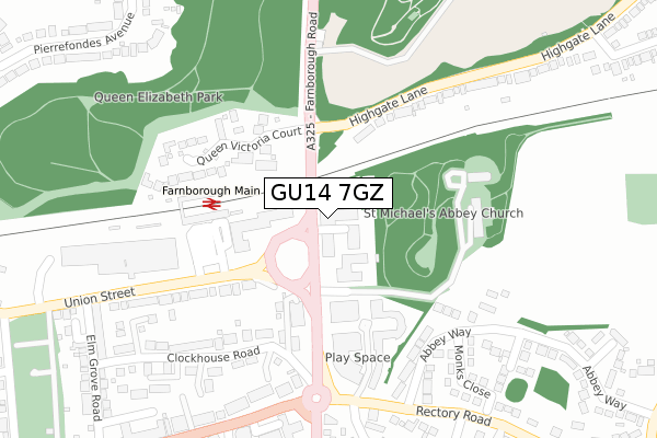
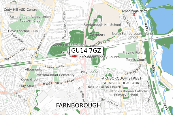
GU14 7GZ is located in the Empress electoral ward, within the local authority district of Rushmoor and the English Parliamentary constituency of Aldershot. The Sub Integrated Care Board (ICB) Location is NHS Frimley ICB - D4U1Y and the police force is Hampshire. This postcode has been in use since December 2019.


GetTheData
Source: OS Open Zoomstack (Ordnance Survey)
Licence: Open Government Licence (requires attribution)
Attribution: Contains OS data © Crown copyright and database right 2024
Source: Open Postcode Geo
Licence: Open Government Licence (requires attribution)
Attribution: Contains OS data © Crown copyright and database right 2024; Contains Royal Mail data © Royal Mail copyright and database right 2024; Source: Office for National Statistics licensed under the Open Government Licence v.3.0
| Easting | 487043 |
| Northing | 156035 |
| Latitude | 51.296799 |
| Longitude | -0.752934 |
GetTheData
Source: Open Postcode Geo
Licence: Open Government Licence
| Country | England |
| Postcode District | GU14 |
➜ See where GU14 is on a map ➜ Where is Farnborough? | |
GetTheData
Source: Land Registry Price Paid Data
Licence: Open Government Licence
| Ward | Empress |
| Constituency | Aldershot |
GetTheData
Source: ONS Postcode Database
Licence: Open Government Licence
| Ham And Blackbird (Union Street) | Farnborough | 97m |
| Farnborough Road (Highgate Lane) | Farnborough Street | 128m |
| Farnborough Road (Highgate Lane) | Farnborough Street | 170m |
| Ham And Blackbird (Farnborough Road) | Farnborough | 178m |
| Main Rail Station (Access Loop Road) | Farnborough | 205m |
| Farnborough (Main) Station | 0.2km |
| Farnborough North Station | 0.9km |
| Frimley Station | 1.7km |
GetTheData
Source: NaPTAN
Licence: Open Government Licence
GetTheData
Source: ONS Postcode Database
Licence: Open Government Licence


➜ Get more ratings from the Food Standards Agency
GetTheData
Source: Food Standards Agency
Licence: FSA terms & conditions
| Last Collection | |||
|---|---|---|---|
| Location | Mon-Fri | Sat | Distance |
| Queen Victoria Court | 16:45 | 11:15 | 132m |
| Railway Station | 17:15 | 11:45 | 149m |
| Salisbury Road | 16:45 | 12:00 | 383m |
GetTheData
Source: Dracos
Licence: Creative Commons Attribution-ShareAlike
The below table lists the International Territorial Level (ITL) codes (formerly Nomenclature of Territorial Units for Statistics (NUTS) codes) and Local Administrative Units (LAU) codes for GU14 7GZ:
| ITL 1 Code | Name |
|---|---|
| TLJ | South East (England) |
| ITL 2 Code | Name |
| TLJ3 | Hampshire and Isle of Wight |
| ITL 3 Code | Name |
| TLJ37 | North Hampshire |
| LAU 1 Code | Name |
| E07000092 | Rushmoor |
GetTheData
Source: ONS Postcode Directory
Licence: Open Government Licence
The below table lists the Census Output Area (OA), Lower Layer Super Output Area (LSOA), and Middle Layer Super Output Area (MSOA) for GU14 7GZ:
| Code | Name | |
|---|---|---|
| OA | E00167939 | |
| LSOA | E01023096 | Rushmoor 004A |
| MSOA | E02004805 | Rushmoor 004 |
GetTheData
Source: ONS Postcode Directory
Licence: Open Government Licence
| GU14 7NH | Farnborough Road | 60m |
| GU14 7NP | Jubilee Hall Road | 66m |
| GU14 7NA | Farnborough Road | 99m |
| GU14 7FT | Coombe Way | 166m |
| GU14 7LY | Farnborough Road | 173m |
| GU14 7FX | Coombe Way | 178m |
| GU14 8AR | Queen Victoria Court | 190m |
| GU14 7RA | Gable End | 214m |
| GU14 7FY | Coombe Way | 224m |
| GU14 7GB | Coombe Way | 229m |
GetTheData
Source: Open Postcode Geo; Land Registry Price Paid Data
Licence: Open Government Licence