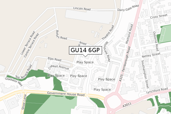
GU14 6GP is located in the St Mark's electoral ward, within the local authority district of Rushmoor and the English Parliamentary constituency of Aldershot. The Sub Integrated Care Board (ICB) Location is NHS Frimley ICB - D4U1Y and the police force is Hampshire. This postcode has been in use since June 2018.


GetTheData
Source: OS Open Zoomstack (Ordnance Survey)
Licence: Open Government Licence (requires attribution)
Attribution: Contains OS data © Crown copyright and database right 2025
Source: Open Postcode Geo
Licence: Open Government Licence (requires attribution)
Attribution: Contains OS data © Crown copyright and database right 2025; Contains Royal Mail data © Royal Mail copyright and database right 2025; Source: Office for National Statistics licensed under the Open Government Licence v.3.0
| Easting | 486644 |
| Northing | 153701 |
| Latitude | 51.275877 |
| Longitude | -0.759221 |
GetTheData
Source: Open Postcode Geo
Licence: Open Government Licence
| Country | England |
| Postcode District | GU14 |
➜ See where GU14 is on a map ➜ Where is Farnborough? | |
GetTheData
Source: Land Registry Price Paid Data
Licence: Open Government Licence
| Ward | St Mark's |
| Constituency | Aldershot |
GetTheData
Source: ONS Postcode Database
Licence: Open Government Licence
| Show Centre Control Point (Etps Road) | South Farnborough | 65m |
| Cottesmore Place (Queens Gate Road) | South Farnborough | 77m |
| Temp - International Air Show | South Farnborough | 232m |
| Maitland Road (Farnborough Road) | South Farnborough | 258m |
| Maitland Road (Farnborough Road) | South Farnborough | 268m |
| North Camp Station | 2km |
| Farnborough (Main) Station | 2.3km |
| Ash Vale Station | 2.7km |
GetTheData
Source: NaPTAN
Licence: Open Government Licence
| Percentage of properties with Next Generation Access | 100.0% |
| Percentage of properties with Superfast Broadband | 100.0% |
| Percentage of properties with Ultrafast Broadband | 100.0% |
| Percentage of properties with Full Fibre Broadband | 100.0% |
Superfast Broadband is between 30Mbps and 300Mbps
Ultrafast Broadband is > 300Mbps
| Percentage of properties unable to receive 2Mbps | 0.0% |
| Percentage of properties unable to receive 5Mbps | 0.0% |
| Percentage of properties unable to receive 10Mbps | 0.0% |
| Percentage of properties unable to receive 30Mbps | 0.0% |
GetTheData
Source: Ofcom
Licence: Ofcom Terms of Use (requires attribution)
GetTheData
Source: ONS Postcode Database
Licence: Open Government Licence


➜ Get more ratings from the Food Standards Agency
GetTheData
Source: Food Standards Agency
Licence: FSA terms & conditions
| Last Collection | |||
|---|---|---|---|
| Location | Mon-Fri | Sat | Distance |
| Netley Street | 16:30 | 11:30 | 258m |
| Osborne Road | 16:30 | 11:15 | 409m |
| Royal Mail Delivery Office | 19:00 | 11:15 | 733m |
GetTheData
Source: Dracos
Licence: Creative Commons Attribution-ShareAlike
The below table lists the International Territorial Level (ITL) codes (formerly Nomenclature of Territorial Units for Statistics (NUTS) codes) and Local Administrative Units (LAU) codes for GU14 6GP:
| ITL 1 Code | Name |
|---|---|
| TLJ | South East (England) |
| ITL 2 Code | Name |
| TLJ3 | Hampshire and Isle of Wight |
| ITL 3 Code | Name |
| TLJ37 | North Hampshire |
| LAU 1 Code | Name |
| E07000092 | Rushmoor |
GetTheData
Source: ONS Postcode Directory
Licence: Open Government Licence
The below table lists the Census Output Area (OA), Lower Layer Super Output Area (LSOA), and Middle Layer Super Output Area (MSOA) for GU14 6GP:
| Code | Name | |
|---|---|---|
| OA | E00117557 | |
| LSOA | E01023136 | Rushmoor 007C |
| MSOA | E02004808 | Rushmoor 007 |
GetTheData
Source: ONS Postcode Directory
Licence: Open Government Licence
| GU14 6FW | Hornchurch Square | 75m |
| GU14 6FD | Etps Road | 79m |
| GU14 6FN | Bedford Court | 80m |
| GU14 6FH | Cottesmore Place | 123m |
| GU14 6FQ | De Havilland Road | 129m |
| GU14 6FL | Woodvale Road | 139m |
| GU14 6FJ | Honington Mews | 148m |
| GU14 6GD | Honington Mews | 178m |
| GU14 6GH | Northolt Close | 180m |
| GU14 6FR | Cranwell Road | 188m |
GetTheData
Source: Open Postcode Geo; Land Registry Price Paid Data
Licence: Open Government Licence