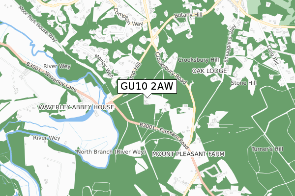
GU10 2AW is located in the Western Commons electoral ward, within the local authority district of Waverley and the English Parliamentary constituency of South West Surrey. The Sub Integrated Care Board (ICB) Location is NHS Frimley ICB - D4U1Y and the police force is Surrey. This postcode has been in use since June 2019.


GetTheData
Source: OS Open Zoomstack (Ordnance Survey)
Licence: Open Government Licence (requires attribution)
Attribution: Contains OS data © Crown copyright and database right 2025
Source: Open Postcode Geo
Licence: Open Government Licence (requires attribution)
Attribution: Contains OS data © Crown copyright and database right 2025; Contains Royal Mail data © Royal Mail copyright and database right 2025; Source: Office for National Statistics licensed under the Open Government Licence v.3.0
| Easting | 487436 |
| Northing | 145624 |
| Latitude | 51.203144 |
| Longitude | -0.749839 |
GetTheData
Source: Open Postcode Geo
Licence: Open Government Licence
| Country | England |
| Postcode District | GU10 |
➜ See where GU10 is on a map | |
GetTheData
Source: Land Registry Price Paid Data
Licence: Open Government Licence
| Ward | Western Commons |
| Constituency | South West Surrey |
GetTheData
Source: ONS Postcode Database
Licence: Open Government Licence
| Waverley Lane | Waverley Abbey | 425m |
| Waverley Lane | Waverley Abbey | 439m |
| Crossroads (Sands Road) | The Sands | 1,115m |
| Crossroads (Sands Road) | The Sands | 1,139m |
| Blighton Lane (Sands Road) | The Sands | 1,204m |
| Farnham Station | 3.1km |
| Aldershot Station | 4.9km |
GetTheData
Source: NaPTAN
Licence: Open Government Licence
GetTheData
Source: ONS Postcode Database
Licence: Open Government Licence


➜ Get more ratings from the Food Standards Agency
GetTheData
Source: Food Standards Agency
Licence: FSA terms & conditions
| Last Collection | |||
|---|---|---|---|
| Location | Mon-Fri | Sat | Distance |
| Waverley Lane | 16:00 | 08:30 | 320m |
| Crooksbury Road | 16:00 | 07:30 | 409m |
| Sands Road | 16:30 | 08:45 | 1,106m |
GetTheData
Source: Dracos
Licence: Creative Commons Attribution-ShareAlike
The below table lists the International Territorial Level (ITL) codes (formerly Nomenclature of Territorial Units for Statistics (NUTS) codes) and Local Administrative Units (LAU) codes for GU10 2AW:
| ITL 1 Code | Name |
|---|---|
| TLJ | South East (England) |
| ITL 2 Code | Name |
| TLJ2 | Surrey, East and West Sussex |
| ITL 3 Code | Name |
| TLJ25 | West Surrey |
| LAU 1 Code | Name |
| E07000216 | Waverley |
GetTheData
Source: ONS Postcode Directory
Licence: Open Government Licence
The below table lists the Census Output Area (OA), Lower Layer Super Output Area (LSOA), and Middle Layer Super Output Area (MSOA) for GU10 2AW:
| Code | Name | |
|---|---|---|
| OA | E00157588 | |
| LSOA | E01030908 | Waverley 018A |
| MSOA | E02006839 | Waverley 018 |
GetTheData
Source: ONS Postcode Directory
Licence: Open Government Licence
| GU10 1RJ | Camp Hill | 280m |
| GU10 2AZ | 325m | |
| GU10 1RQ | Cobbetts Ridge | 343m |
| GU9 8ES | Waverley Lane | 354m |
| GU10 1RF | Crooksbury Road | 391m |
| GU10 1RH | Monks Well | 483m |
| GU10 2AY | 484m | |
| GU10 1RG | Camp Hill | 496m |
| GU9 8EP | Waverley Lane | 549m |
| GU10 1RB | Temples Close | 573m |
GetTheData
Source: Open Postcode Geo; Land Registry Price Paid Data
Licence: Open Government Licence