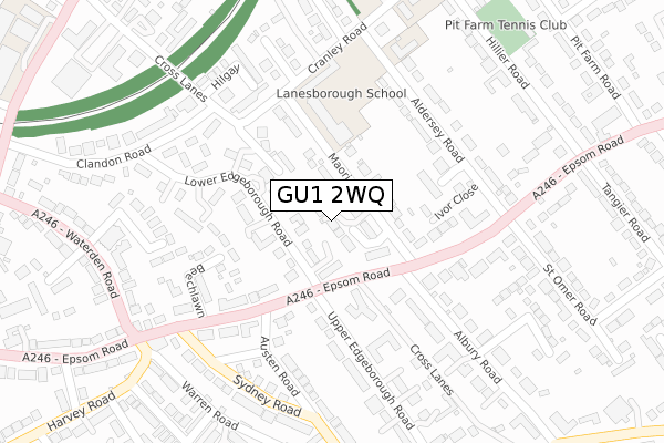
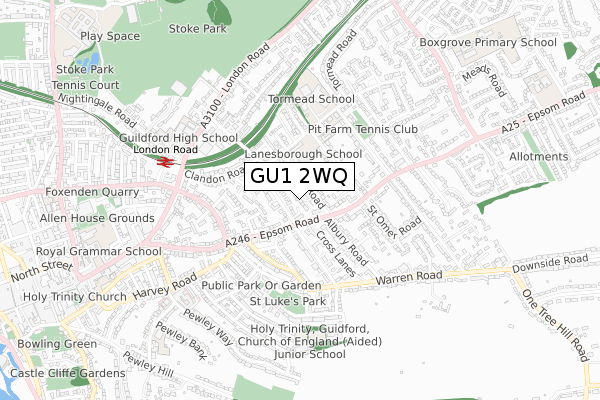
GU1 2WQ is located in the Castle electoral ward, within the local authority district of Guildford and the English Parliamentary constituency of Guildford. The Sub Integrated Care Board (ICB) Location is NHS Surrey Heartlands ICB - 92A and the police force is Surrey. This postcode has been in use since October 2019.


GetTheData
Source: OS Open Zoomstack (Ordnance Survey)
Licence: Open Government Licence (requires attribution)
Attribution: Contains OS data © Crown copyright and database right 2025
Source: Open Postcode Geo
Licence: Open Government Licence (requires attribution)
Attribution: Contains OS data © Crown copyright and database right 2025; Contains Royal Mail data © Royal Mail copyright and database right 2025; Source: Office for National Statistics licensed under the Open Government Licence v.3.0
| Easting | 500825 |
| Northing | 149884 |
| Latitude | 51.239233 |
| Longitude | -0.557055 |
GetTheData
Source: Open Postcode Geo
Licence: Open Government Licence
| Country | England |
| Postcode District | GU1 |
➜ See where GU1 is on a map ➜ Where is Guildford? | |
GetTheData
Source: Land Registry Price Paid Data
Licence: Open Government Licence
| Ward | Castle |
| Constituency | Guildford |
GetTheData
Source: ONS Postcode Database
Licence: Open Government Licence
2, SWAYNE PLACE, GUILDFORD, GU1 2WQ 2020 6 AUG £1,625,000 |
1, SWAYNE PLACE, GUILDFORD, GU1 2WQ 2019 1 NOV £1,755,000 |
5, SWAYNE PLACE, GUILDFORD, GU1 2WQ 2019 31 OCT £1,285,000 |
4, SWAYNE PLACE, GUILDFORD, GU1 2WQ 2019 30 OCT £1,285,000 |
3, SWAYNE PLACE, GUILDFORD, GU1 2WQ 2019 30 OCT £1,525,000 |
6, SWAYNE PLACE, GUILDFORD, GU1 2WQ 2019 29 OCT £1,365,000 |
GetTheData
Source: HM Land Registry Price Paid Data
Licence: Contains HM Land Registry data © Crown copyright and database right 2025. This data is licensed under the Open Government Licence v3.0.
| Albury Road North (Epsom Road) | Guildford | 88m |
| Albury Road North (Epsom Road) | Guildford | 119m |
| Waterden Road (Epsom Road) | Guildford | 216m |
| Waterden Road (Epsom Road) | Guildford | 255m |
| Cranley Road | Guildford | 260m |
| London Road (Guildford) Station | 0.6km |
| Guildford Station | 1.6km |
| Shalford (Surrey) Station | 2.9km |
GetTheData
Source: NaPTAN
Licence: Open Government Licence
GetTheData
Source: ONS Postcode Database
Licence: Open Government Licence


➜ Get more ratings from the Food Standards Agency
GetTheData
Source: Food Standards Agency
Licence: FSA terms & conditions
| Last Collection | |||
|---|---|---|---|
| Location | Mon-Fri | Sat | Distance |
| Sandford Arms | 17:45 | 12:30 | 263m |
| St Omer Road | 17:30 | 12:30 | 268m |
| Albury Road | 17:30 | 12:30 | 289m |
GetTheData
Source: Dracos
Licence: Creative Commons Attribution-ShareAlike
The below table lists the International Territorial Level (ITL) codes (formerly Nomenclature of Territorial Units for Statistics (NUTS) codes) and Local Administrative Units (LAU) codes for GU1 2WQ:
| ITL 1 Code | Name |
|---|---|
| TLJ | South East (England) |
| ITL 2 Code | Name |
| TLJ2 | Surrey, East and West Sussex |
| ITL 3 Code | Name |
| TLJ25 | West Surrey |
| LAU 1 Code | Name |
| E07000209 | Guildford |
GetTheData
Source: ONS Postcode Directory
Licence: Open Government Licence
The below table lists the Census Output Area (OA), Lower Layer Super Output Area (LSOA), and Middle Layer Super Output Area (MSOA) for GU1 2WQ:
| Code | Name | |
|---|---|---|
| OA | E00155259 | |
| LSOA | E01030438 | Guildford 013A |
| MSOA | E02006356 | Guildford 013 |
GetTheData
Source: ONS Postcode Directory
Licence: Open Government Licence
| GU1 2EQ | Easington Place | 53m |
| GU1 2DP | Elmhurst Court | 74m |
| GU1 2EJ | Easington Place | 80m |
| GU1 2EL | Maori Road | 87m |
| GU1 2DX | Lower Edgeborough Road | 93m |
| GU1 2DY | Lower Edgeborough Road | 95m |
| GU1 2EY | Lower Edgeborough Road | 106m |
| GU1 2EG | Maori Road | 107m |
| GU1 2DZ | Lower Edgeborough Road | 122m |
| GU1 2EF | Cross Lanes | 122m |
GetTheData
Source: Open Postcode Geo; Land Registry Price Paid Data
Licence: Open Government Licence