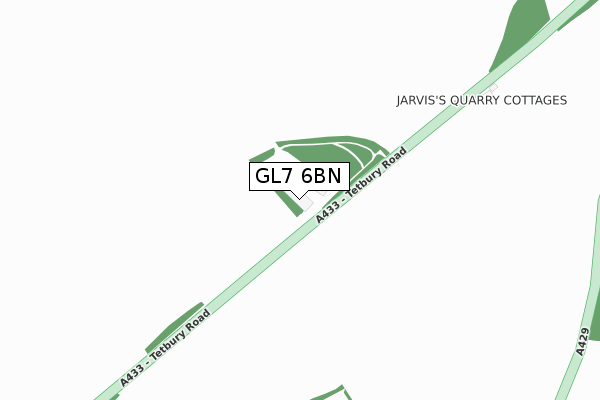
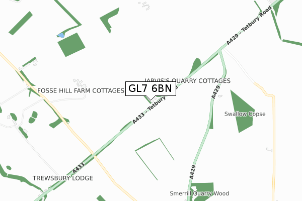
GL7 6BN is located in the Kemble electoral ward, within the local authority district of Cotswold and the English Parliamentary constituency of The Cotswolds. The Sub Integrated Care Board (ICB) Location is NHS Gloucestershire ICB - 11M and the police force is Gloucestershire. This postcode has been in use since January 1980.


GetTheData
Source: OS Open Zoomstack (Ordnance Survey)
Licence: Open Government Licence (requires attribution)
Attribution: Contains OS data © Crown copyright and database right 2025
Source: Open Postcode Geo
Licence: Open Government Licence (requires attribution)
Attribution: Contains OS data © Crown copyright and database right 2025; Contains Royal Mail data © Royal Mail copyright and database right 2025; Source: Office for National Statistics licensed under the Open Government Licence v.3.0
| Easting | 399798 |
| Northing | 200016 |
| Latitude | 51.698894 |
| Longitude | -2.004314 |
GetTheData
Source: Open Postcode Geo
Licence: Open Government Licence
| Country | England |
| Postcode District | GL7 |
➜ See where GL7 is on a map | |
GetTheData
Source: Land Registry Price Paid Data
Licence: Open Government Licence
Elevation or altitude of GL7 6BN as distance above sea level:
| Metres | Feet | |
|---|---|---|
| Elevation | 120m | 394ft |
Elevation is measured from the approximate centre of the postcode, to the nearest point on an OS contour line from OS Terrain 50, which has contour spacing of ten vertical metres.
➜ How high above sea level am I? Find the elevation of your current position using your device's GPS.
GetTheData
Source: Open Postcode Elevation
Licence: Open Government Licence
| Ward | Kemble |
| Constituency | The Cotswolds |
GetTheData
Source: ONS Postcode Database
Licence: Open Government Licence
| Thameshead (Fosse Way A433) | Thames Head | 884m |
| Thameshead (Fosse Way A433) | Thames Head | 888m |
| Smerrill Quarry (A429) | Kemble | 1,079m |
| Smerrill Quarry | Kemble | 1,088m |
| Royal Agricultural College (Stroud Road A419) | Cirencester | 1,493m |
| Kemble Station | 2.8km |
GetTheData
Source: NaPTAN
Licence: Open Government Licence
GetTheData
Source: ONS Postcode Database
Licence: Open Government Licence


➜ Get more ratings from the Food Standards Agency
GetTheData
Source: Food Standards Agency
Licence: FSA terms & conditions
| Last Collection | |||
|---|---|---|---|
| Location | Mon-Fri | Sat | Distance |
| Coates | 16:15 | 08:30 | 2,107m |
| Dockham Hse | 16:15 | 09:15 | 2,329m |
| Waitrose Sheep Street | 17:30 | 11:15 | 2,787m |
GetTheData
Source: Dracos
Licence: Creative Commons Attribution-ShareAlike
The below table lists the International Territorial Level (ITL) codes (formerly Nomenclature of Territorial Units for Statistics (NUTS) codes) and Local Administrative Units (LAU) codes for GL7 6BN:
| ITL 1 Code | Name |
|---|---|
| TLK | South West (England) |
| ITL 2 Code | Name |
| TLK1 | Gloucestershire, Wiltshire and Bath/Bristol area |
| ITL 3 Code | Name |
| TLK13 | Gloucestershire CC |
| LAU 1 Code | Name |
| E07000079 | Cotswold |
GetTheData
Source: ONS Postcode Directory
Licence: Open Government Licence
The below table lists the Census Output Area (OA), Lower Layer Super Output Area (LSOA), and Middle Layer Super Output Area (MSOA) for GL7 6BN:
| Code | Name | |
|---|---|---|
| OA | E00112947 | |
| LSOA | E01022221 | Cotswold 010A |
| MSOA | E02004624 | Cotswold 010 |
GetTheData
Source: ONS Postcode Directory
Licence: Open Government Licence
| GL7 6NX | 1268m | |
| GL7 6PZ | 1556m | |
| GL7 6NZ | Tetbury Road | 1560m |
| GL7 6BP | 1584m | |
| GL7 1WF | Drift Way | 1774m |
| GL7 1QR | Reeves Close | 1822m |
| GL7 1WN | Drift Way | 1830m |
| GL7 6NH | 1852m | |
| GL7 1QB | Drift Close | 1855m |
| GL7 1TF | Morestall Drive | 1865m |
GetTheData
Source: Open Postcode Geo; Land Registry Price Paid Data
Licence: Open Government Licence