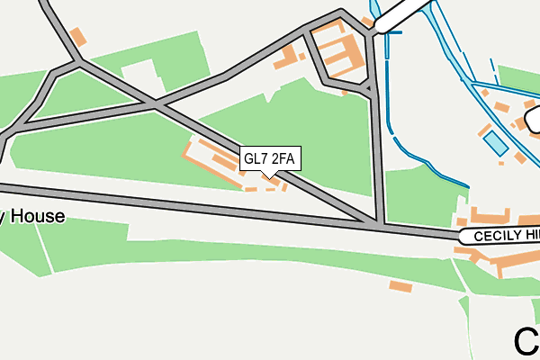
GL7 2FA is located in the Abbey electoral ward, within the local authority district of Cotswold and the English Parliamentary constituency of The Cotswolds. The Sub Integrated Care Board (ICB) Location is NHS Gloucestershire ICB - 11M and the police force is Gloucestershire. This postcode has been in use since May 2017.


GetTheData
Source: OS OpenMap – Local (Ordnance Survey)
Source: OS VectorMap District (Ordnance Survey)
Licence: Open Government Licence (requires attribution)
| Easting | 401600 |
| Northing | 202194 |
| Latitude | 51.718475 |
| Longitude | -1.978231 |
GetTheData
Source: Open Postcode Geo
Licence: Open Government Licence
| Country | England |
| Postcode District | GL7 |
➜ See where GL7 is on a map | |
GetTheData
Source: Land Registry Price Paid Data
Licence: Open Government Licence
| Ward | Abbey |
| Constituency | The Cotswolds |
GetTheData
Source: ONS Postcode Database
Licence: Open Government Licence
| Barton Court (Gloucester Street) | Cirencester | 517m |
| Old Station Car Park (Tetbury Road) | Cirencester | 518m |
| Hospital (A429) | Cirencester | 622m |
| Register Office (Sheep Street) | Cirencester | 623m |
| Barclay Court (Trafalgar Road) | Cirencester | 641m |
| Kemble Station | 5.5km |
GetTheData
Source: NaPTAN
Licence: Open Government Licence
GetTheData
Source: ONS Postcode Database
Licence: Open Government Licence


➜ Get more ratings from the Food Standards Agency
GetTheData
Source: Food Standards Agency
Licence: FSA terms & conditions
| Last Collection | |||
|---|---|---|---|
| Location | Mon-Fri | Sat | Distance |
| Dugdale Road | 17:30 | 12:15 | 642m |
| Waitrose Sheep Street | 17:30 | 11:15 | 702m |
| Ashcroft Road | 17:45 | 11:45 | 771m |
GetTheData
Source: Dracos
Licence: Creative Commons Attribution-ShareAlike
The below table lists the International Territorial Level (ITL) codes (formerly Nomenclature of Territorial Units for Statistics (NUTS) codes) and Local Administrative Units (LAU) codes for GL7 2FA:
| ITL 1 Code | Name |
|---|---|
| TLK | South West (England) |
| ITL 2 Code | Name |
| TLK1 | Gloucestershire, Wiltshire and Bath/Bristol area |
| ITL 3 Code | Name |
| TLK13 | Gloucestershire CC |
| LAU 1 Code | Name |
| E07000079 | Cotswold |
GetTheData
Source: ONS Postcode Directory
Licence: Open Government Licence
The below table lists the Census Output Area (OA), Lower Layer Super Output Area (LSOA), and Middle Layer Super Output Area (MSOA) for GL7 2FA:
| Code | Name | |
|---|---|---|
| OA | E00112798 | |
| LSOA | E01022195 | Cotswold 007B |
| MSOA | E02004621 | Cotswold 007 |
GetTheData
Source: ONS Postcode Directory
Licence: Open Government Licence
| GL7 2EF | Cecily Hill | 313m |
| GL7 2BB | The Mead | 325m |
| GL7 2BG | Mill Place | 355m |
| GL7 2BX | Park Street | 473m |
| GL7 2BH | Coxwell Street | 486m |
| GL7 2AX | Thomas Street | 489m |
| GL7 2BA | Thomas Street | 501m |
| GL7 2DL | Gloucester Street | 507m |
| GL7 2DW | Gloucester Street | 511m |
| GL7 2DJ | Gloucester Street | 519m |
GetTheData
Source: Open Postcode Geo; Land Registry Price Paid Data
Licence: Open Government Licence