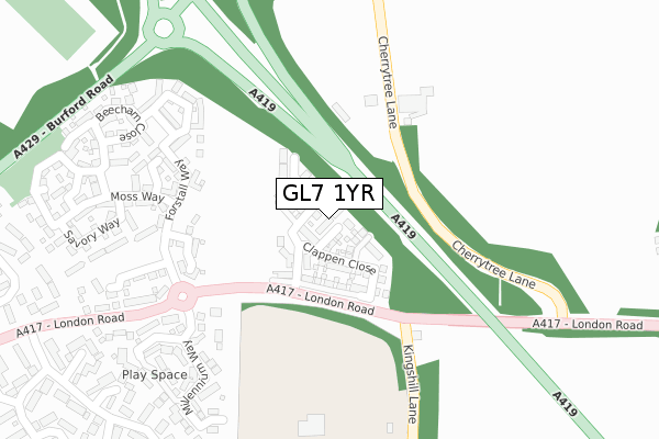
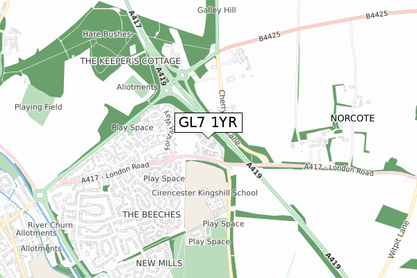
GL7 1YR is located in the The Beeches electoral ward, within the local authority district of Cotswold and the English Parliamentary constituency of The Cotswolds. The Sub Integrated Care Board (ICB) Location is NHS Gloucestershire ICB - 11M and the police force is Gloucestershire. This postcode has been in use since December 2017.


GetTheData
Source: OS Open Zoomstack (Ordnance Survey)
Licence: Open Government Licence (requires attribution)
Attribution: Contains OS data © Crown copyright and database right 2025
Source: Open Postcode Geo
Licence: Open Government Licence (requires attribution)
Attribution: Contains OS data © Crown copyright and database right 2025; Contains Royal Mail data © Royal Mail copyright and database right 2025; Source: Office for National Statistics licensed under the Open Government Licence v.3.0
| Easting | 403903 |
| Northing | 202419 |
| Latitude | 51.720487 |
| Longitude | -1.944891 |
GetTheData
Source: Open Postcode Geo
Licence: Open Government Licence
| Country | England |
| Postcode District | GL7 |
➜ See where GL7 is on a map ➜ Where is Cirencester? | |
GetTheData
Source: Land Registry Price Paid Data
Licence: Open Government Licence
| Ward | The Beeches |
| Constituency | The Cotswolds |
GetTheData
Source: ONS Postcode Database
Licence: Open Government Licence
15, HARMER CLOSE, CIRENCESTER, GL7 1YR 2017 21 DEC £555,000 |
14, HARMER CLOSE, CIRENCESTER, GL7 1YR 2017 20 DEC £525,000 |
13, HARMER CLOSE, CIRENCESTER, GL7 1YR 2017 15 DEC £435,000 |
GetTheData
Source: HM Land Registry Price Paid Data
Licence: Contains HM Land Registry data © Crown copyright and database right 2025. This data is licensed under the Open Government Licence v3.0.
| Kingshill Lane (London Road A417) | Cirencester | 132m |
| Kingshill Lane (London Road A417) | Cirencester | 165m |
| Kingshill School (Kingshill Lane) | Cirencester | 333m |
| Kingshill School (Kingshill Lane) | Cirencester | 376m |
| Kingshill School Grounds | Cirencester | 397m |
GetTheData
Source: NaPTAN
Licence: Open Government Licence
| Percentage of properties with Next Generation Access | 100.0% |
| Percentage of properties with Superfast Broadband | 100.0% |
| Percentage of properties with Ultrafast Broadband | 100.0% |
| Percentage of properties with Full Fibre Broadband | 100.0% |
Superfast Broadband is between 30Mbps and 300Mbps
Ultrafast Broadband is > 300Mbps
| Median download speed | 360.0Mbps |
| Average download speed | 360.0Mbps |
| Maximum download speed | 360.00Mbps |
| Median upload speed | 360.0Mbps |
| Average upload speed | 360.0Mbps |
| Maximum upload speed | 360.00Mbps |
| Percentage of properties unable to receive 2Mbps | 0.0% |
| Percentage of properties unable to receive 5Mbps | 0.0% |
| Percentage of properties unable to receive 10Mbps | 0.0% |
| Percentage of properties unable to receive 30Mbps | 0.0% |
GetTheData
Source: Ofcom
Licence: Ofcom Terms of Use (requires attribution)
GetTheData
Source: ONS Postcode Database
Licence: Open Government Licence


➜ Get more ratings from the Food Standards Agency
GetTheData
Source: Food Standards Agency
Licence: FSA terms & conditions
| Last Collection | |||
|---|---|---|---|
| Location | Mon-Fri | Sat | Distance |
| New Mills | 17:15 | 11:45 | 537m |
| The Avenue | 17:30 | 09:00 | 1,331m |
| Whiteway | 17:30 | 11:15 | 1,412m |
GetTheData
Source: Dracos
Licence: Creative Commons Attribution-ShareAlike
The below table lists the International Territorial Level (ITL) codes (formerly Nomenclature of Territorial Units for Statistics (NUTS) codes) and Local Administrative Units (LAU) codes for GL7 1YR:
| ITL 1 Code | Name |
|---|---|
| TLK | South West (England) |
| ITL 2 Code | Name |
| TLK1 | Gloucestershire, Wiltshire and Bath/Bristol area |
| ITL 3 Code | Name |
| TLK13 | Gloucestershire CC |
| LAU 1 Code | Name |
| E07000079 | Cotswold |
GetTheData
Source: ONS Postcode Directory
Licence: Open Government Licence
The below table lists the Census Output Area (OA), Lower Layer Super Output Area (LSOA), and Middle Layer Super Output Area (MSOA) for GL7 1YR:
| Code | Name | |
|---|---|---|
| OA | E00112774 | |
| LSOA | E01022188 | Cotswold 006A |
| MSOA | E02004620 | Cotswold 006 |
GetTheData
Source: ONS Postcode Directory
Licence: Open Government Licence
| GL7 1FT | Parry Close | 214m |
| GL7 1LH | Forstall Way | 216m |
| GL7 1JQ | Forstall Way | 243m |
| GL7 1LS | Forstall Way | 265m |
| GL7 1RS | Moss Way | 298m |
| GL7 1GN | Ormand Close | 307m |
| GL7 1GJ | Winstone Gardens | 325m |
| GL7 1GH | Blackberry Walk | 325m |
| GL7 1FL | Century Close | 333m |
| GL7 1RJ | Trotman Walk | 339m |
GetTheData
Source: Open Postcode Geo; Land Registry Price Paid Data
Licence: Open Government Licence