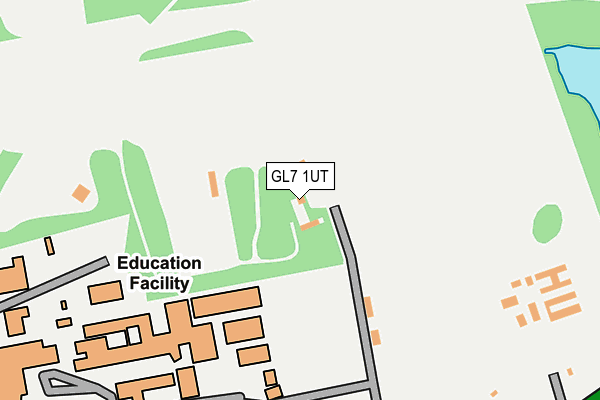
GL7 1UT is located in the Abbey electoral ward, within the local authority district of Cotswold and the English Parliamentary constituency of The Cotswolds. The Sub Integrated Care Board (ICB) Location is NHS Gloucestershire ICB - 11M and the police force is Gloucestershire. This postcode has been in use since January 1995.


GetTheData
Source: OS OpenMap – Local (Ordnance Survey)
Source: OS VectorMap District (Ordnance Survey)
Licence: Open Government Licence (requires attribution)
| Easting | 401216 |
| Northing | 201686 |
| Latitude | 51.713904 |
| Longitude | -1.983799 |
GetTheData
Source: Open Postcode Geo
Licence: Open Government Licence
| Country | England |
| Postcode District | GL7 |
➜ See where GL7 is on a map | |
GetTheData
Source: Land Registry Price Paid Data
Licence: Open Government Licence
Elevation or altitude of GL7 1UT as distance above sea level:
| Metres | Feet | |
|---|---|---|
| Elevation | 130m | 427ft |
Elevation is measured from the approximate centre of the postcode, to the nearest point on an OS contour line from OS Terrain 50, which has contour spacing of ten vertical metres.
➜ How high above sea level am I? Find the elevation of your current position using your device's GPS.
GetTheData
Source: Open Postcode Elevation
Licence: Open Government Licence
| Ward | Abbey |
| Constituency | The Cotswolds |
GetTheData
Source: ONS Postcode Database
Licence: Open Government Licence
| Deer Park School Grounds | Cirencester | 284m |
| Deer Park School (Stroud Road A419) | Cirencester | 342m |
| Deer Park School (Stroud Road A419) | Cirencester | 351m |
| Chesterton Lane (A429) | Cirencester | 359m |
| Cemetery (Chesterton Lane) | Chesterton | 556m |
| Kemble Station | 4.9km |
GetTheData
Source: NaPTAN
Licence: Open Government Licence
GetTheData
Source: ONS Postcode Database
Licence: Open Government Licence


➜ Get more ratings from the Food Standards Agency
GetTheData
Source: Food Standards Agency
Licence: FSA terms & conditions
| Last Collection | |||
|---|---|---|---|
| Location | Mon-Fri | Sat | Distance |
| Waitrose Sheep Street | 17:30 | 11:15 | 836m |
| Ashcroft Road | 17:45 | 11:45 | 1,043m |
| Querns Lane | 17:45 | 11:45 | 1,185m |
GetTheData
Source: Dracos
Licence: Creative Commons Attribution-ShareAlike
The below table lists the International Territorial Level (ITL) codes (formerly Nomenclature of Territorial Units for Statistics (NUTS) codes) and Local Administrative Units (LAU) codes for GL7 1UT:
| ITL 1 Code | Name |
|---|---|
| TLK | South West (England) |
| ITL 2 Code | Name |
| TLK1 | Gloucestershire, Wiltshire and Bath/Bristol area |
| ITL 3 Code | Name |
| TLK13 | Gloucestershire CC |
| LAU 1 Code | Name |
| E07000079 | Cotswold |
GetTheData
Source: ONS Postcode Directory
Licence: Open Government Licence
The below table lists the Census Output Area (OA), Lower Layer Super Output Area (LSOA), and Middle Layer Super Output Area (MSOA) for GL7 1UT:
| Code | Name | |
|---|---|---|
| OA | E00112798 | |
| LSOA | E01022195 | Cotswold 007B |
| MSOA | E02004621 | Cotswold 007 |
GetTheData
Source: ONS Postcode Directory
Licence: Open Government Licence
| GL7 1XA | Stroud Road | 206m |
| GL7 1UZ | Stroud Road | 368m |
| GL7 1XU | Chesterton Park | 425m |
| GL7 1XX | Smiths Field | 450m |
| GL7 1XE | Chesterton Lane | 523m |
| GL7 1UU | Keepers Gate | 530m |
| GL7 1XT | Chesterton Park | 569m |
| GL7 1XS | Chesterton Park | 599m |
| GL7 1XG | Chesterton Lane | 657m |
| GL7 1YF | Four Acres View | 675m |
GetTheData
Source: Open Postcode Geo; Land Registry Price Paid Data
Licence: Open Government Licence