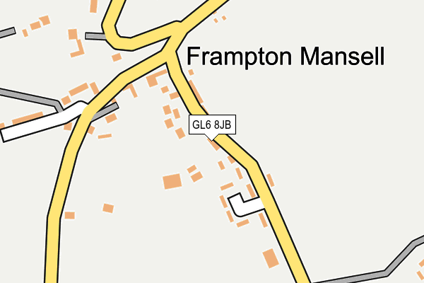
GL6 8JB is in Frampton Mansell, Stroud. GL6 8JB is located in the Ermin electoral ward, within the local authority district of Cotswold and the English Parliamentary constituency of The Cotswolds. The Sub Integrated Care Board (ICB) Location is NHS Gloucestershire ICB - 11M and the police force is Gloucestershire. This postcode has been in use since January 1980.


GetTheData
Source: OS OpenMap – Local (Ordnance Survey)
Source: OS VectorMap District (Ordnance Survey)
Licence: Open Government Licence (requires attribution)
| Easting | 392243 |
| Northing | 202405 |
| Latitude | 51.720319 |
| Longitude | -2.113685 |
GetTheData
Source: Open Postcode Geo
Licence: Open Government Licence
| Locality | Frampton Mansell |
| Town/City | Stroud |
| Country | England |
| Postcode District | GL6 |
➜ See where GL6 is on a map ➜ Where is Frampton Mansell? | |
GetTheData
Source: Land Registry Price Paid Data
Licence: Open Government Licence
Elevation or altitude of GL6 8JB as distance above sea level:
| Metres | Feet | |
|---|---|---|
| Elevation | 180m | 591ft |
Elevation is measured from the approximate centre of the postcode, to the nearest point on an OS contour line from OS Terrain 50, which has contour spacing of ten vertical metres.
➜ How high above sea level am I? Find the elevation of your current position using your device's GPS.
GetTheData
Source: Open Postcode Elevation
Licence: Open Government Licence
| Ward | Ermin |
| Constituency | The Cotswolds |
GetTheData
Source: ONS Postcode Database
Licence: Open Government Licence
| Highfields | Frampton Mansell | 66m |
| St Luke's Church (Main Street) | Frampton Mansell | 199m |
| St Luke's Church (Main Street) | Frampton Mansell | 211m |
| The Hollies (Main Street) | Frampton Mansell | 266m |
| The Hollies (Main Street) | Frampton Mansell | 271m |
GetTheData
Source: NaPTAN
Licence: Open Government Licence
| Percentage of properties with Next Generation Access | 100.0% |
| Percentage of properties with Superfast Broadband | 100.0% |
| Percentage of properties with Ultrafast Broadband | 100.0% |
| Percentage of properties with Full Fibre Broadband | 100.0% |
Superfast Broadband is between 30Mbps and 300Mbps
Ultrafast Broadband is > 300Mbps
| Median download speed | 24.3Mbps |
| Average download speed | 90.6Mbps |
| Maximum download speed | 300.00Mbps |
| Median upload speed | 1.3Mbps |
| Average upload speed | 81.4Mbps |
| Maximum upload speed | 300.00Mbps |
| Percentage of properties unable to receive 2Mbps | 0.0% |
| Percentage of properties unable to receive 5Mbps | 0.0% |
| Percentage of properties unable to receive 10Mbps | 0.0% |
| Percentage of properties unable to receive 30Mbps | 0.0% |
GetTheData
Source: Ofcom
Licence: Ofcom Terms of Use (requires attribution)
Estimated total energy consumption in GL6 8JB by fuel type, 2015.
| Consumption (kWh) | 134,829 |
|---|---|
| Meter count | 19 |
| Mean (kWh/meter) | 7,096 |
| Median (kWh/meter) | 4,138 |
GetTheData
Source: Postcode level gas estimates: 2015 (experimental)
Source: Postcode level electricity estimates: 2015 (experimental)
Licence: Open Government Licence
GetTheData
Source: ONS Postcode Database
Licence: Open Government Licence


➜ Get more ratings from the Food Standards Agency
GetTheData
Source: Food Standards Agency
Licence: FSA terms & conditions
| Last Collection | |||
|---|---|---|---|
| Location | Mon-Fri | Sat | Distance |
| Frampton Mansell P.o. | 16:30 | 09:30 | 213m |
| Cowcombe Lane | 16:30 | 08:00 | 1,670m |
| Chalford Valley | 16:45 | 10:00 | 2,007m |
GetTheData
Source: Dracos
Licence: Creative Commons Attribution-ShareAlike
The below table lists the International Territorial Level (ITL) codes (formerly Nomenclature of Territorial Units for Statistics (NUTS) codes) and Local Administrative Units (LAU) codes for GL6 8JB:
| ITL 1 Code | Name |
|---|---|
| TLK | South West (England) |
| ITL 2 Code | Name |
| TLK1 | Gloucestershire, Wiltshire and Bath/Bristol area |
| ITL 3 Code | Name |
| TLK13 | Gloucestershire CC |
| LAU 1 Code | Name |
| E07000079 | Cotswold |
GetTheData
Source: ONS Postcode Directory
Licence: Open Government Licence
The below table lists the Census Output Area (OA), Lower Layer Super Output Area (LSOA), and Middle Layer Super Output Area (MSOA) for GL6 8JB:
| Code | Name | |
|---|---|---|
| OA | E00112950 | |
| LSOA | E01022221 | Cotswold 010A |
| MSOA | E02004624 | Cotswold 010 |
GetTheData
Source: ONS Postcode Directory
Licence: Open Government Licence
| GL6 8JA | Highfields | 56m |
| GL6 8JF | 221m | |
| GL6 8JE | 280m | |
| GL6 8JG | 399m | |
| GL6 8JQ | 566m | |
| GL6 8HU | White Horse Cottages | 646m |
| GL6 8HZ | 694m | |
| GL6 8JH | 719m | |
| GL6 8JX | Downs Mill | 982m |
| GL6 7PD | 1085m |
GetTheData
Source: Open Postcode Geo; Land Registry Price Paid Data
Licence: Open Government Licence