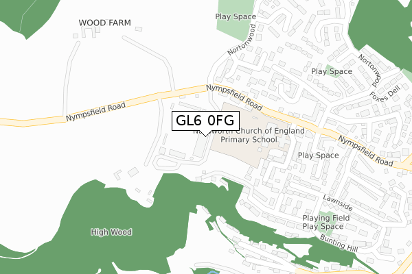
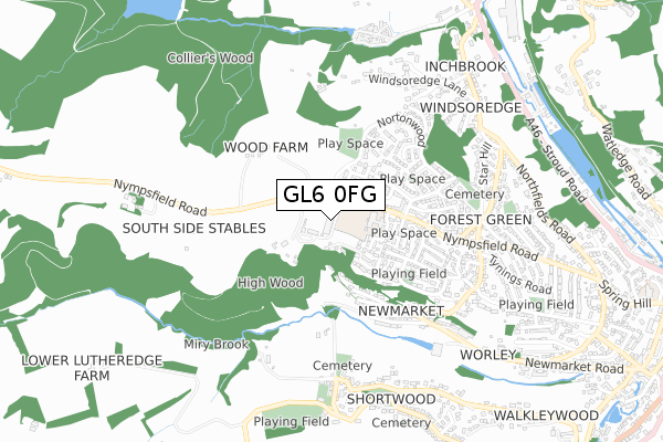
GL6 0FG is located in the Nailsworth electoral ward, within the local authority district of Stroud and the English Parliamentary constituency of Stroud. The Sub Integrated Care Board (ICB) Location is NHS Gloucestershire ICB - 11M and the police force is Gloucestershire. This postcode has been in use since November 2008.


GetTheData
Source: OS Open Zoomstack (Ordnance Survey)
Licence: Open Government Licence (requires attribution)
Attribution: Contains OS data © Crown copyright and database right 2025
Source: Open Postcode Geo
Licence: Open Government Licence (requires attribution)
Attribution: Contains OS data © Crown copyright and database right 2025; Contains Royal Mail data © Royal Mail copyright and database right 2025; Source: Office for National Statistics licensed under the Open Government Licence v.3.0
| Easting | 383708 |
| Northing | 200038 |
| Latitude | 51.698848 |
| Longitude | -2.237132 |
GetTheData
Source: Open Postcode Geo
Licence: Open Government Licence
| Country | England |
| Postcode District | GL6 |
➜ See where GL6 is on a map ➜ Where is Nailsworth? | |
GetTheData
Source: Land Registry Price Paid Data
Licence: Open Government Licence
Elevation or altitude of GL6 0FG as distance above sea level:
| Metres | Feet | |
|---|---|---|
| Elevation | 160m | 525ft |
Elevation is measured from the approximate centre of the postcode, to the nearest point on an OS contour line from OS Terrain 50, which has contour spacing of ten vertical metres.
➜ How high above sea level am I? Find the elevation of your current position using your device's GPS.
GetTheData
Source: Open Postcode Elevation
Licence: Open Government Licence
| Ward | Nailsworth |
| Constituency | Stroud |
GetTheData
Source: ONS Postcode Database
Licence: Open Government Licence
| Nailsworth Primary School (Nympsfield Road) | Forest Green | 144m |
| Nailsworth Primary School (Nympsfield Road) | Forest Green | 165m |
| Carters Way (Nortonwood) | Forest Green | 192m |
| Colliers Wood (Nortonwood) | Forest Green | 292m |
| Nortonwood (Nympsfield Road) | Forest Green | 310m |
GetTheData
Source: NaPTAN
Licence: Open Government Licence
GetTheData
Source: ONS Postcode Database
Licence: Open Government Licence


➜ Get more ratings from the Food Standards Agency
GetTheData
Source: Food Standards Agency
Licence: FSA terms & conditions
| Last Collection | |||
|---|---|---|---|
| Location | Mon-Fri | Sat | Distance |
| Norton Wood Forest Green | 16:30 | 11:30 | 279m |
| Lawnside Stores | 16:30 | 11:15 | 392m |
| Forest Green P.o. | 16:30 | 11:30 | 590m |
GetTheData
Source: Dracos
Licence: Creative Commons Attribution-ShareAlike
The below table lists the International Territorial Level (ITL) codes (formerly Nomenclature of Territorial Units for Statistics (NUTS) codes) and Local Administrative Units (LAU) codes for GL6 0FG:
| ITL 1 Code | Name |
|---|---|
| TLK | South West (England) |
| ITL 2 Code | Name |
| TLK1 | Gloucestershire, Wiltshire and Bath/Bristol area |
| ITL 3 Code | Name |
| TLK13 | Gloucestershire CC |
| LAU 1 Code | Name |
| E07000082 | Stroud |
GetTheData
Source: ONS Postcode Directory
Licence: Open Government Licence
The below table lists the Census Output Area (OA), Lower Layer Super Output Area (LSOA), and Middle Layer Super Output Area (MSOA) for GL6 0FG:
| Code | Name | |
|---|---|---|
| OA | E00113798 | |
| LSOA | E01022387 | Stroud 013C |
| MSOA | E02004663 | Stroud 013 |
GetTheData
Source: ONS Postcode Directory
Licence: Open Government Licence
| GL6 0ET | Cottage Gardens | 113m |
| GL6 0BJ | Highwood Drive | 183m |
| GL6 0EU | Nympsfield Road | 192m |
| GL6 0TP | Carters Way | 214m |
| GL6 0TQ | Bunting Way | 228m |
| GL6 0RH | Wood End Lane | 280m |
| GL6 0BG | Beechwood Close | 285m |
| GL6 0HD | Norton Wood | 297m |
| GL6 0HE | Badgers Way | 318m |
| GL6 0RJ | Newmarket | 334m |
GetTheData
Source: Open Postcode Geo; Land Registry Price Paid Data
Licence: Open Government Licence