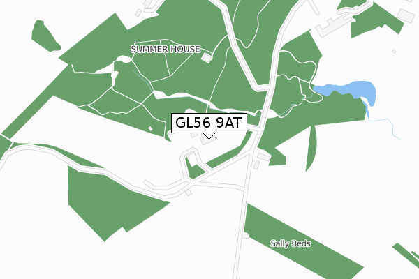
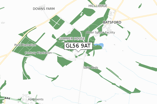
GL56 9AT is located in the Moreton West electoral ward, within the local authority district of Cotswold and the English Parliamentary constituency of The Cotswolds. The Sub Integrated Care Board (ICB) Location is NHS Gloucestershire ICB - 11M and the police force is Gloucestershire. This postcode has been in use since March 2019.


GetTheData
Source: OS Open Zoomstack (Ordnance Survey)
Licence: Open Government Licence (requires attribution)
Attribution: Contains OS data © Crown copyright and database right 2025
Source: Open Postcode Geo
Licence: Open Government Licence (requires attribution)
Attribution: Contains OS data © Crown copyright and database right 2025; Contains Royal Mail data © Royal Mail copyright and database right 2025; Source: Office for National Statistics licensed under the Open Government Licence v.3.0
| Easting | 418244 |
| Northing | 233407 |
| Latitude | 51.998821 |
| Longitude | -1.735662 |
GetTheData
Source: Open Postcode Geo
Licence: Open Government Licence
| Country | England |
| Postcode District | GL56 |
➜ See where GL56 is on a map | |
GetTheData
Source: Land Registry Price Paid Data
Licence: Open Government Licence
| Ward | Moreton West |
| Constituency | The Cotswolds |
GetTheData
Source: ONS Postcode Database
Licence: Open Government Licence
| Saw Mill Crossroads (Aston Magna Road) | Batsford | 909m |
| Saw Mill Crossroads (Aston Magna Road) | Batsford | 912m |
| Batsford Arboretum (A44) | Bourton-on-the-hill | 995m |
| Fenhill Close | Bourton-on-the-hill | 1,006m |
| Batsford Arboretum (A44) | Bourton-on-the-hill | 1,008m |
| Moreton-in-Marsh Station | 2.5km |
GetTheData
Source: NaPTAN
Licence: Open Government Licence
GetTheData
Source: ONS Postcode Database
Licence: Open Government Licence
| Last Collection | |||
|---|---|---|---|
| Location | Mon-Fri | Sat | Distance |
| High Street | 17:00 | 10:45 | 2,427m |
| Post Office | 17:30 | 11:00 | 2,486m |
| Todenham Road | 15:15 | 07:30 | 2,544m |
GetTheData
Source: Dracos
Licence: Creative Commons Attribution-ShareAlike
The below table lists the International Territorial Level (ITL) codes (formerly Nomenclature of Territorial Units for Statistics (NUTS) codes) and Local Administrative Units (LAU) codes for GL56 9AT:
| ITL 1 Code | Name |
|---|---|
| TLK | South West (England) |
| ITL 2 Code | Name |
| TLK1 | Gloucestershire, Wiltshire and Bath/Bristol area |
| ITL 3 Code | Name |
| TLK13 | Gloucestershire CC |
| LAU 1 Code | Name |
| E07000079 | Cotswold |
GetTheData
Source: ONS Postcode Directory
Licence: Open Government Licence
The below table lists the Census Output Area (OA), Lower Layer Super Output Area (LSOA), and Middle Layer Super Output Area (MSOA) for GL56 9AT:
| Code | Name | |
|---|---|---|
| OA | E00112851 | |
| LSOA | E01022205 | Cotswold 002C |
| MSOA | E02004616 | Cotswold 002 |
GetTheData
Source: ONS Postcode Directory
Licence: Open Government Licence
| GL56 9AE | 1069m | |
| GL56 9AD | Fenhill Close | 1081m |
| GL56 9AH | 1125m | |
| GL56 9AQ | 1175m | |
| GL56 9AF | 1200m | |
| GL56 9AP | Chantry Gardens | 1206m |
| GL56 9AG | 1251m | |
| GL56 9AJ | 1570m | |
| GL56 9AB | 1769m | |
| GL56 9LE | 1944m |
GetTheData
Source: Open Postcode Geo; Land Registry Price Paid Data
Licence: Open Government Licence