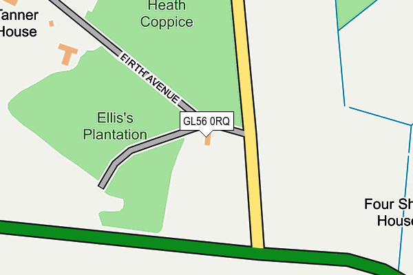
GL56 0RQ is located in the Moreton East electoral ward, within the local authority district of Cotswold and the English Parliamentary constituency of The Cotswolds. The Sub Integrated Care Board (ICB) Location is NHS Gloucestershire ICB - 11M and the police force is Gloucestershire. This postcode has been in use since November 2011.


GetTheData
Source: OS OpenMap – Local (Ordnance Survey)
Source: OS VectorMap District (Ordnance Survey)
Licence: Open Government Licence (requires attribution)
| Easting | 422734 |
| Northing | 232373 |
| Latitude | 51.989349 |
| Longitude | -1.670342 |
GetTheData
Source: Open Postcode Geo
Licence: Open Government Licence
| Country | England |
| Postcode District | GL56 |
➜ See where GL56 is on a map | |
GetTheData
Source: Land Registry Price Paid Data
Licence: Open Government Licence
Elevation or altitude of GL56 0RQ as distance above sea level:
| Metres | Feet | |
|---|---|---|
| Elevation | 130m | 427ft |
Elevation is measured from the approximate centre of the postcode, to the nearest point on an OS contour line from OS Terrain 50, which has contour spacing of ten vertical metres.
➜ How high above sea level am I? Find the elevation of your current position using your device's GPS.
GetTheData
Source: Open Postcode Elevation
Licence: Open Government Licence
| Ward | Moreton East |
| Constituency | The Cotswolds |
GetTheData
Source: ONS Postcode Database
Licence: Open Government Licence
| Four Shires Stone Farm | Moreton-in-marsh | 383m |
| Four Shire School Farm | Moreton-in-marsh | 387m |
| Fire Service College (A44) | Moreton-in-marsh | 464m |
| Fire Service College (A44) | Moreton-in-marsh | 548m |
| Mosedale (London Road) | Moreton-in-marsh | 1,328m |
| Moreton-in-Marsh Station | 2.1km |
GetTheData
Source: NaPTAN
Licence: Open Government Licence
GetTheData
Source: ONS Postcode Database
Licence: Open Government Licence


➜ Get more ratings from the Food Standards Agency
GetTheData
Source: Food Standards Agency
Licence: FSA terms & conditions
| Last Collection | |||
|---|---|---|---|
| Location | Mon-Fri | Sat | Distance |
| Todenham Road | 15:15 | 07:30 | 2,070m |
| Post Office | 17:30 | 11:00 | 2,154m |
| Church Street | 17:00 | 10:45 | 2,185m |
GetTheData
Source: Dracos
Licence: Creative Commons Attribution-ShareAlike
The below table lists the International Territorial Level (ITL) codes (formerly Nomenclature of Territorial Units for Statistics (NUTS) codes) and Local Administrative Units (LAU) codes for GL56 0RQ:
| ITL 1 Code | Name |
|---|---|
| TLK | South West (England) |
| ITL 2 Code | Name |
| TLK1 | Gloucestershire, Wiltshire and Bath/Bristol area |
| ITL 3 Code | Name |
| TLK13 | Gloucestershire CC |
| LAU 1 Code | Name |
| E07000079 | Cotswold |
GetTheData
Source: ONS Postcode Directory
Licence: Open Government Licence
The below table lists the Census Output Area (OA), Lower Layer Super Output Area (LSOA), and Middle Layer Super Output Area (MSOA) for GL56 0RQ:
| Code | Name | |
|---|---|---|
| OA | E00112896 | |
| LSOA | E01022212 | Cotswold 002E |
| MSOA | E02004616 | Cotswold 002 |
GetTheData
Source: ONS Postcode Directory
Licence: Open Government Licence
| GL56 0PE | Great Wolford Road | 876m |
| GL56 0PG | London Road | 955m |
| GL56 0GN | Halifax Way | 1151m |
| GL56 0GP | Lancaster Corner | 1170m |
| GL56 0GF | Lysander Way | 1180m |
| GL56 0JQ | Cotswold Business Village | 1184m |
| GL56 0GQ | Meteor Link | 1188m |
| GL56 0GD | Lysander Way | 1214m |
| GL56 0GT | Hampden Way | 1225m |
| GL56 0GU | Beaufort Road | 1229m |
GetTheData
Source: Open Postcode Geo; Land Registry Price Paid Data
Licence: Open Government Licence