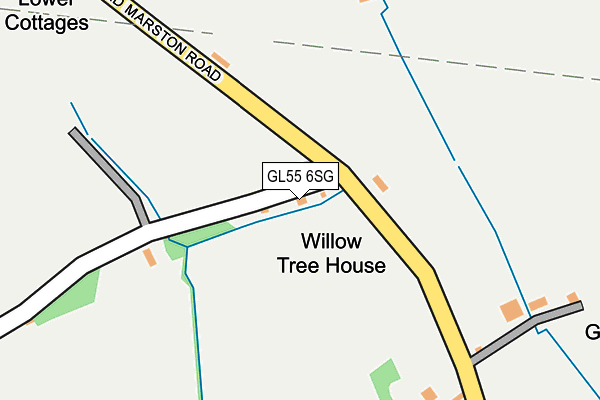
GL55 6SG lies on G C C Houses in Mickleton, Chipping Campden. GL55 6SG is located in the Campden & Vale electoral ward, within the local authority district of Cotswold and the English Parliamentary constituency of The Cotswolds. The Sub Integrated Care Board (ICB) Location is NHS Gloucestershire ICB - 11M and the police force is Gloucestershire. This postcode has been in use since January 1980.


GetTheData
Source: OS OpenMap – Local (Ordnance Survey)
Source: OS VectorMap District (Ordnance Survey)
Licence: Open Government Licence (requires attribution)
| Easting | 415061 |
| Northing | 244755 |
| Latitude | 52.100929 |
| Longitude | -1.781539 |
GetTheData
Source: Open Postcode Geo
Licence: Open Government Licence
| Street | G C C Houses |
| Locality | Mickleton |
| Town/City | Chipping Campden |
| Country | England |
| Postcode District | GL55 |
➜ See where GL55 is on a map | |
GetTheData
Source: Land Registry Price Paid Data
Licence: Open Government Licence
Elevation or altitude of GL55 6SG as distance above sea level:
| Metres | Feet | |
|---|---|---|
| Elevation | 60m | 197ft |
Elevation is measured from the approximate centre of the postcode, to the nearest point on an OS contour line from OS Terrain 50, which has contour spacing of ten vertical metres.
➜ How high above sea level am I? Find the elevation of your current position using your device's GPS.
GetTheData
Source: Open Postcode Elevation
Licence: Open Government Licence
| Ward | Campden & Vale |
| Constituency | The Cotswolds |
GetTheData
Source: ONS Postcode Database
Licence: Open Government Licence
| Stratford Road | Mickleton | 1,352m |
| Stratford Road | Mickleton | 1,380m |
| Meon Road (Granbrook Lane) | Mickleton | 1,472m |
| Meon Road (Granbrook Lane) | Mickleton | 1,478m |
| Marston Grange (Broad Marston Road) | Broad Marston | 1,485m |
| Honeybourne Station | 3.6km |
GetTheData
Source: NaPTAN
Licence: Open Government Licence
GetTheData
Source: ONS Postcode Database
Licence: Open Government Licence


➜ Get more ratings from the Food Standards Agency
GetTheData
Source: Food Standards Agency
Licence: FSA terms & conditions
| Last Collection | |||
|---|---|---|---|
| Location | Mon-Fri | Sat | Distance |
| The Butts | 16:30 | 10:30 | 1,463m |
| Mickleton P.o. | 16:30 | 10:30 | 1,585m |
| Broad Marston | 16:15 | 07:15 | 1,922m |
GetTheData
Source: Dracos
Licence: Creative Commons Attribution-ShareAlike
The below table lists the International Territorial Level (ITL) codes (formerly Nomenclature of Territorial Units for Statistics (NUTS) codes) and Local Administrative Units (LAU) codes for GL55 6SG:
| ITL 1 Code | Name |
|---|---|
| TLK | South West (England) |
| ITL 2 Code | Name |
| TLK1 | Gloucestershire, Wiltshire and Bath/Bristol area |
| ITL 3 Code | Name |
| TLK13 | Gloucestershire CC |
| LAU 1 Code | Name |
| E07000079 | Cotswold |
GetTheData
Source: ONS Postcode Directory
Licence: Open Government Licence
The below table lists the Census Output Area (OA), Lower Layer Super Output Area (LSOA), and Middle Layer Super Output Area (MSOA) for GL55 6SG:
| Code | Name | |
|---|---|---|
| OA | E00112743 | |
| LSOA | E01022185 | Cotswold 001E |
| MSOA | E02004615 | Cotswold 001 |
GetTheData
Source: ONS Postcode Directory
Licence: Open Government Licence
| GL55 6SF | Broad Marston Lane | 273m |
| GL55 6ST | Long Marston Lane | 628m |
| GL55 6SR | Stratford Road | 964m |
| GL55 6PU | Honeybourne Lane | 1130m |
| GL55 6RG | Sovereign Fields | 1252m |
| GL55 6SU | Stratford Road | 1256m |
| GL55 6SW | Stratford Road | 1288m |
| GL55 6TZ | Inverlea Court | 1333m |
| GL55 6SJ | Back Lane | 1345m |
| GL55 6UA | Wheatfield Court | 1354m |
GetTheData
Source: Open Postcode Geo; Land Registry Price Paid Data
Licence: Open Government Licence