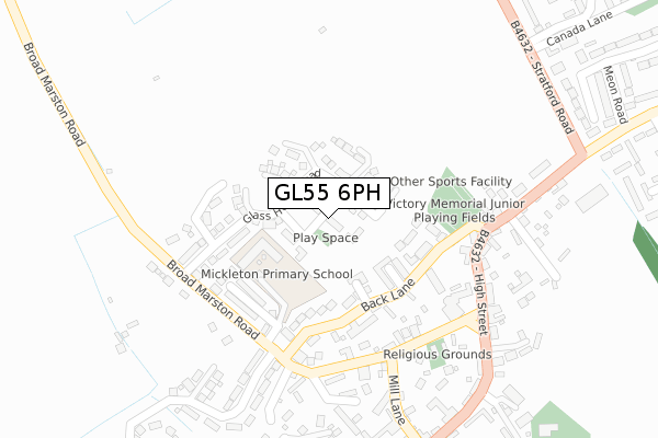
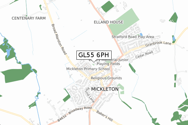
GL55 6PH is located in the Campden & Vale electoral ward, within the local authority district of Cotswold and the English Parliamentary constituency of The Cotswolds. The Sub Integrated Care Board (ICB) Location is NHS Gloucestershire ICB - 11M and the police force is Gloucestershire. This postcode has been in use since January 2018.


GetTheData
Source: OS Open Zoomstack (Ordnance Survey)
Licence: Open Government Licence (requires attribution)
Attribution: Contains OS data © Crown copyright and database right 2025
Source: Open Postcode Geo
Licence: Open Government Licence (requires attribution)
Attribution: Contains OS data © Crown copyright and database right 2025; Contains Royal Mail data © Royal Mail copyright and database right 2025; Source: Office for National Statistics licensed under the Open Government Licence v.3.0
| Easting | 415859 |
| Northing | 243823 |
| Latitude | 52.092541 |
| Longitude | -1.769922 |
GetTheData
Source: Open Postcode Geo
Licence: Open Government Licence
| Country | England |
| Postcode District | GL55 |
➜ See where GL55 is on a map | |
GetTheData
Source: Land Registry Price Paid Data
Licence: Open Government Licence
| Ward | Campden & Vale |
| Constituency | The Cotswolds |
GetTheData
Source: ONS Postcode Database
Licence: Open Government Licence
| Three Ways Hotel (B4632 High Street) | Mickleton | 271m |
| Three Ways Hotel (B4632 High Street) | Mickleton | 278m |
| King's Arms (High Street) | Mickleton | 369m |
| Stratford Road | Mickleton | 384m |
| King's Arms (High Street) | Mickleton | 385m |
| Honeybourne Station | 4.5km |
GetTheData
Source: NaPTAN
Licence: Open Government Licence
| Percentage of properties with Next Generation Access | 0.0% |
| Percentage of properties with Superfast Broadband | 0.0% |
| Percentage of properties with Ultrafast Broadband | 0.0% |
| Percentage of properties with Full Fibre Broadband | 0.0% |
Superfast Broadband is between 30Mbps and 300Mbps
Ultrafast Broadband is > 300Mbps
| Median download speed | 19.6Mbps |
| Average download speed | 19.4Mbps |
| Maximum download speed | 21.44Mbps |
| Median upload speed | 1.1Mbps |
| Average upload speed | 1.1Mbps |
| Maximum upload speed | 1.27Mbps |
| Percentage of properties unable to receive 2Mbps | 0.0% |
| Percentage of properties unable to receive 5Mbps | 0.0% |
| Percentage of properties unable to receive 10Mbps | 0.0% |
| Percentage of properties unable to receive 30Mbps | 100.0% |
GetTheData
Source: Ofcom
Licence: Ofcom Terms of Use (requires attribution)
GetTheData
Source: ONS Postcode Database
Licence: Open Government Licence


➜ Get more ratings from the Food Standards Agency
GetTheData
Source: Food Standards Agency
Licence: FSA terms & conditions
| Last Collection | |||
|---|---|---|---|
| Location | Mon-Fri | Sat | Distance |
| Mickleton P.o. | 16:30 | 10:30 | 367m |
| The Butts | 16:30 | 10:30 | 426m |
| Little Hidcote | 16:15 | 08:45 | 2,039m |
GetTheData
Source: Dracos
Licence: Creative Commons Attribution-ShareAlike
The below table lists the International Territorial Level (ITL) codes (formerly Nomenclature of Territorial Units for Statistics (NUTS) codes) and Local Administrative Units (LAU) codes for GL55 6PH:
| ITL 1 Code | Name |
|---|---|
| TLK | South West (England) |
| ITL 2 Code | Name |
| TLK1 | Gloucestershire, Wiltshire and Bath/Bristol area |
| ITL 3 Code | Name |
| TLK13 | Gloucestershire CC |
| LAU 1 Code | Name |
| E07000079 | Cotswold |
GetTheData
Source: ONS Postcode Directory
Licence: Open Government Licence
The below table lists the Census Output Area (OA), Lower Layer Super Output Area (LSOA), and Middle Layer Super Output Area (MSOA) for GL55 6PH:
| Code | Name | |
|---|---|---|
| OA | E00112743 | |
| LSOA | E01022185 | Cotswold 001E |
| MSOA | E02004615 | Cotswold 001 |
GetTheData
Source: ONS Postcode Directory
Licence: Open Government Licence
| GL55 6TZ | Inverlea Court | 108m |
| GL55 6UA | Wheatfield Court | 127m |
| GL55 6SJ | Back Lane | 130m |
| GL55 6TY | Bearcroft Gardens | 152m |
| GL55 6RG | Sovereign Fields | 187m |
| GL55 6SD | Chapel Lane | 200m |
| GL55 6SA | High Street | 288m |
| GL55 6SE | Mill Lane | 294m |
| GL55 6SL | High Street | 295m |
| GL55 6TT | Greyrick Court | 309m |
GetTheData
Source: Open Postcode Geo; Land Registry Price Paid Data
Licence: Open Government Licence