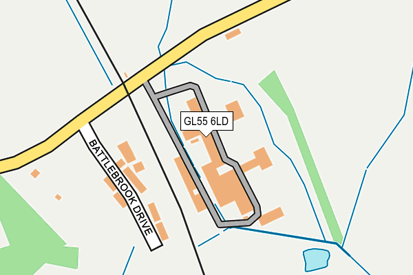
GL55 6LD is located in the Blockley electoral ward, within the local authority district of Cotswold and the English Parliamentary constituency of The Cotswolds. The Sub Integrated Care Board (ICB) Location is NHS Gloucestershire ICB - 11M and the police force is Gloucestershire. This postcode has been in use since January 1980.


GetTheData
Source: OS OpenMap – Local (Ordnance Survey)
Source: OS VectorMap District (Ordnance Survey)
Licence: Open Government Licence (requires attribution)
| Easting | 416960 |
| Northing | 239667 |
| Latitude | 52.055131 |
| Longitude | -1.754067 |
GetTheData
Source: Open Postcode Geo
Licence: Open Government Licence
| Country | England |
| Postcode District | GL55 |
➜ See where GL55 is on a map | |
GetTheData
Source: Land Registry Price Paid Data
Licence: Open Government Licence
Elevation or altitude of GL55 6LD as distance above sea level:
| Metres | Feet | |
|---|---|---|
| Elevation | 120m | 394ft |
Elevation is measured from the approximate centre of the postcode, to the nearest point on an OS contour line from OS Terrain 50, which has contour spacing of ten vertical metres.
➜ How high above sea level am I? Find the elevation of your current position using your device's GPS.
GetTheData
Source: Open Postcode Elevation
Licence: Open Government Licence
| Ward | Blockley |
| Constituency | The Cotswolds |
GetTheData
Source: ONS Postcode Database
Licence: Open Government Licence
| Station Cottages (Station Road) | Chipping Campden | 214m |
| Station Cottages (Station Road) | Chipping Campden | 257m |
| Berrington Road (Station Road) | Chipping Campden | 957m |
| Berrington Road (Station Road) | Chipping Campden | 995m |
| Village Hall (Hidcote Road) | Ebrington | 1,511m |
GetTheData
Source: NaPTAN
Licence: Open Government Licence
GetTheData
Source: ONS Postcode Database
Licence: Open Government Licence


➜ Get more ratings from the Food Standards Agency
GetTheData
Source: Food Standards Agency
Licence: FSA terms & conditions
| Last Collection | |||
|---|---|---|---|
| Location | Mon-Fri | Sat | Distance |
| Catbrook | 15:45 | 10:00 | 1,937m |
| Park Road | 17:00 | 10:00 | 2,168m |
| Little Hidcote | 16:15 | 08:45 | 3,229m |
GetTheData
Source: Dracos
Licence: Creative Commons Attribution-ShareAlike
The below table lists the International Territorial Level (ITL) codes (formerly Nomenclature of Territorial Units for Statistics (NUTS) codes) and Local Administrative Units (LAU) codes for GL55 6LD:
| ITL 1 Code | Name |
|---|---|
| TLK | South West (England) |
| ITL 2 Code | Name |
| TLK1 | Gloucestershire, Wiltshire and Bath/Bristol area |
| ITL 3 Code | Name |
| TLK13 | Gloucestershire CC |
| LAU 1 Code | Name |
| E07000079 | Cotswold |
GetTheData
Source: ONS Postcode Directory
Licence: Open Government Licence
The below table lists the Census Output Area (OA), Lower Layer Super Output Area (LSOA), and Middle Layer Super Output Area (MSOA) for GL55 6LD:
| Code | Name | |
|---|---|---|
| OA | E00112739 | |
| LSOA | E01022184 | Cotswold 001D |
| MSOA | E02004615 | Cotswold 001 |
GetTheData
Source: ONS Postcode Directory
Licence: Open Government Licence
| GL55 6LE | Station Road | 154m |
| GL55 6LG | Station Road | 254m |
| GL55 6LF | Station Road | 351m |
| GL55 6LA | Paxford Road | 370m |
| GL55 6LB | Station Road | 408m |
| GL55 6JT | Castle Nurseries | 796m |
| GL55 6JD | Station Road | 813m |
| GL55 6JR | Castle Gardens | 859m |
| GL55 6JA | Berrington Road | 939m |
| GL55 6HZ | Station Road | 1004m |
GetTheData
Source: Open Postcode Geo; Land Registry Price Paid Data
Licence: Open Government Licence