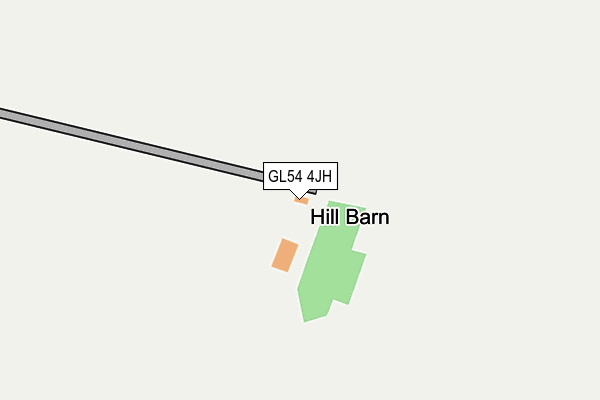
GL54 4JH is in Shipton Oliffe, Cheltenham. GL54 4JH is located in the Sandywell electoral ward, within the local authority district of Cotswold and the English Parliamentary constituency of The Cotswolds. The Sub Integrated Care Board (ICB) Location is NHS Gloucestershire ICB - 11M and the police force is Gloucestershire. This postcode has been in use since January 1980.


GetTheData
Source: OS OpenMap – Local (Ordnance Survey)
Source: OS VectorMap District (Ordnance Survey)
Licence: Open Government Licence (requires attribution)
| Easting | 405802 |
| Northing | 218964 |
| Latitude | 51.869223 |
| Longitude | -1.917138 |
GetTheData
Source: Open Postcode Geo
Licence: Open Government Licence
| Locality | Shipton Oliffe |
| Town/City | Cheltenham |
| Country | England |
| Postcode District | GL54 |
➜ See where GL54 is on a map | |
GetTheData
Source: Land Registry Price Paid Data
Licence: Open Government Licence
Elevation or altitude of GL54 4JH as distance above sea level:
| Metres | Feet | |
|---|---|---|
| Elevation | 220m | 722ft |
Elevation is measured from the approximate centre of the postcode, to the nearest point on an OS contour line from OS Terrain 50, which has contour spacing of ten vertical metres.
➜ How high above sea level am I? Find the elevation of your current position using your device's GPS.
GetTheData
Source: Open Postcode Elevation
Licence: Open Government Licence
| Ward | Sandywell |
| Constituency | The Cotswolds |
GetTheData
Source: ONS Postcode Database
Licence: Open Government Licence
| Home Farm School Stop | Hampen | 1,196m |
| Crossroads (White Way) | Compton Abdale | 1,595m |
| Crossroads (White Way) | Compton Abdale | 1,597m |
| Turn (A40) | Hazleton | 1,623m |
| Turn (A40) | Hazleton | 1,651m |
GetTheData
Source: NaPTAN
Licence: Open Government Licence
GetTheData
Source: ONS Postcode Database
Licence: Open Government Licence
| Last Collection | |||
|---|---|---|---|
| Location | Mon-Fri | Sat | Distance |
| Salperton | 16:45 | 10:30 | 2,266m |
| Withington(Church) | 16:15 | 10:30 | 4,357m |
| Foxcote | 17:00 | 09:00 | 4,586m |
GetTheData
Source: Dracos
Licence: Creative Commons Attribution-ShareAlike
The below table lists the International Territorial Level (ITL) codes (formerly Nomenclature of Territorial Units for Statistics (NUTS) codes) and Local Administrative Units (LAU) codes for GL54 4JH:
| ITL 1 Code | Name |
|---|---|
| TLK | South West (England) |
| ITL 2 Code | Name |
| TLK1 | Gloucestershire, Wiltshire and Bath/Bristol area |
| ITL 3 Code | Name |
| TLK13 | Gloucestershire CC |
| LAU 1 Code | Name |
| E07000079 | Cotswold |
GetTheData
Source: ONS Postcode Directory
Licence: Open Government Licence
The below table lists the Census Output Area (OA), Lower Layer Super Output Area (LSOA), and Middle Layer Super Output Area (MSOA) for GL54 4JH:
| Code | Name | |
|---|---|---|
| OA | E00112926 | |
| LSOA | E01022216 | Cotswold 004D |
| MSOA | E02004618 | Cotswold 004 |
GetTheData
Source: ONS Postcode Directory
Licence: Open Government Licence
| GL54 4JJ | 981m | |
| GL54 4DN | 1567m | |
| GL54 4JQ | 1779m | |
| GL54 4JF | 1865m | |
| GL54 4HW | The Hive | 1890m |
| GL54 4JG | Syreford Road | 1978m |
| GL54 4HY | 1991m | |
| GL54 4JE | 2014m | |
| GL54 4JT | Yew Tree Close | 2051m |
| GL54 4DW | Pike Hill Rise | 2134m |
GetTheData
Source: Open Postcode Geo; Land Registry Price Paid Data
Licence: Open Government Licence