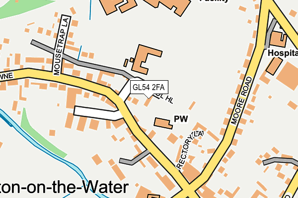
GL54 2FA is located in the Bourton Village electoral ward, within the local authority district of Cotswold and the English Parliamentary constituency of The Cotswolds. The Sub Integrated Care Board (ICB) Location is NHS Gloucestershire ICB - 11M and the police force is Gloucestershire. This postcode has been in use since February 2017.


GetTheData
Source: OS OpenMap – Local (Ordnance Survey)
Source: OS VectorMap District (Ordnance Survey)
Licence: Open Government Licence (requires attribution)
| Easting | 416673 |
| Northing | 220911 |
| Latitude | 51.886519 |
| Longitude | -1.759147 |
GetTheData
Source: Open Postcode Geo
Licence: Open Government Licence
| Country | England |
| Postcode District | GL54 |
➜ See where GL54 is on a map ➜ Where is Bourton-on-the-Water? | |
GetTheData
Source: Land Registry Price Paid Data
Licence: Open Government Licence
| Ward | Bourton Village |
| Constituency | The Cotswolds |
GetTheData
Source: ONS Postcode Database
Licence: Open Government Licence
| Primary School | Bourton-on-the-water | 30m |
| Newsagent (Lansdowne) | Bourton-on-the-water | 155m |
| Edinburgh Wool Shop (High Street) | Bourton-on-the-water | 162m |
| Moore Hospital (Moore Road) | Bourton-on-the-water | 243m |
| Moore Hospital (Moore Road) | Bourton-on-the-water | 244m |
GetTheData
Source: NaPTAN
Licence: Open Government Licence
| Percentage of properties with Next Generation Access | 100.0% |
| Percentage of properties with Superfast Broadband | 100.0% |
| Percentage of properties with Ultrafast Broadband | 0.0% |
| Percentage of properties with Full Fibre Broadband | 0.0% |
Superfast Broadband is between 30Mbps and 300Mbps
Ultrafast Broadband is > 300Mbps
| Percentage of properties unable to receive 2Mbps | 0.0% |
| Percentage of properties unable to receive 5Mbps | 0.0% |
| Percentage of properties unable to receive 10Mbps | 0.0% |
| Percentage of properties unable to receive 30Mbps | 0.0% |
GetTheData
Source: Ofcom
Licence: Ofcom Terms of Use (requires attribution)
GetTheData
Source: ONS Postcode Database
Licence: Open Government Licence


➜ Get more ratings from the Food Standards Agency
GetTheData
Source: Food Standards Agency
Licence: FSA terms & conditions
| Last Collection | |||
|---|---|---|---|
| Location | Mon-Fri | Sat | Distance |
| Landsdown | 16:30 | 10:30 | 286m |
| Wyck Rissington Church | 16:15 | 08:15 | 2,520m |
| Upper Slaughter | 15:45 | 09:45 | 2,528m |
GetTheData
Source: Dracos
Licence: Creative Commons Attribution-ShareAlike
The below table lists the International Territorial Level (ITL) codes (formerly Nomenclature of Territorial Units for Statistics (NUTS) codes) and Local Administrative Units (LAU) codes for GL54 2FA:
| ITL 1 Code | Name |
|---|---|
| TLK | South West (England) |
| ITL 2 Code | Name |
| TLK1 | Gloucestershire, Wiltshire and Bath/Bristol area |
| ITL 3 Code | Name |
| TLK13 | Gloucestershire CC |
| LAU 1 Code | Name |
| E07000079 | Cotswold |
GetTheData
Source: ONS Postcode Directory
Licence: Open Government Licence
The below table lists the Census Output Area (OA), Lower Layer Super Output Area (LSOA), and Middle Layer Super Output Area (MSOA) for GL54 2FA:
| Code | Name | |
|---|---|---|
| OA | E00112718 | |
| LSOA | E01022181 | Cotswold 003B |
| MSOA | E02004617 | Cotswold 003 |
GetTheData
Source: ONS Postcode Directory
Licence: Open Government Licence
| GL54 2BH | Perryfield Court | 94m |
| GL54 2AX | Rectory Lane | 127m |
| GL54 2AP | High Street | 130m |
| GL54 2AZ | Moore Road | 164m |
| GL54 2AU | Mouse Trap Lane | 205m |
| GL54 2AR | Lansdown | 225m |
| GL54 2AN | High Street | 232m |
| GL54 2BX | Victoria Street | 277m |
| GL54 2BY | Sherbourne Street | 279m |
| GL54 2BU | Victoria Street | 300m |
GetTheData
Source: Open Postcode Geo; Land Registry Price Paid Data
Licence: Open Government Licence