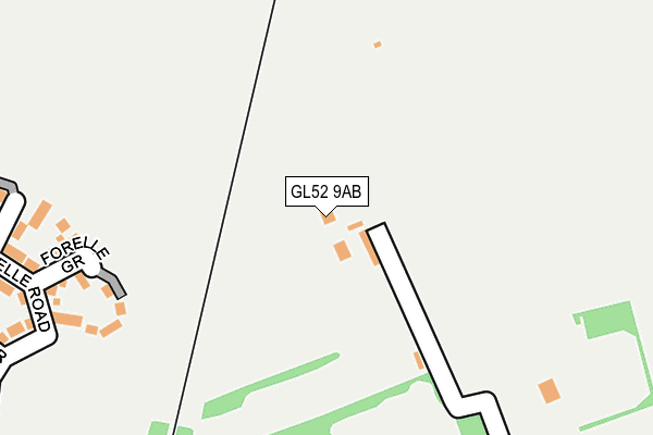
GL52 9AB is located in the Cleeve Hill electoral ward, within the local authority district of Tewkesbury and the English Parliamentary constituency of Tewkesbury. The Sub Integrated Care Board (ICB) Location is NHS Gloucestershire ICB - 11M and the police force is Gloucestershire. This postcode has been in use since August 2010.


GetTheData
Source: OS OpenMap – Local (Ordnance Survey)
Source: OS VectorMap District (Ordnance Survey)
Licence: Open Government Licence (requires attribution)
| Easting | 396882 |
| Northing | 228304 |
| Latitude | 51.953217 |
| Longitude | -2.046778 |
GetTheData
Source: Open Postcode Geo
Licence: Open Government Licence
| Country | England |
| Postcode District | GL52 |
➜ See where GL52 is on a map ➜ Where is Woodmancote? | |
GetTheData
Source: Land Registry Price Paid Data
Licence: Open Government Licence
Elevation or altitude of GL52 9AB as distance above sea level:
| Metres | Feet | |
|---|---|---|
| Elevation | 80m | 262ft |
Elevation is measured from the approximate centre of the postcode, to the nearest point on an OS contour line from OS Terrain 50, which has contour spacing of ten vertical metres.
➜ How high above sea level am I? Find the elevation of your current position using your device's GPS.
GetTheData
Source: Open Postcode Elevation
Licence: Open Government Licence
| Ward | Cleeve Hill |
| Constituency | Tewkesbury |
GetTheData
Source: ONS Postcode Database
Licence: Open Government Licence
| Oxbutts Caravan Park | Woodmancote | 613m |
| Railway Bridge (Station Road) | Woodmancote | 628m |
| Oxbutts Caravan Park | Woodmancote | 628m |
| Millham Road (Station Road) | Bishop's Cleeve | 653m |
| Bushcombe Lane | Woodmancote | 733m |
GetTheData
Source: NaPTAN
Licence: Open Government Licence
GetTheData
Source: ONS Postcode Database
Licence: Open Government Licence


➜ Get more ratings from the Food Standards Agency
GetTheData
Source: Food Standards Agency
Licence: FSA terms & conditions
| Last Collection | |||
|---|---|---|---|
| Location | Mon-Fri | Sat | Distance |
| Oxbutts Park B Cleeve | 16:15 | 11:15 | 605m |
| Ryeworyh | 17:00 | 12:15 | 965m |
| Sandown Road | 17:15 | 11:00 | 1,047m |
GetTheData
Source: Dracos
Licence: Creative Commons Attribution-ShareAlike
The below table lists the International Territorial Level (ITL) codes (formerly Nomenclature of Territorial Units for Statistics (NUTS) codes) and Local Administrative Units (LAU) codes for GL52 9AB:
| ITL 1 Code | Name |
|---|---|
| TLK | South West (England) |
| ITL 2 Code | Name |
| TLK1 | Gloucestershire, Wiltshire and Bath/Bristol area |
| ITL 3 Code | Name |
| TLK13 | Gloucestershire CC |
| LAU 1 Code | Name |
| E07000083 | Tewkesbury |
GetTheData
Source: ONS Postcode Directory
Licence: Open Government Licence
The below table lists the Census Output Area (OA), Lower Layer Super Output Area (LSOA), and Middle Layer Super Output Area (MSOA) for GL52 9AB:
| Code | Name | |
|---|---|---|
| OA | E00169002 | |
| LSOA | E01022433 | Tewkesbury 005B |
| MSOA | E02004670 | Tewkesbury 005 |
GetTheData
Source: ONS Postcode Directory
Licence: Open Government Licence
| GL52 8HF | Bullfinch Road | 395m |
| GL52 8HP | Little Grebe Road | 443m |
| GL52 8HR | Little Grebe Road | 446m |
| GL52 8HN | Curlew Close | 450m |
| GL52 8BE | Millham Road | 474m |
| GL52 9QH | Butts Lane | 487m |
| GL52 8HE | Lapwing Drive | 490m |
| GL52 8HD | Greenfinch Road | 510m |
| GL52 8YT | Oxmead Close | 511m |
| GL52 8BG | Millham Road | 525m |
GetTheData
Source: Open Postcode Geo; Land Registry Price Paid Data
Licence: Open Government Licence