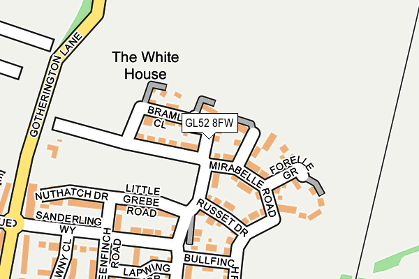
GL52 8FW is located in the Cleeve St Michael's electoral ward, within the local authority district of Tewkesbury and the English Parliamentary constituency of Tewkesbury. The Sub Integrated Care Board (ICB) Location is NHS Gloucestershire ICB - 11M and the police force is Gloucestershire. This postcode has been in use since May 2017.


GetTheData
Source: OS OpenMap – Local (Ordnance Survey)
Source: OS VectorMap District (Ordnance Survey)
Licence: Open Government Licence (requires attribution)
| Easting | 396586 |
| Northing | 228323 |
| Latitude | 51.953395 |
| Longitude | -2.051078 |
GetTheData
Source: Open Postcode Geo
Licence: Open Government Licence
| Country | England |
| Postcode District | GL52 |
➜ See where GL52 is on a map ➜ Where is Bishop's Cleeve? | |
GetTheData
Source: Land Registry Price Paid Data
Licence: Open Government Licence
| Ward | Cleeve St Michael's |
| Constituency | Tewkesbury |
GetTheData
Source: ONS Postcode Database
Licence: Open Government Licence
| Hardy Road (Gotherington Lane) | Bishop's Cleeve | 496m |
| Hardy Road (Gotherington Lane) | Bishop's Cleeve | 523m |
| Homelands Park | Bishop's Cleeve | 546m |
| Millham Road (Station Road) | Bishop's Cleeve | 552m |
| Homelands Park | Bishop's Cleeve | 555m |
GetTheData
Source: NaPTAN
Licence: Open Government Licence
| Percentage of properties with Next Generation Access | 100.0% |
| Percentage of properties with Superfast Broadband | 100.0% |
| Percentage of properties with Ultrafast Broadband | 100.0% |
| Percentage of properties with Full Fibre Broadband | 100.0% |
Superfast Broadband is between 30Mbps and 300Mbps
Ultrafast Broadband is > 300Mbps
| Median download speed | 200.0Mbps |
| Average download speed | 144.8Mbps |
| Maximum download speed | 350.00Mbps |
| Median upload speed | 1.0Mbps |
| Average upload speed | 1.0Mbps |
| Maximum upload speed | 1.25Mbps |
| Percentage of properties unable to receive 2Mbps | 0.0% |
| Percentage of properties unable to receive 5Mbps | 0.0% |
| Percentage of properties unable to receive 10Mbps | 0.0% |
| Percentage of properties unable to receive 30Mbps | 0.0% |
GetTheData
Source: Ofcom
Licence: Ofcom Terms of Use (requires attribution)
GetTheData
Source: ONS Postcode Database
Licence: Open Government Licence


➜ Get more ratings from the Food Standards Agency
GetTheData
Source: Food Standards Agency
Licence: FSA terms & conditions
| Last Collection | |||
|---|---|---|---|
| Location | Mon-Fri | Sat | Distance |
| Oxbutts Park B Cleeve | 16:15 | 11:15 | 615m |
| Sandown Road | 17:15 | 11:00 | 773m |
| Bishops Cleeve P.o. | 17:30 | 11:45 | 903m |
GetTheData
Source: Dracos
Licence: Creative Commons Attribution-ShareAlike
The below table lists the International Territorial Level (ITL) codes (formerly Nomenclature of Territorial Units for Statistics (NUTS) codes) and Local Administrative Units (LAU) codes for GL52 8FW:
| ITL 1 Code | Name |
|---|---|
| TLK | South West (England) |
| ITL 2 Code | Name |
| TLK1 | Gloucestershire, Wiltshire and Bath/Bristol area |
| ITL 3 Code | Name |
| TLK13 | Gloucestershire CC |
| LAU 1 Code | Name |
| E07000083 | Tewkesbury |
GetTheData
Source: ONS Postcode Directory
Licence: Open Government Licence
The below table lists the Census Output Area (OA), Lower Layer Super Output Area (LSOA), and Middle Layer Super Output Area (MSOA) for GL52 8FW:
| Code | Name | |
|---|---|---|
| OA | E00114072 | |
| LSOA | E01022435 | Tewkesbury 005C |
| MSOA | E02004670 | Tewkesbury 005 |
GetTheData
Source: ONS Postcode Directory
Licence: Open Government Licence
| GL52 8HP | Little Grebe Road | 221m |
| GL52 8HE | Lapwing Drive | 254m |
| GL52 8HR | Little Grebe Road | 258m |
| GL52 8HF | Bullfinch Road | 259m |
| GL52 8HD | Greenfinch Road | 260m |
| GL52 8GR | Sanderling Way | 263m |
| GL52 8GU | Nuthatch Drive | 274m |
| GL52 8HN | Curlew Close | 294m |
| GL52 8GZ | Wagtail Grove | 318m |
| GL52 8GX | Tawny Close | 342m |
GetTheData
Source: Open Postcode Geo; Land Registry Price Paid Data
Licence: Open Government Licence