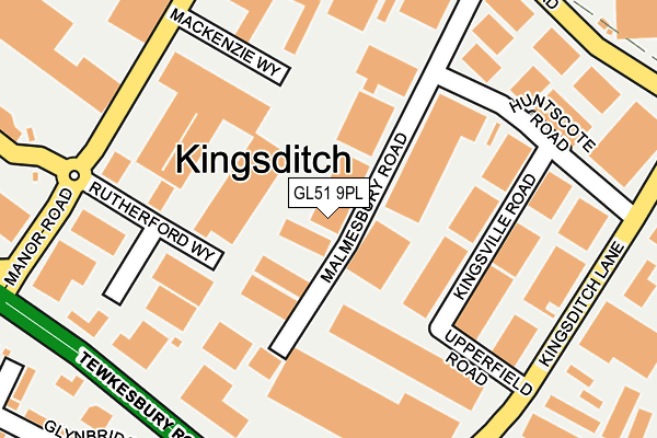
GL51 9PL lies on Malmesbury Road in Kingsditch Trading Estate, Cheltenham. GL51 9PL is located in the Swindon Village electoral ward, within the local authority district of Cheltenham and the English Parliamentary constituency of Tewkesbury. The Sub Integrated Care Board (ICB) Location is NHS Gloucestershire ICB - 11M and the police force is Gloucestershire. This postcode has been in use since January 1980.


GetTheData
Source: OS OpenMap – Local (Ordnance Survey)
Source: OS VectorMap District (Ordnance Survey)
Licence: Open Government Licence (requires attribution)
| Easting | 393262 |
| Northing | 224266 |
| Latitude | 51.916887 |
| Longitude | -2.099366 |
GetTheData
Source: Open Postcode Geo
Licence: Open Government Licence
| Street | Malmesbury Road |
| Locality | Kingsditch Trading Estate |
| Town/City | Cheltenham |
| Country | England |
| Postcode District | GL51 |
➜ See where GL51 is on a map ➜ Where is Cheltenham? | |
GetTheData
Source: Land Registry Price Paid Data
Licence: Open Government Licence
Elevation or altitude of GL51 9PL as distance above sea level:
| Metres | Feet | |
|---|---|---|
| Elevation | 40m | 131ft |
Elevation is measured from the approximate centre of the postcode, to the nearest point on an OS contour line from OS Terrain 50, which has contour spacing of ten vertical metres.
➜ How high above sea level am I? Find the elevation of your current position using your device's GPS.
GetTheData
Source: Open Postcode Elevation
Licence: Open Government Licence
| Ward | Swindon Village |
| Constituency | Tewkesbury |
GetTheData
Source: ONS Postcode Database
Licence: Open Government Licence
| Gallagher Retail Park (Manor Road) | Kingsditch | 213m |
| Gallagher Retail Park (Manor Road) | Kingsditch | 220m |
| Upperfield Road (Kingsditch Lane) | Kingsditch | 236m |
| Upperfield Road (Kingsditch Lane) | Kingsditch | 250m |
| Retail Park (Tewkesbury Road) | Kingsditch | 260m |
| Cheltenham Spa Station | 2.2km |
GetTheData
Source: NaPTAN
Licence: Open Government Licence
| Median download speed | 3.0Mbps |
| Average download speed | 6.8Mbps |
| Maximum download speed | 39.06Mbps |
| Median upload speed | 0.9Mbps |
| Average upload speed | 1.9Mbps |
| Maximum upload speed | 9.76Mbps |
GetTheData
Source: Ofcom
Licence: Ofcom Terms of Use (requires attribution)
Estimated total energy consumption in GL51 9PL by fuel type, 2015.
| Consumption (kWh) | 152,335 |
|---|---|
| Meter count | 7 |
| Mean (kWh/meter) | 21,762 |
| Median (kWh/meter) | 10,470 |
GetTheData
Source: Postcode level gas estimates: 2015 (experimental)
Source: Postcode level electricity estimates: 2015 (experimental)
Licence: Open Government Licence
GetTheData
Source: ONS Postcode Database
Licence: Open Government Licence


➜ Get more ratings from the Food Standards Agency
GetTheData
Source: Food Standards Agency
Licence: FSA terms & conditions
| Last Collection | |||
|---|---|---|---|
| Location | Mon-Fri | Sat | Distance |
| Huntscote Road | 18:30 | 12:30 | 196m |
| Kingsditch Trading Estate | 18:30 | 265m | |
| Village Road | 17:00 | 12:30 | 449m |
GetTheData
Source: Dracos
Licence: Creative Commons Attribution-ShareAlike
The below table lists the International Territorial Level (ITL) codes (formerly Nomenclature of Territorial Units for Statistics (NUTS) codes) and Local Administrative Units (LAU) codes for GL51 9PL:
| ITL 1 Code | Name |
|---|---|
| TLK | South West (England) |
| ITL 2 Code | Name |
| TLK1 | Gloucestershire, Wiltshire and Bath/Bristol area |
| ITL 3 Code | Name |
| TLK13 | Gloucestershire CC |
| LAU 1 Code | Name |
| E07000078 | Cheltenham |
GetTheData
Source: ONS Postcode Directory
Licence: Open Government Licence
The below table lists the Census Output Area (OA), Lower Layer Super Output Area (LSOA), and Middle Layer Super Output Area (MSOA) for GL51 9PL:
| Code | Name | |
|---|---|---|
| OA | E00112637 | |
| LSOA | E01022165 | Cheltenham 001C |
| MSOA | E02004600 | Cheltenham 001 |
GetTheData
Source: ONS Postcode Directory
Licence: Open Government Licence
| GL51 9TX | Mackenzie Way | 148m |
| GL51 9PB | Kingsditch Lane | 220m |
| GL51 9SG | Tewkesbury Road | 295m |
| GL51 0BZ | Glynbridge Gardens | 324m |
| GL51 0UN | Summerfield Close | 332m |
| GL51 9DU | Tewkesbury Road | 343m |
| GL51 0AF | Riverview Way | 346m |
| GL51 0UL | Patterdale Close | 386m |
| GL51 9NH | Shaftesbury Industrial Estate | 387m |
| GL51 9TW | Gara Close | 432m |
GetTheData
Source: Open Postcode Geo; Land Registry Price Paid Data
Licence: Open Government Licence