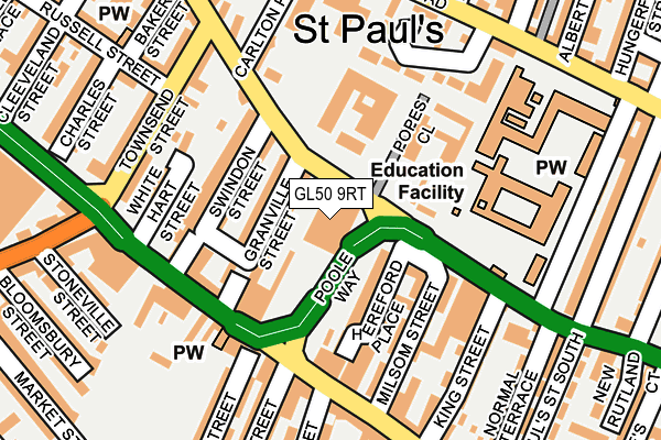
GL50 9RT is located in the St Paul's electoral ward, within the local authority district of Cheltenham and the English Parliamentary constituency of Cheltenham. The Sub Integrated Care Board (ICB) Location is NHS Gloucestershire ICB - 11M and the police force is Gloucestershire. This postcode has been in use since January 2011.


GetTheData
Source: OS OpenMap – Local (Ordnance Survey)
Source: OS VectorMap District (Ordnance Survey)
Licence: Open Government Licence (requires attribution)
| Easting | 394452 |
| Northing | 223016 |
| Latitude | 51.905654 |
| Longitude | -2.082050 |
GetTheData
Source: Open Postcode Geo
Licence: Open Government Licence
| Country | England |
| Postcode District | GL50 |
➜ See where GL50 is on a map ➜ Where is Cheltenham? | |
GetTheData
Source: Land Registry Price Paid Data
Licence: Open Government Licence
Elevation or altitude of GL50 9RT as distance above sea level:
| Metres | Feet | |
|---|---|---|
| Elevation | 50m | 164ft |
Elevation is measured from the approximate centre of the postcode, to the nearest point on an OS contour line from OS Terrain 50, which has contour spacing of ten vertical metres.
➜ How high above sea level am I? Find the elevation of your current position using your device's GPS.
GetTheData
Source: Open Postcode Elevation
Licence: Open Government Licence
| Ward | St Paul's |
| Constituency | Cheltenham |
GetTheData
Source: ONS Postcode Database
Licence: Open Government Licence
| Medical Centre (Swindon Road) | Cheltenham | 39m |
| Francis Close Hall (Saint Margaret's Road) | Cheltenham | 82m |
| Medical Centre (Swindon Road) | Cheltenham | 100m |
| Carlton Place (Swindon Road) | Cheltenham | 146m |
| Grove Street (High Street) | Cheltenham | 160m |
| Cheltenham Spa Station | 1.5km |
GetTheData
Source: NaPTAN
Licence: Open Government Licence
GetTheData
Source: ONS Postcode Database
Licence: Open Government Licence


➜ Get more ratings from the Food Standards Agency
GetTheData
Source: Food Standards Agency
Licence: FSA terms & conditions
| Last Collection | |||
|---|---|---|---|
| Location | Mon-Fri | Sat | Distance |
| Swindon Road Delivery Office | 19:00 | 13:00 | 2m |
| Tesco Tewkesbury Road | 17:00 | 12:45 | 365m |
| Swindon Road | 17:15 | 12:15 | 442m |
GetTheData
Source: Dracos
Licence: Creative Commons Attribution-ShareAlike
The below table lists the International Territorial Level (ITL) codes (formerly Nomenclature of Territorial Units for Statistics (NUTS) codes) and Local Administrative Units (LAU) codes for GL50 9RT:
| ITL 1 Code | Name |
|---|---|
| TLK | South West (England) |
| ITL 2 Code | Name |
| TLK1 | Gloucestershire, Wiltshire and Bath/Bristol area |
| ITL 3 Code | Name |
| TLK13 | Gloucestershire CC |
| LAU 1 Code | Name |
| E07000078 | Cheltenham |
GetTheData
Source: ONS Postcode Directory
Licence: Open Government Licence
The below table lists the Census Output Area (OA), Lower Layer Super Output Area (LSOA), and Middle Layer Super Output Area (MSOA) for GL50 9RT:
| Code | Name | |
|---|---|---|
| OA | E00112574 | |
| LSOA | E01022152 | Cheltenham 004C |
| MSOA | E02004603 | Cheltenham 004 |
GetTheData
Source: ONS Postcode Directory
Licence: Open Government Licence
| GL50 4BJ | Swindon Road | 50m |
| GL50 4BL | Granville Street | 66m |
| GL50 4BE | Nailsworth Terrace | 73m |
| GL51 9ET | Swindon Street | 90m |
| GL50 4BG | Hereford Place | 96m |
| GL50 4BD | Hereford Place | 97m |
| GL51 9ES | Swindon Street | 110m |
| GL50 3HU | High Street | 111m |
| GL50 4JQ | Hereford Place | 111m |
| GL50 3HX | High Street | 131m |
GetTheData
Source: Open Postcode Geo; Land Registry Price Paid Data
Licence: Open Government Licence