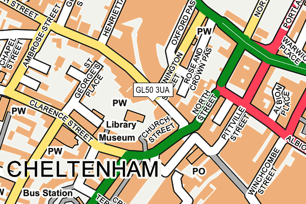
GL50 3UA is located in the Lansdown electoral ward, within the local authority district of Cheltenham and the English Parliamentary constituency of Cheltenham. The Sub Integrated Care Board (ICB) Location is NHS Gloucestershire ICB - 11M and the police force is Gloucestershire. This postcode has been in use since July 1983.


GetTheData
Source: OS OpenMap – Local (Ordnance Survey)
Source: OS VectorMap District (Ordnance Survey)
Licence: Open Government Licence (requires attribution)
| Easting | 394870 |
| Northing | 222571 |
| Latitude | 51.901657 |
| Longitude | -2.075968 |
GetTheData
Source: Open Postcode Geo
Licence: Open Government Licence
| Country | England |
| Postcode District | GL50 |
➜ See where GL50 is on a map ➜ Where is Cheltenham? | |
GetTheData
Source: Land Registry Price Paid Data
Licence: Open Government Licence
Elevation or altitude of GL50 3UA as distance above sea level:
| Metres | Feet | |
|---|---|---|
| Elevation | 60m | 197ft |
Elevation is measured from the approximate centre of the postcode, to the nearest point on an OS contour line from OS Terrain 50, which has contour spacing of ten vertical metres.
➜ How high above sea level am I? Find the elevation of your current position using your device's GPS.
GetTheData
Source: Open Postcode Elevation
Licence: Open Government Licence
| Ward | Lansdown |
| Constituency | Cheltenham |
GetTheData
Source: ONS Postcode Database
Licence: Open Government Licence
| High Street Layover (High Street) | Cheltenham | 20m |
| High Street | Cheltenham | 39m |
| High Street | Cheltenham | 71m |
| Clarence Street | Cheltenham | 75m |
| Clarence Street | Cheltenham | 81m |
| Cheltenham Spa Station | 1.7km |
GetTheData
Source: NaPTAN
Licence: Open Government Licence
GetTheData
Source: ONS Postcode Database
Licence: Open Government Licence


➜ Get more ratings from the Food Standards Agency
GetTheData
Source: Food Standards Agency
Licence: FSA terms & conditions
| Last Collection | |||
|---|---|---|---|
| Location | Mon-Fri | Sat | Distance |
| Lower High Street | 18:45 | 13:00 | 22m |
| Imperial Circus | 18:30 | 110m | |
| Clarence Street | 17:45 | 13:00 | 171m |
GetTheData
Source: Dracos
Licence: Creative Commons Attribution-ShareAlike
The below table lists the International Territorial Level (ITL) codes (formerly Nomenclature of Territorial Units for Statistics (NUTS) codes) and Local Administrative Units (LAU) codes for GL50 3UA:
| ITL 1 Code | Name |
|---|---|
| TLK | South West (England) |
| ITL 2 Code | Name |
| TLK1 | Gloucestershire, Wiltshire and Bath/Bristol area |
| ITL 3 Code | Name |
| TLK13 | Gloucestershire CC |
| LAU 1 Code | Name |
| E07000078 | Cheltenham |
GetTheData
Source: ONS Postcode Directory
Licence: Open Government Licence
The below table lists the Census Output Area (OA), Lower Layer Super Output Area (LSOA), and Middle Layer Super Output Area (MSOA) for GL50 3UA:
| Code | Name | |
|---|---|---|
| OA | E00112435 | |
| LSOA | E01022127 | Cheltenham 009G |
| MSOA | E02004608 | Cheltenham 009 |
GetTheData
Source: ONS Postcode Directory
Licence: Open Government Licence
| GL50 3HF | High Street | 39m |
| GL50 3HH | High Street | 40m |
| GL50 3JL | Clarence Street | 72m |
| GL50 4ED | Bennington Street | 93m |
| GL50 3JX | Well Walk | 117m |
| GL50 4DS | North Place | 119m |
| GL50 3JZ | St Georges Place | 122m |
| GL50 1LR | Promenade | 124m |
| GL50 3JS | Clarence Street | 126m |
| GL50 3NU | Clarence Street | 126m |
GetTheData
Source: Open Postcode Geo; Land Registry Price Paid Data
Licence: Open Government Licence