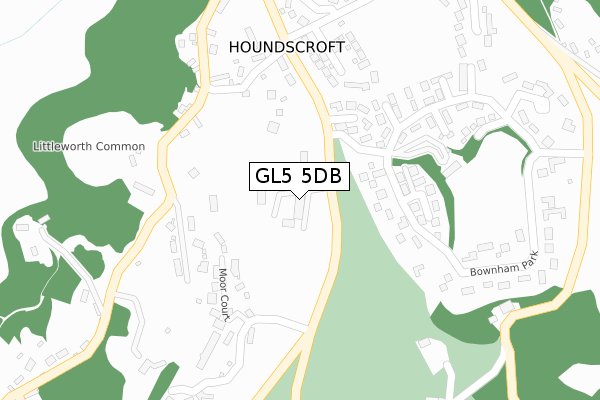
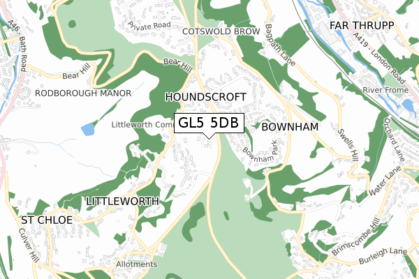
GL5 5DB is located in the Amberley and Woodchester electoral ward, within the local authority district of Stroud and the English Parliamentary constituency of Stroud. The Sub Integrated Care Board (ICB) Location is NHS Gloucestershire ICB - 11M and the police force is Gloucestershire. This postcode has been in use since February 2018.


GetTheData
Source: OS Open Zoomstack (Ordnance Survey)
Licence: Open Government Licence (requires attribution)
Attribution: Contains OS data © Crown copyright and database right 2025
Source: Open Postcode Geo
Licence: Open Government Licence (requires attribution)
Attribution: Contains OS data © Crown copyright and database right 2025; Contains Royal Mail data © Royal Mail copyright and database right 2025; Source: Office for National Statistics licensed under the Open Government Licence v.3.0
| Easting | 385451 |
| Northing | 202285 |
| Latitude | 51.719103 |
| Longitude | -2.212003 |
GetTheData
Source: Open Postcode Geo
Licence: Open Government Licence
| Country | England |
| Postcode District | GL5 |
➜ See where GL5 is on a map ➜ Where is Houndscroft? | |
GetTheData
Source: Land Registry Price Paid Data
Licence: Open Government Licence
| Ward | Amberley And Woodchester |
| Constituency | Stroud |
GetTheData
Source: ONS Postcode Database
Licence: Open Government Licence
10, AMBERLEY RIDGE, RODBOROUGH COMMON, STROUD, GL5 5DB 2019 7 MAY £1,255,000 |
9, AMBERLEY RIDGE, RODBOROUGH COMMON, STROUD, GL5 5DB 2018 27 MAR £386,000 |
GetTheData
Source: HM Land Registry Price Paid Data
Licence: Contains HM Land Registry data © Crown copyright and database right 2025. This data is licensed under the Open Government Licence v3.0.
| Amberley Ridge School (Pines Road) | Burleigh | 67m |
| Bownham Park | Amberley | 188m |
| Moor Court | Amberley | 207m |
| Moor Court | Amberley | 218m |
| Bear Inn | Rodborough Common | 306m |
| Stroud (Glos) Station | 2.9km |
| Stonehouse Station | 5.5km |
GetTheData
Source: NaPTAN
Licence: Open Government Licence
GetTheData
Source: ONS Postcode Database
Licence: Open Government Licence


➜ Get more ratings from the Food Standards Agency
GetTheData
Source: Food Standards Agency
Licence: FSA terms & conditions
| Last Collection | |||
|---|---|---|---|
| Location | Mon-Fri | Sat | Distance |
| Bear Inn | 16:15 | 10:15 | 398m |
| Swells Hill Brimscombe | 15:45 | 10:30 | 874m |
| Burleigh Corner | 16:00 | 08:45 | 1,022m |
GetTheData
Source: Dracos
Licence: Creative Commons Attribution-ShareAlike
The below table lists the International Territorial Level (ITL) codes (formerly Nomenclature of Territorial Units for Statistics (NUTS) codes) and Local Administrative Units (LAU) codes for GL5 5DB:
| ITL 1 Code | Name |
|---|---|
| TLK | South West (England) |
| ITL 2 Code | Name |
| TLK1 | Gloucestershire, Wiltshire and Bath/Bristol area |
| ITL 3 Code | Name |
| TLK13 | Gloucestershire CC |
| LAU 1 Code | Name |
| E07000082 | Stroud |
GetTheData
Source: ONS Postcode Directory
Licence: Open Government Licence
The below table lists the Census Output Area (OA), Lower Layer Super Output Area (LSOA), and Middle Layer Super Output Area (MSOA) for GL5 5DB:
| Code | Name | |
|---|---|---|
| OA | E00113610 | |
| LSOA | E01022350 | Stroud 010A |
| MSOA | E02004660 | Stroud 010 |
GetTheData
Source: ONS Postcode Directory
Licence: Open Government Licence
| GL5 5DD | Shepherds Well | 145m |
| GL5 5DG | Houndscroft | 184m |
| GL5 5DA | 226m | |
| GL5 5DF | Houndscroft | 238m |
| GL5 5BZ | Bownham Park | 238m |
| GL5 5GA | 247m | |
| GL5 5DQ | Houndscroft | 279m |
| GL5 5BY | Bownham Park | 309m |
| GL5 5DZ | Bownham Mead | 385m |
| GL5 2QB | 410m |
GetTheData
Source: Open Postcode Geo; Land Registry Price Paid Data
Licence: Open Government Licence