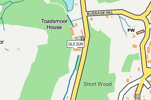
GL5 2UH is located in the Chalford electoral ward, within the local authority district of Stroud and the English Parliamentary constituency of Stroud. The Sub Integrated Care Board (ICB) Location is NHS Gloucestershire ICB - 11M and the police force is Gloucestershire. This postcode has been in use since January 1980.


GetTheData
Source: OS OpenMap – Local (Ordnance Survey)
Source: OS VectorMap District (Ordnance Survey)
Licence: Open Government Licence (requires attribution)
| Easting | 387990 |
| Northing | 203430 |
| Latitude | 51.729454 |
| Longitude | -2.175293 |
GetTheData
Source: Open Postcode Geo
Licence: Open Government Licence
| Country | England |
| Postcode District | GL5 |
➜ See where GL5 is on a map | |
GetTheData
Source: Land Registry Price Paid Data
Licence: Open Government Licence
Elevation or altitude of GL5 2UH as distance above sea level:
| Metres | Feet | |
|---|---|---|
| Elevation | 90m | 295ft |
Elevation is measured from the approximate centre of the postcode, to the nearest point on an OS contour line from OS Terrain 50, which has contour spacing of ten vertical metres.
➜ How high above sea level am I? Find the elevation of your current position using your device's GPS.
GetTheData
Source: Open Postcode Elevation
Licence: Open Government Licence
| Ward | Chalford |
| Constituency | Stroud |
GetTheData
Source: ONS Postcode Database
Licence: Open Government Licence
| Hampton Colours | Toadsmoor | 38m |
| Village Hall (The Ridgeway) | Bussage | 413m |
| Village Hall (The Ridgeway) | Bussage | 426m |
| Garage (Vatch Lane) | Toadsmoor | 429m |
| Merlins Mill (Toadsmoor Road) | Brimscombe | 436m |
| Stroud (Glos) Station | 3.5km |
GetTheData
Source: NaPTAN
Licence: Open Government Licence
GetTheData
Source: ONS Postcode Database
Licence: Open Government Licence

➜ Get more ratings from the Food Standards Agency
GetTheData
Source: Food Standards Agency
Licence: FSA terms & conditions
| Last Collection | |||
|---|---|---|---|
| Location | Mon-Fri | Sat | Distance |
| Bussage | 17:00 | 10:00 | 411m |
| Lypiatt View Bussage | 16:45 | 10:00 | 714m |
| Old Common Bussage | 17:10 | 10:00 | 836m |
GetTheData
Source: Dracos
Licence: Creative Commons Attribution-ShareAlike
The below table lists the International Territorial Level (ITL) codes (formerly Nomenclature of Territorial Units for Statistics (NUTS) codes) and Local Administrative Units (LAU) codes for GL5 2UH:
| ITL 1 Code | Name |
|---|---|
| TLK | South West (England) |
| ITL 2 Code | Name |
| TLK1 | Gloucestershire, Wiltshire and Bath/Bristol area |
| ITL 3 Code | Name |
| TLK13 | Gloucestershire CC |
| LAU 1 Code | Name |
| E07000082 | Stroud |
GetTheData
Source: ONS Postcode Directory
Licence: Open Government Licence
The below table lists the Census Output Area (OA), Lower Layer Super Output Area (LSOA), and Middle Layer Super Output Area (MSOA) for GL5 2UH:
| Code | Name | |
|---|---|---|
| OA | E00113710 | |
| LSOA | E01022368 | Stroud 008C |
| MSOA | E02004658 | Stroud 008 |
GetTheData
Source: ONS Postcode Directory
Licence: Open Government Licence
| GL6 8AY | 286m | |
| GL6 8AX | 299m | |
| GL6 8AZ | The Row | 314m |
| GL6 8AU | 345m | |
| GL6 8BA | 367m | |
| GL5 2UL | Toadsmoor | 396m |
| GL6 8BB | 444m | |
| GL6 8AT | 513m | |
| GL6 8DQ | The Hawthorns | 514m |
| GL6 8BY | Ashley Drive | 523m |
GetTheData
Source: Open Postcode Geo; Land Registry Price Paid Data
Licence: Open Government Licence