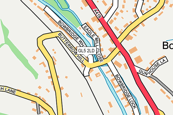
GL5 2LD is located in the Stroud Trinity electoral ward, within the local authority district of Stroud and the English Parliamentary constituency of Stroud. The Sub Integrated Care Board (ICB) Location is NHS Gloucestershire ICB - 11M and the police force is Gloucestershire. This postcode has been in use since June 2017.


GetTheData
Source: OS OpenMap – Local (Ordnance Survey)
Source: OS VectorMap District (Ordnance Survey)
Licence: Open Government Licence (requires attribution)
| Easting | 385587 |
| Northing | 204417 |
| Latitude | 51.738276 |
| Longitude | -2.210123 |
GetTheData
Source: Open Postcode Geo
Licence: Open Government Licence
| Country | England |
| Postcode District | GL5 |
➜ See where GL5 is on a map ➜ Where is Stroud? | |
GetTheData
Source: Land Registry Price Paid Data
Licence: Open Government Licence
| Ward | Stroud Trinity |
| Constituency | Stroud |
GetTheData
Source: ONS Postcode Database
Licence: Open Government Licence
| British Oak (London Road) | Bowbridge | 192m |
| Garage (Butterrow Hill) | Bowbridge | 218m |
| Garage (Butterrow Hill) | Bowbridge | 229m |
| Southfield (Park Road) | Stroud | 266m |
| Garage (London Road) | Bowbridge | 277m |
| Stroud (Glos) Station | 1km |
| Stonehouse Station | 4.9km |
GetTheData
Source: NaPTAN
Licence: Open Government Licence
| Percentage of properties with Next Generation Access | 100.0% |
| Percentage of properties with Superfast Broadband | 100.0% |
| Percentage of properties with Ultrafast Broadband | 0.0% |
| Percentage of properties with Full Fibre Broadband | 0.0% |
Superfast Broadband is between 30Mbps and 300Mbps
Ultrafast Broadband is > 300Mbps
| Median download speed | 58.1Mbps |
| Average download speed | 49.8Mbps |
| Maximum download speed | 79.10Mbps |
| Median upload speed | 19.5Mbps |
| Average upload speed | 13.8Mbps |
| Maximum upload speed | 20.00Mbps |
| Percentage of properties unable to receive 2Mbps | 0.0% |
| Percentage of properties unable to receive 5Mbps | 0.0% |
| Percentage of properties unable to receive 10Mbps | 0.0% |
| Percentage of properties unable to receive 30Mbps | 0.0% |
GetTheData
Source: Ofcom
Licence: Ofcom Terms of Use (requires attribution)
GetTheData
Source: ONS Postcode Database
Licence: Open Government Licence


➜ Get more ratings from the Food Standards Agency
GetTheData
Source: Food Standards Agency
Licence: FSA terms & conditions
| Last Collection | |||
|---|---|---|---|
| Location | Mon-Fri | Sat | Distance |
| Bowbridge Old P.o. | 17:00 | 12:00 | 266m |
| London Road | 17:15 | 12:00 | 336m |
| Waitrose London Road | 17:15 | 12:00 | 424m |
GetTheData
Source: Dracos
Licence: Creative Commons Attribution-ShareAlike
The below table lists the International Territorial Level (ITL) codes (formerly Nomenclature of Territorial Units for Statistics (NUTS) codes) and Local Administrative Units (LAU) codes for GL5 2LD:
| ITL 1 Code | Name |
|---|---|
| TLK | South West (England) |
| ITL 2 Code | Name |
| TLK1 | Gloucestershire, Wiltshire and Bath/Bristol area |
| ITL 3 Code | Name |
| TLK13 | Gloucestershire CC |
| LAU 1 Code | Name |
| E07000082 | Stroud |
GetTheData
Source: ONS Postcode Directory
Licence: Open Government Licence
The below table lists the Census Output Area (OA), Lower Layer Super Output Area (LSOA), and Middle Layer Super Output Area (MSOA) for GL5 2LD:
| Code | Name | |
|---|---|---|
| OA | E00113919 | |
| LSOA | E01022410 | Stroud 006C |
| MSOA | E02004656 | Stroud 006 |
GetTheData
Source: ONS Postcode Directory
Licence: Open Government Licence
| GL5 2AT | London Road | 125m |
| GL5 2LB | Eagle Mill Close | 136m |
| GL5 2AY | London Road | 176m |
| GL5 2LF | Butterrow Hill | 177m |
| GL5 2AE | Arundel Mill Lane | 191m |
| GL5 2LA | 222m | |
| GL5 2JF | Park Road | 234m |
| GL5 2BS | Arundel Mill Lane | 260m |
| GL5 2BZ | London Road | 270m |
| GL5 2JG | Park Road | 273m |
GetTheData
Source: Open Postcode Geo; Land Registry Price Paid Data
Licence: Open Government Licence