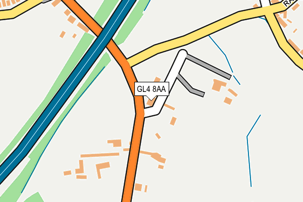
GL4 8AA lies on Gloucester Road in Upton St Leonards, Gloucester. GL4 8AA is located in the Painswick and Upton electoral ward, within the local authority district of Stroud and the English Parliamentary constituency of Stroud. The Sub Integrated Care Board (ICB) Location is NHS Gloucestershire ICB - 11M and the police force is Gloucestershire. This postcode has been in use since January 1980.


GetTheData
Source: OS OpenMap – Local (Ordnance Survey)
Source: OS VectorMap District (Ordnance Survey)
Licence: Open Government Licence (requires attribution)
| Easting | 385952 |
| Northing | 214611 |
| Latitude | 51.829935 |
| Longitude | -2.205257 |
GetTheData
Source: Open Postcode Geo
Licence: Open Government Licence
| Street | Gloucester Road |
| Locality | Upton St Leonards |
| Town/City | Gloucester |
| Country | England |
| Postcode District | GL4 |
➜ See where GL4 is on a map ➜ Where is Upton St Leonards? | |
GetTheData
Source: Land Registry Price Paid Data
Licence: Open Government Licence
Elevation or altitude of GL4 8AA as distance above sea level:
| Metres | Feet | |
|---|---|---|
| Elevation | 60m | 197ft |
Elevation is measured from the approximate centre of the postcode, to the nearest point on an OS contour line from OS Terrain 50, which has contour spacing of ten vertical metres.
➜ How high above sea level am I? Find the elevation of your current position using your device's GPS.
GetTheData
Source: Open Postcode Elevation
Licence: Open Government Licence
| Ward | Painswick And Upton |
| Constituency | Stroud |
GetTheData
Source: ONS Postcode Database
Licence: Open Government Licence
| Kings Head | Upton St Leonards | 30m |
| Kings Head (Upton Hill B4073) | Upton St Leonards | 79m |
| Recreation Ground (Rance Pitch) | Upton St Leonards | 273m |
| Recreation Ground (Rance Pitch) | Upton St Leonards | 303m |
| Fern Lawn (Painswick Road) | Abbeydale | 331m |
| Gloucester Station | 4.6km |
GetTheData
Source: NaPTAN
Licence: Open Government Licence
GetTheData
Source: ONS Postcode Database
Licence: Open Government Licence


➜ Get more ratings from the Food Standards Agency
GetTheData
Source: Food Standards Agency
Licence: FSA terms & conditions
| Last Collection | |||
|---|---|---|---|
| Location | Mon-Fri | Sat | Distance |
| The Lawns | 17:30 | 12:30 | 371m |
| Village Hall (Upton St Leonard | 17:15 | 12:30 | 475m |
| Corncroft Lane | 17:30 | 12:15 | 514m |
GetTheData
Source: Dracos
Licence: Creative Commons Attribution-ShareAlike
The below table lists the International Territorial Level (ITL) codes (formerly Nomenclature of Territorial Units for Statistics (NUTS) codes) and Local Administrative Units (LAU) codes for GL4 8AA:
| ITL 1 Code | Name |
|---|---|
| TLK | South West (England) |
| ITL 2 Code | Name |
| TLK1 | Gloucestershire, Wiltshire and Bath/Bristol area |
| ITL 3 Code | Name |
| TLK13 | Gloucestershire CC |
| LAU 1 Code | Name |
| E07000082 | Stroud |
GetTheData
Source: ONS Postcode Directory
Licence: Open Government Licence
The below table lists the Census Output Area (OA), Lower Layer Super Output Area (LSOA), and Middle Layer Super Output Area (MSOA) for GL4 8AA:
| Code | Name | |
|---|---|---|
| OA | E00113930 | |
| LSOA | E01022412 | Stroud 001D |
| MSOA | E02004651 | Stroud 001 |
GetTheData
Source: ONS Postcode Directory
Licence: Open Government Licence
| GL4 8AB | Rance Lane | 130m |
| GL4 6EZ | Painswick Road | 241m |
| GL4 8DA | Upton Hill | 267m |
| GL4 8DG | High Street | 298m |
| GL4 8AD | Rance Pitch | 313m |
| GL4 5XS | Fern Lawn | 322m |
| GL4 5YY | The Lawns | 326m |
| GL4 5YZ | The Lawns | 343m |
| GL4 6XU | Corncroft Lane | 371m |
| GL4 8DQ | Perry Orchard | 381m |
GetTheData
Source: Open Postcode Geo; Land Registry Price Paid Data
Licence: Open Government Licence