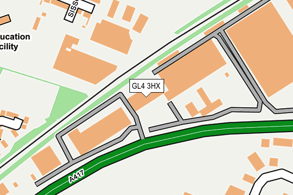
GL4 3HX is located in the Barnwood electoral ward, within the local authority district of Gloucester and the English Parliamentary constituency of Gloucester. The Sub Integrated Care Board (ICB) Location is NHS Gloucestershire ICB - 11M and the police force is Gloucestershire. This postcode has been in use since June 2000.


GetTheData
Source: OS OpenMap – Local (Ordnance Survey)
Source: OS VectorMap District (Ordnance Survey)
Licence: Open Government Licence (requires attribution)
| Easting | 385691 |
| Northing | 218684 |
| Latitude | 51.866555 |
| Longitude | -2.209211 |
GetTheData
Source: Open Postcode Geo
Licence: Open Government Licence
| Country | England |
| Postcode District | GL4 |
➜ See where GL4 is on a map ➜ Where is Gloucester? | |
GetTheData
Source: Land Registry Price Paid Data
Licence: Open Government Licence
Elevation or altitude of GL4 3HX as distance above sea level:
| Metres | Feet | |
|---|---|---|
| Elevation | 20m | 66ft |
Elevation is measured from the approximate centre of the postcode, to the nearest point on an OS contour line from OS Terrain 50, which has contour spacing of ten vertical metres.
➜ How high above sea level am I? Find the elevation of your current position using your device's GPS.
GetTheData
Source: Open Postcode Elevation
Licence: Open Government Licence
| Ward | Barnwood |
| Constituency | Gloucester |
GetTheData
Source: ONS Postcode Database
Licence: Open Government Licence
| Budgen's Garage (Barnwood Road) | Barnwood | 373m |
| Hazel Court (Barnwood Road) | Barnwood | 375m |
| Lonsdale Road (Elmbridge Road) | Elmbridge | 457m |
| Lonsdale Road (Elmbridge Road) | Elmbridge | 457m |
| Sisson Road (Elmbridge Road) | Elmbridge | 468m |
| Gloucester Station | 2km |
GetTheData
Source: NaPTAN
Licence: Open Government Licence
| Median download speed | 36.3Mbps |
| Average download speed | 31.8Mbps |
| Maximum download speed | 50.46Mbps |
| Median upload speed | 7.0Mbps |
| Average upload speed | 6.7Mbps |
| Maximum upload speed | 12.56Mbps |
GetTheData
Source: Ofcom
Licence: Ofcom Terms of Use (requires attribution)
GetTheData
Source: ONS Postcode Database
Licence: Open Government Licence


➜ Get more ratings from the Food Standards Agency
GetTheData
Source: Food Standards Agency
Licence: FSA terms & conditions
| Last Collection | |||
|---|---|---|---|
| Location | Mon-Fri | Sat | Distance |
| Sisson Road | 17:45 | 12:45 | 471m |
| Royal Mail, Eastern Avenue | 19:30 | 15:45 | 505m |
| Armscroft Road | 17:45 | 12:15 | 611m |
GetTheData
Source: Dracos
Licence: Creative Commons Attribution-ShareAlike
The below table lists the International Territorial Level (ITL) codes (formerly Nomenclature of Territorial Units for Statistics (NUTS) codes) and Local Administrative Units (LAU) codes for GL4 3HX:
| ITL 1 Code | Name |
|---|---|
| TLK | South West (England) |
| ITL 2 Code | Name |
| TLK1 | Gloucestershire, Wiltshire and Bath/Bristol area |
| ITL 3 Code | Name |
| TLK13 | Gloucestershire CC |
| LAU 1 Code | Name |
| E07000081 | Gloucester |
GetTheData
Source: ONS Postcode Directory
Licence: Open Government Licence
The below table lists the Census Output Area (OA), Lower Layer Super Output Area (LSOA), and Middle Layer Super Output Area (MSOA) for GL4 3HX:
| Code | Name | |
|---|---|---|
| OA | E00113296 | |
| LSOA | E01022287 | Gloucester 007G |
| MSOA | E02004642 | Gloucester 007 |
GetTheData
Source: ONS Postcode Directory
Licence: Open Government Licence
| GL4 3BN | Saw Mills End | 290m |
| GL4 3BP | Wellingtonia Gardens | 294m |
| GL2 0RP | Windfall Way | 299m |
| GL2 0RL | Sisson End | 311m |
| GL2 0RA | Sisson Road | 317m |
| GL2 0RJ | Sisson Road | 325m |
| GL4 3HA | Barnwood Road | 348m |
| GL4 3BZ | Wellingtonia Gardens | 361m |
| GL2 0NS | Braeburn Close | 369m |
| GL2 0PZ | Willowleaze | 382m |
GetTheData
Source: Open Postcode Geo; Land Registry Price Paid Data
Licence: Open Government Licence