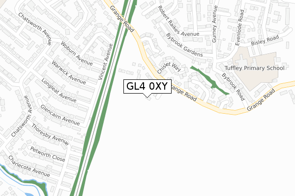
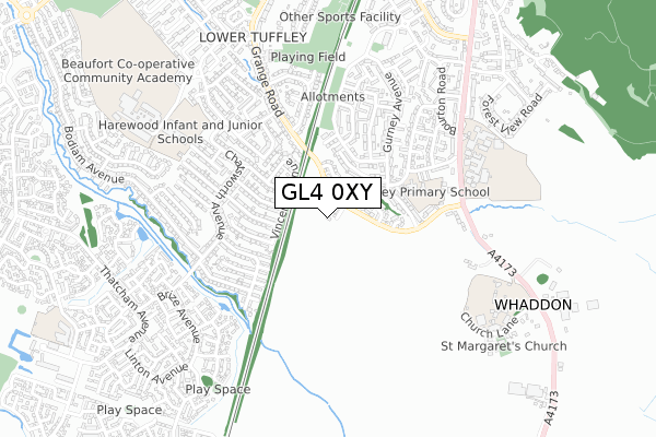
GL4 0XY is located in the Tuffley electoral ward, within the local authority district of Gloucester and the English Parliamentary constituency of Gloucester. The Sub Integrated Care Board (ICB) Location is NHS Gloucestershire ICB - 11M and the police force is Gloucestershire. This postcode has been in use since January 2020.


GetTheData
Source: OS Open Zoomstack (Ordnance Survey)
Licence: Open Government Licence (requires attribution)
Attribution: Contains OS data © Crown copyright and database right 2025
Source: Open Postcode Geo
Licence: Open Government Licence (requires attribution)
Attribution: Contains OS data © Crown copyright and database right 2025; Contains Royal Mail data © Royal Mail copyright and database right 2025; Source: Office for National Statistics licensed under the Open Government Licence v.3.0
| Easting | 382614 |
| Northing | 214154 |
| Latitude | 51.825738 |
| Longitude | -2.253669 |
GetTheData
Source: Open Postcode Geo
Licence: Open Government Licence
| Country | England |
| Postcode District | GL4 |
➜ See where GL4 is on a map ➜ Where is Gloucester? | |
GetTheData
Source: Land Registry Price Paid Data
Licence: Open Government Licence
| Ward | Tuffley |
| Constituency | Gloucester |
GetTheData
Source: ONS Postcode Database
Licence: Open Government Licence
50, ATKYNS DRIVE, TUFFLEY, GLOUCESTER, GL4 0XY 2023 17 AUG £370,000 |
1, ATKYNS DRIVE, TUFFLEY, GLOUCESTER, GL4 0XY 2022 7 MAR £295,995 |
42, ATKYNS DRIVE, TUFFLEY, GLOUCESTER, GL4 0XY 2020 27 OCT £282,000 |
45, ATKYNS DRIVE, TUFFLEY, GLOUCESTER, GL4 0XY 2020 23 OCT £328,995 |
44, ATKYNS DRIVE, TUFFLEY, GLOUCESTER, GL4 0XY 2020 19 OCT £356,995 |
43, ATKYNS DRIVE, TUFFLEY, GLOUCESTER, GL4 0XY 2020 30 SEP £307,000 |
48, ATKYNS DRIVE, TUFFLEY, GLOUCESTER, GL4 0XY 2020 16 SEP £362,425 |
47, ATKYNS DRIVE, TUFFLEY, GLOUCESTER, GL4 0XY 2020 28 AUG £285,995 |
41, ATKYNS DRIVE, TUFFLEY, GLOUCESTER, GL4 0XY 2020 28 AUG £329,995 |
39, ATKYNS DRIVE, TUFFLEY, GLOUCESTER, GL4 0XY 2020 28 AUG £365,995 |
GetTheData
Source: HM Land Registry Price Paid Data
Licence: Contains HM Land Registry data © Crown copyright and database right 2025. This data is licensed under the Open Government Licence v3.0.
| Goddard Way (Robert Raikes Avenue) | Tuffley | 291m |
| Gurney Avenue (Robert Raikes Avenue) | Tuffley | 311m |
| Bybrook Road School Stop (Grange Road) | Tuffley | 362m |
| Bybrook Road School Service (Grange Road) | Tuffley | 362m |
| Sulgrave Close (Chatsworth Avenue) | Lower Tuffley | 386m |
| Gloucester Station | 4.6km |
GetTheData
Source: NaPTAN
Licence: Open Government Licence
GetTheData
Source: ONS Postcode Database
Licence: Open Government Licence


➜ Get more ratings from the Food Standards Agency
GetTheData
Source: Food Standards Agency
Licence: FSA terms & conditions
| Last Collection | |||
|---|---|---|---|
| Location | Mon-Fri | Sat | Distance |
| Linsley Way | 17:15 | 12:15 | 337m |
| Chatsworth Avenue | 17:30 | 12:45 | 389m |
| Windsor Drive | 17:30 | 12:45 | 423m |
GetTheData
Source: Dracos
Licence: Creative Commons Attribution-ShareAlike
The below table lists the International Territorial Level (ITL) codes (formerly Nomenclature of Territorial Units for Statistics (NUTS) codes) and Local Administrative Units (LAU) codes for GL4 0XY:
| ITL 1 Code | Name |
|---|---|
| TLK | South West (England) |
| ITL 2 Code | Name |
| TLK1 | Gloucestershire, Wiltshire and Bath/Bristol area |
| ITL 3 Code | Name |
| TLK13 | Gloucestershire CC |
| LAU 1 Code | Name |
| E07000081 | Gloucester |
GetTheData
Source: ONS Postcode Directory
Licence: Open Government Licence
The below table lists the Census Output Area (OA), Lower Layer Super Output Area (LSOA), and Middle Layer Super Output Area (MSOA) for GL4 0XY:
| Code | Name | |
|---|---|---|
| OA | E00113573 | |
| LSOA | E01022345 | Gloucester 012C |
| MSOA | E02004647 | Gloucester 012 |
GetTheData
Source: ONS Postcode Directory
Licence: Open Government Licence
| GL4 0QQ | Chislet Way | 161m |
| GL4 0RE | Enborne Close | 190m |
| GL4 0SL | Warwick Avenue | 207m |
| GL4 0SN | Woburn Avenue | 212m |
| GL4 0QD | Whaddon Way | 221m |
| GL4 0SG | Longleat Avenue | 224m |
| GL4 0SW | Vincent Avenue | 225m |
| GL4 0SQ | Glencairn Avenue | 247m |
| GL4 0HQ | Bybrook Gardens | 249m |
| GL4 0NP | Grange Road | 256m |
GetTheData
Source: Open Postcode Geo; Land Registry Price Paid Data
Licence: Open Government Licence