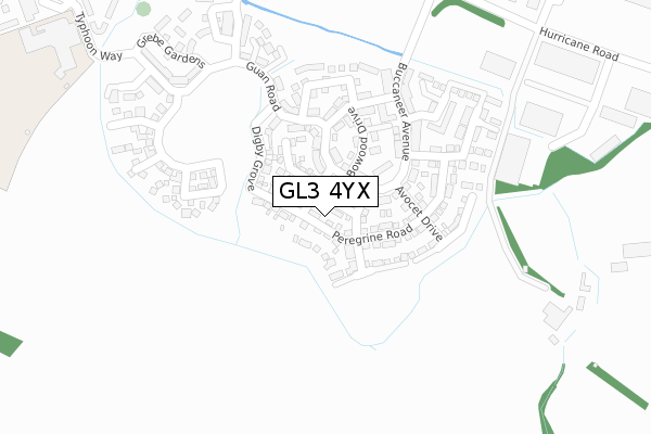
GL3 4YX is located in the Brockworth West electoral ward, within the local authority district of Tewkesbury and the English Parliamentary constituency of Tewkesbury. The Sub Integrated Care Board (ICB) Location is NHS Gloucestershire ICB - 11M and the police force is Gloucestershire. This postcode has been in use since May 2019.


GetTheData
Source: OS Open Zoomstack (Ordnance Survey)
Licence: Open Government Licence (requires attribution)
Attribution: Contains OS data © Crown copyright and database right 2025
Source: Open Postcode Geo
Licence: Open Government Licence (requires attribution)
Attribution: Contains OS data © Crown copyright and database right 2025; Contains Royal Mail data © Royal Mail copyright and database right 2025; Source: Office for National Statistics licensed under the Open Government Licence v.3.0
| Easting | 388007 |
| Northing | 215450 |
| Latitude | 51.837533 |
| Longitude | -2.175461 |
GetTheData
Source: Open Postcode Geo
Licence: Open Government Licence
| Country | England |
| Postcode District | GL3 |
➜ See where GL3 is on a map ➜ Where is Brockworth? | |
GetTheData
Source: Land Registry Price Paid Data
Licence: Open Government Licence
| Ward | Brockworth West |
| Constituency | Tewkesbury |
GetTheData
Source: ONS Postcode Database
Licence: Open Government Licence
2024 8 FEB £430,000 |
2022 8 DEC £430,000 |
2022 17 JUN £368,000 |
2021 10 SEP £340,000 |
20, DE HAVILLAND GARDENS, BROCKWORTH, GLOUCESTER, GL3 4YX 2020 17 DEC £310,000 |
18, DE HAVILLAND GARDENS, BROCKWORTH, GLOUCESTER, GL3 4YX 2020 11 DEC £440,000 |
19, DE HAVILLAND GARDENS, BROCKWORTH, GLOUCESTER, GL3 4YX 2020 4 DEC £440,000 |
17, DE HAVILLAND GARDENS, BROCKWORTH, GLOUCESTER, GL3 4YX 2020 27 NOV £343,000 |
2020 27 NOV £338,000 |
2020 5 JUN £395,000 |
GetTheData
Source: HM Land Registry Price Paid Data
Licence: Contains HM Land Registry data © Crown copyright and database right 2025. This data is licensed under the Open Government Licence v3.0.
| Grebe Gardens | Brockworth | 292m |
| Grebe Gardens | Brockworth | 321m |
| Beaumont Walk | Brockworth | 438m |
| Gambet Road (School Stop) | Brockworth | 440m |
| Coopers Edge School | Hucclecote | 445m |
| Gloucester Station | 5.3km |
GetTheData
Source: NaPTAN
Licence: Open Government Licence
| Percentage of properties with Next Generation Access | 8.7% |
| Percentage of properties with Superfast Broadband | 8.7% |
| Percentage of properties with Ultrafast Broadband | 8.7% |
| Percentage of properties with Full Fibre Broadband | 8.7% |
Superfast Broadband is between 30Mbps and 300Mbps
Ultrafast Broadband is > 300Mbps
| Percentage of properties unable to receive 2Mbps | 0.0% |
| Percentage of properties unable to receive 5Mbps | 91.3% |
| Percentage of properties unable to receive 10Mbps | 91.3% |
| Percentage of properties unable to receive 30Mbps | 91.3% |
GetTheData
Source: Ofcom
Licence: Ofcom Terms of Use (requires attribution)
GetTheData
Source: ONS Postcode Database
Licence: Open Government Licence


➜ Get more ratings from the Food Standards Agency
GetTheData
Source: Food Standards Agency
Licence: FSA terms & conditions
| Last Collection | |||
|---|---|---|---|
| Location | Mon-Fri | Sat | Distance |
| Green Street | 16:30 | 07:45 | 1,090m |
| Bond End | 17:15 | 12:30 | 1,331m |
| Green Bank | 17:45 | 12:45 | 1,391m |
GetTheData
Source: Dracos
Licence: Creative Commons Attribution-ShareAlike
The below table lists the International Territorial Level (ITL) codes (formerly Nomenclature of Territorial Units for Statistics (NUTS) codes) and Local Administrative Units (LAU) codes for GL3 4YX:
| ITL 1 Code | Name |
|---|---|
| TLK | South West (England) |
| ITL 2 Code | Name |
| TLK1 | Gloucestershire, Wiltshire and Bath/Bristol area |
| ITL 3 Code | Name |
| TLK13 | Gloucestershire CC |
| LAU 1 Code | Name |
| E07000083 | Tewkesbury |
GetTheData
Source: ONS Postcode Directory
Licence: Open Government Licence
The below table lists the Census Output Area (OA), Lower Layer Super Output Area (LSOA), and Middle Layer Super Output Area (MSOA) for GL3 4YX:
| Code | Name | |
|---|---|---|
| OA | E00113986 | |
| LSOA | E01022422 | Tewkesbury 009B |
| MSOA | E02004674 | Tewkesbury 009 |
GetTheData
Source: ONS Postcode Directory
Licence: Open Government Licence
| GL3 4UN | Bowood Drive | 153m |
| GL3 4RJ | Guan Road | 196m |
| GL3 4SH | Cleveland Drive | 201m |
| GL3 4TG | Buccaneer Avenue | 207m |
| GL3 4TF | Baltimore Court | 208m |
| GL3 4UJ | Tiger Moth Close | 222m |
| GL3 4UL | Buccaneer Avenue | 222m |
| GL3 4UW | Hidcote Road | 242m |
| GL3 4SG | Martlet Way | 258m |
| GL3 4UP | Rodmarton Close | 267m |
GetTheData
Source: Open Postcode Geo; Land Registry Price Paid Data
Licence: Open Government Licence