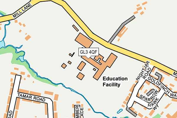
GL3 4QF is located in the Brockworth East electoral ward, within the local authority district of Tewkesbury and the English Parliamentary constituency of Tewkesbury. The Sub Integrated Care Board (ICB) Location is NHS Gloucestershire ICB - 11M and the police force is Gloucestershire. This postcode has been in use since January 1980.


GetTheData
Source: OS OpenMap – Local (Ordnance Survey)
Source: OS VectorMap District (Ordnance Survey)
Licence: Open Government Licence (requires attribution)
| Easting | 389847 |
| Northing | 216634 |
| Latitude | 51.848208 |
| Longitude | -2.148796 |
GetTheData
Source: Open Postcode Geo
Licence: Open Government Licence
| Country | England |
| Postcode District | GL3 |
➜ See where GL3 is on a map ➜ Where is Brockworth? | |
GetTheData
Source: Land Registry Price Paid Data
Licence: Open Government Licence
Elevation or altitude of GL3 4QF as distance above sea level:
| Metres | Feet | |
|---|---|---|
| Elevation | 60m | 197ft |
Elevation is measured from the approximate centre of the postcode, to the nearest point on an OS contour line from OS Terrain 50, which has contour spacing of ten vertical metres.
➜ How high above sea level am I? Find the elevation of your current position using your device's GPS.
GetTheData
Source: Open Postcode Elevation
Licence: Open Government Licence
| Ward | Brockworth East |
| Constituency | Tewkesbury |
GetTheData
Source: ONS Postcode Database
Licence: Open Government Licence
| Millbrook Academy (Mill Lane) | Brockworth | 78m |
| Chase Hotel (Shurdington Road) | Brockworth | 394m |
| Mill Lane (Shurdington Road) | Brockworth | 409m |
| Mill Lane (Shurdington Road) | Brockworth | 424m |
| Chase Hotel (Shurdington Road) | Brockworth | 462m |
GetTheData
Source: NaPTAN
Licence: Open Government Licence
GetTheData
Source: ONS Postcode Database
Licence: Open Government Licence


➜ Get more ratings from the Food Standards Agency
GetTheData
Source: Food Standards Agency
Licence: FSA terms & conditions
| Last Collection | |||
|---|---|---|---|
| Location | Mon-Fri | Sat | Distance |
| Moorfield Road | 17:30 | 12:45 | 340m |
| Abbotswood | 17:45 | 12:45 | 453m |
| Cross Hands | 17:30 | 12:45 | 584m |
GetTheData
Source: Dracos
Licence: Creative Commons Attribution-ShareAlike
The below table lists the International Territorial Level (ITL) codes (formerly Nomenclature of Territorial Units for Statistics (NUTS) codes) and Local Administrative Units (LAU) codes for GL3 4QF:
| ITL 1 Code | Name |
|---|---|
| TLK | South West (England) |
| ITL 2 Code | Name |
| TLK1 | Gloucestershire, Wiltshire and Bath/Bristol area |
| ITL 3 Code | Name |
| TLK13 | Gloucestershire CC |
| LAU 1 Code | Name |
| E07000083 | Tewkesbury |
GetTheData
Source: ONS Postcode Directory
Licence: Open Government Licence
The below table lists the Census Output Area (OA), Lower Layer Super Output Area (LSOA), and Middle Layer Super Output Area (MSOA) for GL3 4QF:
| Code | Name | |
|---|---|---|
| OA | E00113985 | |
| LSOA | E01022424 | Tewkesbury 009D |
| MSOA | E02004674 | Tewkesbury 009 |
GetTheData
Source: ONS Postcode Directory
Licence: Open Government Licence
| GL3 4JY | Humber Place | 194m |
| GL3 4RN | Nightjar Road | 201m |
| GL3 4JZ | Humber Place | 215m |
| GL3 4JR | Tamar Road | 223m |
| GL3 4QA | Sparrow Hawk Way | 251m |
| GL3 4JS | Trent Road | 260m |
| GL3 4LD | Medway Crescent | 263m |
| GL3 4LF | Ribble Close | 272m |
| GL3 4QD | Mill Lane | 276m |
| GL3 4QG | Mill Lane | 280m |
GetTheData
Source: Open Postcode Geo; Land Registry Price Paid Data
Licence: Open Government Licence