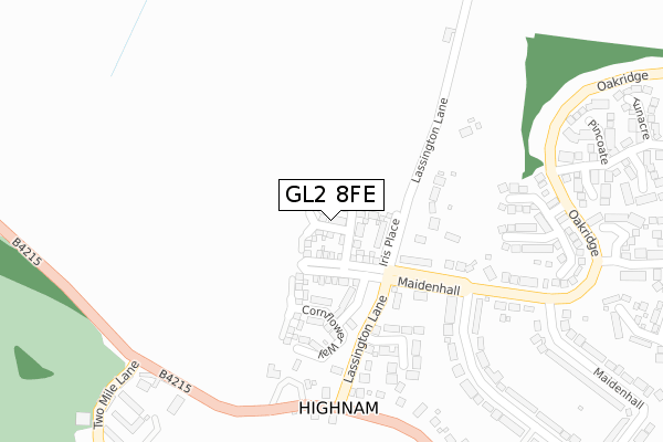
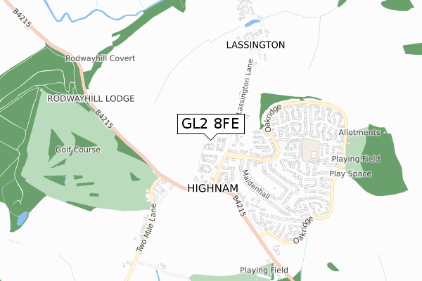
GL2 8FE is located in the Highnam with Haw Bridge electoral ward, within the local authority district of Tewkesbury and the English Parliamentary constituency of Forest of Dean. The Sub Integrated Care Board (ICB) Location is NHS Gloucestershire ICB - 11M and the police force is Gloucestershire. This postcode has been in use since April 2018.


GetTheData
Source: OS Open Zoomstack (Ordnance Survey)
Licence: Open Government Licence (requires attribution)
Attribution: Contains OS data © Crown copyright and database right 2025
Source: Open Postcode Geo
Licence: Open Government Licence (requires attribution)
Attribution: Contains OS data © Crown copyright and database right 2025; Contains Royal Mail data © Royal Mail copyright and database right 2025; Source: Office for National Statistics licensed under the Open Government Licence v.3.0
| Easting | 379332 |
| Northing | 220395 |
| Latitude | 51.881738 |
| Longitude | -2.301666 |
GetTheData
Source: Open Postcode Geo
Licence: Open Government Licence
| Country | England |
| Postcode District | GL2 |
➜ See where GL2 is on a map | |
GetTheData
Source: Land Registry Price Paid Data
Licence: Open Government Licence
| Ward | Highnam With Haw Bridge |
| Constituency | Forest Of Dean |
GetTheData
Source: ONS Postcode Database
Licence: Open Government Licence
| Stores (Maidenhall) | Highnam | 189m |
| Stores (Maidenhall) | Highnam | 201m |
| The Green (B4215) | Highnam | 276m |
| The Green | Highnam | 314m |
| The Range (Oakridge) | Highnam | 383m |
| Gloucester Station | 4.7km |
GetTheData
Source: NaPTAN
Licence: Open Government Licence
| Percentage of properties with Next Generation Access | 100.0% |
| Percentage of properties with Superfast Broadband | 100.0% |
| Percentage of properties with Ultrafast Broadband | 100.0% |
| Percentage of properties with Full Fibre Broadband | 100.0% |
Superfast Broadband is between 30Mbps and 300Mbps
Ultrafast Broadband is > 300Mbps
| Percentage of properties unable to receive 2Mbps | 0.0% |
| Percentage of properties unable to receive 5Mbps | 0.0% |
| Percentage of properties unable to receive 10Mbps | 0.0% |
| Percentage of properties unable to receive 30Mbps | 0.0% |
GetTheData
Source: Ofcom
Licence: Ofcom Terms of Use (requires attribution)
GetTheData
Source: ONS Postcode Database
Licence: Open Government Licence


➜ Get more ratings from the Food Standards Agency
GetTheData
Source: Food Standards Agency
Licence: FSA terms & conditions
| Last Collection | |||
|---|---|---|---|
| Location | Mon-Fri | Sat | Distance |
| Highnam P.o. | 18:00 | 10:15 | 168m |
| Highnam Gr | 18:00 | 10:15 | 268m |
| Main Road Maisemore (Persh Way) | 18:15 | 10:15 | 1,967m |
GetTheData
Source: Dracos
Licence: Creative Commons Attribution-ShareAlike
The below table lists the International Territorial Level (ITL) codes (formerly Nomenclature of Territorial Units for Statistics (NUTS) codes) and Local Administrative Units (LAU) codes for GL2 8FE:
| ITL 1 Code | Name |
|---|---|
| TLK | South West (England) |
| ITL 2 Code | Name |
| TLK1 | Gloucestershire, Wiltshire and Bath/Bristol area |
| ITL 3 Code | Name |
| TLK13 | Gloucestershire CC |
| LAU 1 Code | Name |
| E07000083 | Tewkesbury |
GetTheData
Source: ONS Postcode Directory
Licence: Open Government Licence
The below table lists the Census Output Area (OA), Lower Layer Super Output Area (LSOA), and Middle Layer Super Output Area (MSOA) for GL2 8FE:
| Code | Name | |
|---|---|---|
| OA | E00114121 | |
| LSOA | E01022443 | Tewkesbury 006C |
| MSOA | E02004671 | Tewkesbury 006 |
GetTheData
Source: ONS Postcode Directory
Licence: Open Government Licence
| GL2 8DA | Lassington Grove | 223m |
| GL2 8DQ | The Green | 247m |
| GL2 8NH | Mary Grove | 294m |
| GL2 8NQ | Limekiln Grove | 297m |
| GL2 8DG | Newent Road | 315m |
| GL2 8DH | Lassington Lane | 326m |
| GL2 8NJ | Pipers Grove | 366m |
| GL2 8DL | Maidenhall | 403m |
| GL2 8NF | Mickle Mead | 405m |
| GL2 8NE | Pincoate | 412m |
GetTheData
Source: Open Postcode Geo; Land Registry Price Paid Data
Licence: Open Government Licence