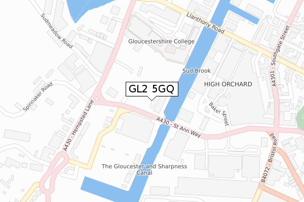
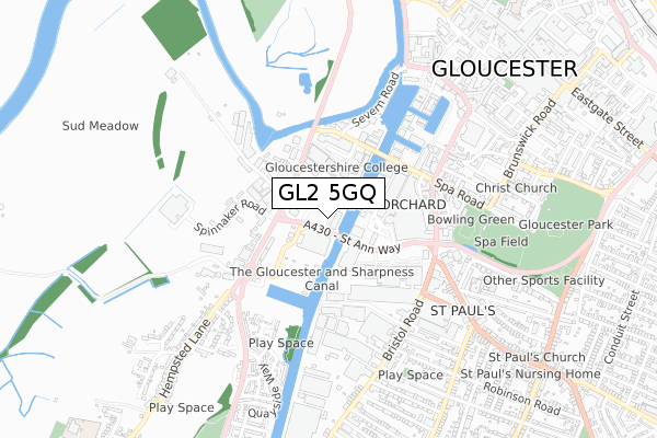
GL2 5GQ is located in the Westgate electoral ward, within the local authority district of Gloucester and the English Parliamentary constituency of Gloucester. The Sub Integrated Care Board (ICB) Location is NHS Gloucestershire ICB - 11M and the police force is Gloucestershire. This postcode has been in use since February 2020.


GetTheData
Source: OS Open Zoomstack (Ordnance Survey)
Licence: Open Government Licence (requires attribution)
Attribution: Contains OS data © Crown copyright and database right 2024
Source: Open Postcode Geo
Licence: Open Government Licence (requires attribution)
Attribution: Contains OS data © Crown copyright and database right 2024; Contains Royal Mail data © Royal Mail copyright and database right 2024; Source: Office for National Statistics licensed under the Open Government Licence v.3.0
| Easting | 382454 |
| Northing | 217886 |
| Latitude | 51.859287 |
| Longitude | -2.256181 |
GetTheData
Source: Open Postcode Geo
Licence: Open Government Licence
| Country | England |
| Postcode District | GL2 |
➜ See where GL2 is on a map ➜ Where is Gloucester? | |
GetTheData
Source: Land Registry Price Paid Data
Licence: Open Government Licence
| Ward | Westgate |
| Constituency | Gloucester |
GetTheData
Source: ONS Postcode Database
Licence: Open Government Licence
| Sainsbury's (St Anne Way) | Hempsted | 210m |
| Llanthony Priory (Llanthony Road) | Gloucester | 213m |
| Sainsbury's (St Anne Way) | Hempsted | 214m |
| Llanthony Priory (Llanthony Road) | Gloucester | 220m |
| Sainsbury's Supermarket (Sainsbury Crescent) | Hempsted | 237m |
| Gloucester Station | 1.4km |
GetTheData
Source: NaPTAN
Licence: Open Government Licence
GetTheData
Source: ONS Postcode Database
Licence: Open Government Licence


➜ Get more ratings from the Food Standards Agency
GetTheData
Source: Food Standards Agency
Licence: FSA terms & conditions
| Last Collection | |||
|---|---|---|---|
| Location | Mon-Fri | Sat | Distance |
| Waterways Museum | 18:30 | 12:30 | 376m |
| Albion | 18:30 | 12:30 | 523m |
| Bristol Road | 17:40 | 12:30 | 563m |
GetTheData
Source: Dracos
Licence: Creative Commons Attribution-ShareAlike
The below table lists the International Territorial Level (ITL) codes (formerly Nomenclature of Territorial Units for Statistics (NUTS) codes) and Local Administrative Units (LAU) codes for GL2 5GQ:
| ITL 1 Code | Name |
|---|---|
| TLK | South West (England) |
| ITL 2 Code | Name |
| TLK1 | Gloucestershire, Wiltshire and Bath/Bristol area |
| ITL 3 Code | Name |
| TLK13 | Gloucestershire CC |
| LAU 1 Code | Name |
| E07000081 | Gloucester |
GetTheData
Source: ONS Postcode Directory
Licence: Open Government Licence
The below table lists the Census Output Area (OA), Lower Layer Super Output Area (LSOA), and Middle Layer Super Output Area (MSOA) for GL2 5GQ:
| Code | Name | |
|---|---|---|
| OA | E00168945 | |
| LSOA | E01022348 | Gloucester 004C |
| MSOA | E02004639 | Gloucester 004 |
GetTheData
Source: ONS Postcode Directory
Licence: Open Government Licence
| GL2 5QT | Llanthony Road | 214m |
| GL2 5HL | 312m | |
| GL2 5HD | Sudmeadow Road | 320m |
| GL2 5HN | Hemmingsdale Road | 324m |
| GL2 5JA | Hempsted Lane | 326m |
| GL2 5FD | Spinnaker Road | 342m |
| GL2 5RB | Church Street | 347m |
| GL1 2EZ | Southgate Street | 358m |
| GL1 2EH | 369m | |
| GL1 1XQ | Southgate Street | 392m |
GetTheData
Source: Open Postcode Geo; Land Registry Price Paid Data
Licence: Open Government Licence