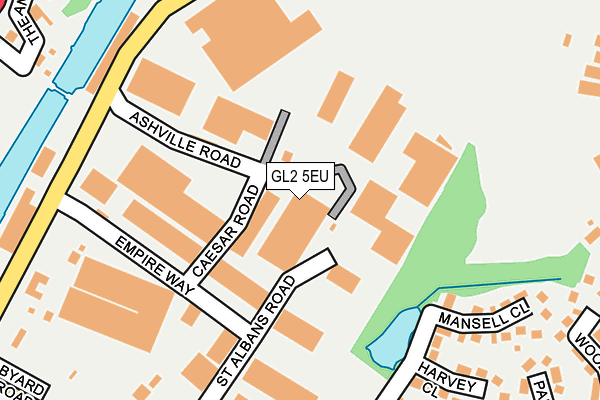
GL2 5EU lies on Ashville Road in Gloucester. GL2 5EU is located in the Podsmead electoral ward, within the local authority district of Gloucester and the English Parliamentary constituency of Gloucester. The Sub Integrated Care Board (ICB) Location is NHS Gloucestershire ICB - 11M and the police force is Gloucestershire. This postcode has been in use since December 1995.


GetTheData
Source: OS OpenMap – Local (Ordnance Survey)
Source: OS VectorMap District (Ordnance Survey)
Licence: Open Government Licence (requires attribution)
| Easting | 382152 |
| Northing | 216295 |
| Latitude | 51.844973 |
| Longitude | -2.260484 |
GetTheData
Source: Open Postcode Geo
Licence: Open Government Licence
| Street | Ashville Road |
| Town/City | Gloucester |
| Country | England |
| Postcode District | GL2 |
➜ See where GL2 is on a map ➜ Where is Gloucester? | |
GetTheData
Source: Land Registry Price Paid Data
Licence: Open Government Licence
Elevation or altitude of GL2 5EU as distance above sea level:
| Metres | Feet | |
|---|---|---|
| Elevation | 10m | 33ft |
Elevation is measured from the approximate centre of the postcode, to the nearest point on an OS contour line from OS Terrain 50, which has contour spacing of ten vertical metres.
➜ How high above sea level am I? Find the elevation of your current position using your device's GPS.
GetTheData
Source: Open Postcode Elevation
Licence: Open Government Licence
| Ward | Podsmead |
| Constituency | Gloucester |
GetTheData
Source: ONS Postcode Database
Licence: Open Government Licence
UNIT 3, ASHVILLE INDUSTRIAL ESTATE, ASHVILLE ROAD, GLOUCESTER, GL2 5EU 2024 19 DEC £400,000 |
UNIT 3, ASHVILLE INDUSTRIAL ESTATE, ASHVILLE ROAD, GLOUCESTER, GL2 5EU 2001 31 JUL £260,000 |
GetTheData
Source: HM Land Registry Price Paid Data
Licence: Contains HM Land Registry data © Crown copyright and database right 2025. This data is licensed under the Open Government Licence v3.0.
| Hempsted Lane (Bristol Road) | Gloucester | 233m |
| Empire Way (Bristol Road) | Gloucester | 294m |
| Bungalows (Shakespeare Avenue) | Podsmead | 360m |
| The Anchorage (Secunda Way) | Hempsted | 384m |
| The Forge | Hempsted | 400m |
| Gloucester Station | 2.7km |
GetTheData
Source: NaPTAN
Licence: Open Government Licence
Estimated total energy consumption in GL2 5EU by fuel type, 2015.
| Consumption (kWh) | 156,836 |
|---|---|
| Meter count | 8 |
| Mean (kWh/meter) | 19,604 |
| Median (kWh/meter) | 17,830 |
GetTheData
Source: Postcode level gas estimates: 2015 (experimental)
Source: Postcode level electricity estimates: 2015 (experimental)
Licence: Open Government Licence
GetTheData
Source: ONS Postcode Database
Licence: Open Government Licence


➜ Get more ratings from the Food Standards Agency
GetTheData
Source: Food Standards Agency
Licence: FSA terms & conditions
| Last Collection | |||
|---|---|---|---|
| Location | Mon-Fri | Sat | Distance |
| Elmgrove | 17:00 | 12:00 | 484m |
| Bristol Road | 17:45 | 12:30 | 485m |
| Tuffley Avenue | 17:30 | 12:45 | 532m |
GetTheData
Source: Dracos
Licence: Creative Commons Attribution-ShareAlike
The below table lists the International Territorial Level (ITL) codes (formerly Nomenclature of Territorial Units for Statistics (NUTS) codes) and Local Administrative Units (LAU) codes for GL2 5EU:
| ITL 1 Code | Name |
|---|---|
| TLK | South West (England) |
| ITL 2 Code | Name |
| TLK1 | Gloucestershire, Wiltshire and Bath/Bristol area |
| ITL 3 Code | Name |
| TLK13 | Gloucestershire CC |
| LAU 1 Code | Name |
| E07000081 | Gloucester |
GetTheData
Source: ONS Postcode Directory
Licence: Open Government Licence
The below table lists the Census Output Area (OA), Lower Layer Super Output Area (LSOA), and Middle Layer Super Output Area (MSOA) for GL2 5EU:
| Code | Name | |
|---|---|---|
| OA | E00113521 | |
| LSOA | E01022333 | Gloucester 009E |
| MSOA | E02004644 | Gloucester 009 |
GetTheData
Source: ONS Postcode Directory
Licence: Open Government Licence
| GL2 5HY | Empire Way | 137m |
| GL2 5FL | Harvey Close | 257m |
| GL2 5AS | Milton Avenue | 284m |
| GL1 5NE | Tuffley Crescent | 325m |
| GL2 5FF | Woodpecker Road | 328m |
| GL2 5FG | Partridge Close | 330m |
| GL1 5ND | Tuffley Crescent | 352m |
| GL1 5NQ | Thornhill Close | 356m |
| GL2 5AR | Milton Avenue | 373m |
| GL2 5JW | The Anchorage | 382m |
GetTheData
Source: Open Postcode Geo; Land Registry Price Paid Data
Licence: Open Government Licence