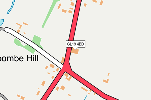
GL19 4BD is located in the Severn Vale North electoral ward, within the local authority district of Tewkesbury and the English Parliamentary constituency of Tewkesbury. The Sub Integrated Care Board (ICB) Location is NHS Gloucestershire ICB - 11M and the police force is Gloucestershire. This postcode has been in use since January 1980.


GetTheData
Source: OS OpenMap – Local (Ordnance Survey)
Source: OS VectorMap District (Ordnance Survey)
Licence: Open Government Licence (requires attribution)
| Easting | 388888 |
| Northing | 227114 |
| Latitude | 51.942414 |
| Longitude | -2.163059 |
GetTheData
Source: Open Postcode Geo
Licence: Open Government Licence
| Country | England |
| Postcode District | GL19 |
➜ See where GL19 is on a map ➜ Where is Coombe Hill? | |
GetTheData
Source: Land Registry Price Paid Data
Licence: Open Government Licence
Elevation or altitude of GL19 4BD as distance above sea level:
| Metres | Feet | |
|---|---|---|
| Elevation | 30m | 98ft |
Elevation is measured from the approximate centre of the postcode, to the nearest point on an OS contour line from OS Terrain 50, which has contour spacing of ten vertical metres.
➜ How high above sea level am I? Find the elevation of your current position using your device's GPS.
GetTheData
Source: Open Postcode Elevation
Licence: Open Government Licence
| Ward | Severn Vale North |
| Constituency | Tewkesbury |
GetTheData
Source: ONS Postcode Database
Licence: Open Government Licence
| Swan Inn | Coombe Hill | 72m |
| Coombe End (Cheltenham Road A4019) | Coombe Hill | 128m |
| Swan Inn | Coombe Hill | 136m |
| Evington Villa | Coombe Hill | 204m |
| St Stephen's Mission Church (A38) | Coombe Hill | 396m |
GetTheData
Source: NaPTAN
Licence: Open Government Licence
GetTheData
Source: ONS Postcode Database
Licence: Open Government Licence


➜ Get more ratings from the Food Standards Agency
GetTheData
Source: Food Standards Agency
Licence: FSA terms & conditions
| Last Collection | |||
|---|---|---|---|
| Location | Mon-Fri | Sat | Distance |
| Coombe Hill | 17:00 | 10:15 | 51m |
| Withybridge | 16:45 | 08:30 | 2,869m |
| School Road Apperley | 16:30 | 10:00 | 3,252m |
GetTheData
Source: Dracos
Licence: Creative Commons Attribution-ShareAlike
The below table lists the International Territorial Level (ITL) codes (formerly Nomenclature of Territorial Units for Statistics (NUTS) codes) and Local Administrative Units (LAU) codes for GL19 4BD:
| ITL 1 Code | Name |
|---|---|
| TLK | South West (England) |
| ITL 2 Code | Name |
| TLK1 | Gloucestershire, Wiltshire and Bath/Bristol area |
| ITL 3 Code | Name |
| TLK13 | Gloucestershire CC |
| LAU 1 Code | Name |
| E07000083 | Tewkesbury |
GetTheData
Source: ONS Postcode Directory
Licence: Open Government Licence
The below table lists the Census Output Area (OA), Lower Layer Super Output Area (LSOA), and Middle Layer Super Output Area (MSOA) for GL19 4BD:
| Code | Name | |
|---|---|---|
| OA | E00114096 | |
| LSOA | E01022442 | Tewkesbury 006B |
| MSOA | E02004671 | Tewkesbury 006 |
GetTheData
Source: ONS Postcode Directory
Licence: Open Government Licence
| GL19 4BA | Tewkesbury Road | 103m |
| GL19 4AY | Tewkesbury Road | 143m |
| GL19 4AZ | Cheltenham Road | 150m |
| GL19 4BE | Tewkesbury Road | 168m |
| GL19 4BQ | Tewkesbury Road | 212m |
| GL19 4AU | Tewkesbury Road | 230m |
| GL19 4BB | The Wharf | 237m |
| GL19 4BL | Tewkesbury Road | 295m |
| GL19 4BJ | Tewkesbury Road | 322m |
| GL19 4AS | Tewkesbury Road | 411m |
GetTheData
Source: Open Postcode Geo; Land Registry Price Paid Data
Licence: Open Government Licence