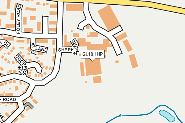
GL18 1HP is located in the Newent & Taynton electoral ward, within the local authority district of Forest of Dean and the English Parliamentary constituency of Forest of Dean. The Sub Integrated Care Board (ICB) Location is NHS Gloucestershire ICB - 11M and the police force is Gloucestershire. This postcode has been in use since June 1981.


GetTheData
Source: OS OpenMap – Local (Ordnance Survey)
Source: OS VectorMap District (Ordnance Survey)
Licence: Open Government Licence (requires attribution)
| Easting | 372983 |
| Northing | 225708 |
| Latitude | 51.929225 |
| Longitude | -2.394321 |
GetTheData
Source: Open Postcode Geo
Licence: Open Government Licence
| Country | England |
| Postcode District | GL18 |
➜ See where GL18 is on a map ➜ Where is Newent? | |
GetTheData
Source: Land Registry Price Paid Data
Licence: Open Government Licence
Elevation or altitude of GL18 1HP as distance above sea level:
| Metres | Feet | |
|---|---|---|
| Elevation | 30m | 98ft |
Elevation is measured from the approximate centre of the postcode, to the nearest point on an OS contour line from OS Terrain 50, which has contour spacing of ten vertical metres.
➜ How high above sea level am I? Find the elevation of your current position using your device's GPS.
GetTheData
Source: Open Postcode Elevation
Licence: Open Government Licence
| Ward | Newent & Taynton |
| Constituency | Forest Of Dean |
GetTheData
Source: ONS Postcode Database
Licence: Open Government Licence
| Onslow Road (Gloucester Street) | Newent | 246m |
| Onslow Road (Gloucester Street) | Newent | 252m |
| Chedworth (Foley Road) | Newent | 335m |
| Oak Park | Newent | 369m |
| The Ryelands (May Hill View) | Newent | 422m |
GetTheData
Source: NaPTAN
Licence: Open Government Licence
GetTheData
Source: ONS Postcode Database
Licence: Open Government Licence


➜ Get more ratings from the Food Standards Agency
GetTheData
Source: Food Standards Agency
Licence: FSA terms & conditions
| Last Collection | |||
|---|---|---|---|
| Location | Mon-Fri | Sat | Distance |
| Onslow Road | 16:00 | 08:30 | 337m |
| Malswick | 16:00 | 07:00 | 867m |
| Health Centre | 17:40 | 09:30 | 892m |
GetTheData
Source: Dracos
Licence: Creative Commons Attribution-ShareAlike
The below table lists the International Territorial Level (ITL) codes (formerly Nomenclature of Territorial Units for Statistics (NUTS) codes) and Local Administrative Units (LAU) codes for GL18 1HP:
| ITL 1 Code | Name |
|---|---|
| TLK | South West (England) |
| ITL 2 Code | Name |
| TLK1 | Gloucestershire, Wiltshire and Bath/Bristol area |
| ITL 3 Code | Name |
| TLK13 | Gloucestershire CC |
| LAU 1 Code | Name |
| E07000080 | Forest of Dean |
GetTheData
Source: ONS Postcode Directory
Licence: Open Government Licence
The below table lists the Census Output Area (OA), Lower Layer Super Output Area (LSOA), and Middle Layer Super Output Area (MSOA) for GL18 1HP:
| Code | Name | |
|---|---|---|
| OA | E00113174 | |
| LSOA | E01022261 | Forest of Dean 002A |
| MSOA | E02004627 | Forest of Dean 002 |
GetTheData
Source: ONS Postcode Directory
Licence: Open Government Licence
| GL18 1DZ | Newent Business Park | 59m |
| GL18 1TB | Ayland Close | 174m |
| GL18 1TU | Blenheim Drive | 176m |
| GL18 1SA | Onslow Road | 204m |
| GL18 1SB | Lightfoot | 222m |
| GL18 1TJ | Coopers Way | 236m |
| GL18 1RY | Newlands Court | 276m |
| GL18 1UD | Oak Tree Way | 291m |
| GL18 1TP | Perry Close | 293m |
| GL18 1SE | Chedworth | 304m |
GetTheData
Source: Open Postcode Geo; Land Registry Price Paid Data
Licence: Open Government Licence