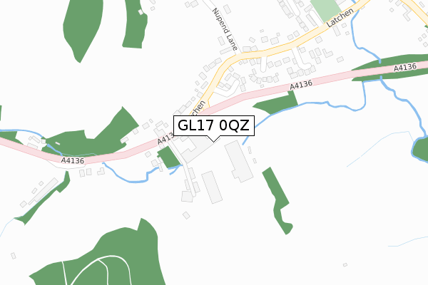
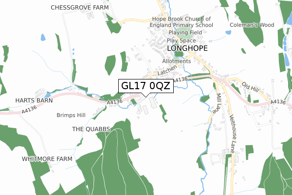
GL17 0QZ is located in the Longhope & Huntley electoral ward, within the local authority district of Forest of Dean and the English Parliamentary constituency of Forest of Dean. The Sub Integrated Care Board (ICB) Location is NHS Gloucestershire ICB - 11M and the police force is Gloucestershire. This postcode has been in use since April 2020.


GetTheData
Source: OS Open Zoomstack (Ordnance Survey)
Licence: Open Government Licence (requires attribution)
Attribution: Contains OS data © Crown copyright and database right 2025
Source: Open Postcode Geo
Licence: Open Government Licence (requires attribution)
Attribution: Contains OS data © Crown copyright and database right 2025; Contains Royal Mail data © Royal Mail copyright and database right 2025; Source: Office for National Statistics licensed under the Open Government Licence v.3.0
| Easting | 368538 |
| Northing | 218443 |
| Latitude | 51.863681 |
| Longitude | -2.458299 |
GetTheData
Source: Open Postcode Geo
Licence: Open Government Licence
| Country | England |
| Postcode District | GL17 |
➜ See where GL17 is on a map ➜ Where is Longhope? | |
GetTheData
Source: Land Registry Price Paid Data
Licence: Open Government Licence
| Ward | Longhope & Huntley |
| Constituency | Forest Of Dean |
GetTheData
Source: ONS Postcode Database
Licence: Open Government Licence
| Yew Tree (A4136) | Longhope | 144m |
| Yew Tree (A4136) | Longhope | 147m |
| Bathams Close (Latchen) | Longhope | 176m |
| Bathams Close (Latchen) | Longhope | 182m |
| Brook Farm (A4136) | Longhope | 352m |
GetTheData
Source: NaPTAN
Licence: Open Government Licence
GetTheData
Source: ONS Postcode Database
Licence: Open Government Licence


➜ Get more ratings from the Food Standards Agency
GetTheData
Source: Food Standards Agency
Licence: FSA terms & conditions
| Last Collection | |||
|---|---|---|---|
| Location | Mon-Fri | Sat | Distance |
| Longhope Post Office | 17:30 | 11:00 | 646m |
| Luxtree Farm | 16:10 | 09:15 | 1,423m |
| Longhope Church | 16:30 | 10:10 | 1,526m |
GetTheData
Source: Dracos
Licence: Creative Commons Attribution-ShareAlike
The below table lists the International Territorial Level (ITL) codes (formerly Nomenclature of Territorial Units for Statistics (NUTS) codes) and Local Administrative Units (LAU) codes for GL17 0QZ:
| ITL 1 Code | Name |
|---|---|
| TLK | South West (England) |
| ITL 2 Code | Name |
| TLK1 | Gloucestershire, Wiltshire and Bath/Bristol area |
| ITL 3 Code | Name |
| TLK13 | Gloucestershire CC |
| LAU 1 Code | Name |
| E07000080 | Forest of Dean |
GetTheData
Source: ONS Postcode Directory
Licence: Open Government Licence
The below table lists the Census Output Area (OA), Lower Layer Super Output Area (LSOA), and Middle Layer Super Output Area (MSOA) for GL17 0QZ:
| Code | Name | |
|---|---|---|
| OA | E00112999 | |
| LSOA | E01022230 | Forest of Dean 005B |
| MSOA | E02004630 | Forest of Dean 005 |
GetTheData
Source: ONS Postcode Directory
Licence: Open Government Licence
| GL17 0QB | Latchen | 191m |
| GL17 0QX | Bathams Close | 194m |
| GL17 0QU | Latchen Orchard | 242m |
| GL17 0QF | Monmouth Road | 248m |
| GL17 0XY | Casita Drive | 310m |
| GL17 0QE | Latchen | 352m |
| GL17 0QA | Latchen | 359m |
| GL17 0QQ | Nupend Lane | 383m |
| GL17 0QS | The Willows | 414m |
| GL17 0QT | Brook End | 494m |
GetTheData
Source: Open Postcode Geo; Land Registry Price Paid Data
Licence: Open Government Licence