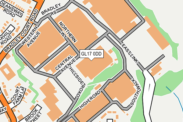
GL17 0DD is located in the Mitcheldean, Ruardean & Drybrook electoral ward, within the local authority district of Forest of Dean and the English Parliamentary constituency of Forest of Dean. The Sub Integrated Care Board (ICB) Location is NHS Gloucestershire ICB - 11M and the police force is Gloucestershire. This postcode has been in use since December 2000.


GetTheData
Source: OS OpenMap – Local (Ordnance Survey)
Source: OS VectorMap District (Ordnance Survey)
Licence: Open Government Licence (requires attribution)
| Easting | 366676 |
| Northing | 218889 |
| Latitude | 51.867583 |
| Longitude | -2.485381 |
GetTheData
Source: Open Postcode Geo
Licence: Open Government Licence
| Country | England |
| Postcode District | GL17 |
➜ See where GL17 is on a map ➜ Where is Mitcheldean? | |
GetTheData
Source: Land Registry Price Paid Data
Licence: Open Government Licence
Elevation or altitude of GL17 0DD as distance above sea level:
| Metres | Feet | |
|---|---|---|
| Elevation | 140m | 459ft |
Elevation is measured from the approximate centre of the postcode, to the nearest point on an OS contour line from OS Terrain 50, which has contour spacing of ten vertical metres.
➜ How high above sea level am I? Find the elevation of your current position using your device's GPS.
GetTheData
Source: Open Postcode Elevation
Licence: Open Government Licence
| Ward | Mitcheldean, Ruardean & Drybrook |
| Constituency | Forest Of Dean |
GetTheData
Source: ONS Postcode Database
Licence: Open Government Licence
| Vantage Point (Central Avenue) | Mitcheldean | 66m |
| Vantage Point (Bradley Court Road) | Mitcheldean | 240m |
| Vantage Point (Bradley Court Road) | Mitcheldean | 254m |
| Vantage Point Car Park (Hillside Road) | Mitcheldean | 289m |
| Police House (Townsend) | Mitcheldean | 317m |
GetTheData
Source: NaPTAN
Licence: Open Government Licence
GetTheData
Source: ONS Postcode Database
Licence: Open Government Licence


➜ Get more ratings from the Food Standards Agency
GetTheData
Source: Food Standards Agency
Licence: FSA terms & conditions
| Last Collection | |||
|---|---|---|---|
| Location | Mon-Fri | Sat | Distance |
| Mitcheldean Post Office | 17:30 | 10:50 | 378m |
| Hollywell Road | 16:20 | 08:00 | 523m |
| Luxtree Farm | 16:10 | 09:15 | 1,259m |
GetTheData
Source: Dracos
Licence: Creative Commons Attribution-ShareAlike
The below table lists the International Territorial Level (ITL) codes (formerly Nomenclature of Territorial Units for Statistics (NUTS) codes) and Local Administrative Units (LAU) codes for GL17 0DD:
| ITL 1 Code | Name |
|---|---|
| TLK | South West (England) |
| ITL 2 Code | Name |
| TLK1 | Gloucestershire, Wiltshire and Bath/Bristol area |
| ITL 3 Code | Name |
| TLK13 | Gloucestershire CC |
| LAU 1 Code | Name |
| E07000080 | Forest of Dean |
GetTheData
Source: ONS Postcode Directory
Licence: Open Government Licence
The below table lists the Census Output Area (OA), Lower Layer Super Output Area (LSOA), and Middle Layer Super Output Area (MSOA) for GL17 0DD:
| Code | Name | |
|---|---|---|
| OA | E00113158 | |
| LSOA | E01022258 | Forest of Dean 003C |
| MSOA | E02004628 | Forest of Dean 003 |
GetTheData
Source: ONS Postcode Directory
Licence: Open Government Licence
| GL17 0DG | Eastern Avenue | 209m |
| GL17 0AY | Court Farm Lane | 256m |
| GL17 0SF | Bradley Court Road | 259m |
| GL17 0DE | Eastern Avenue | 270m |
| GL17 0AU | Brook Street | 275m |
| GL17 0BN | Oakhill Road | 281m |
| GL17 0BD | Talbot Place | 299m |
| GL17 0DH | Parks Road | 324m |
| GL17 0BA | Townsend | 330m |
| GL17 0BE | Townsend | 333m |
GetTheData
Source: Open Postcode Geo; Land Registry Price Paid Data
Licence: Open Government Licence