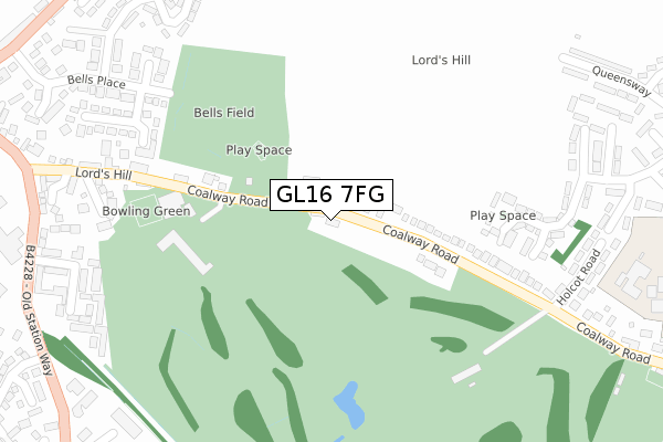
GL16 7FG is located in the Coleford electoral ward, within the local authority district of Forest of Dean and the English Parliamentary constituency of Forest of Dean. The Sub Integrated Care Board (ICB) Location is NHS Gloucestershire ICB - 11M and the police force is Gloucestershire. This postcode has been in use since June 2018.


GetTheData
Source: OS Open Zoomstack (Ordnance Survey)
Licence: Open Government Licence (requires attribution)
Attribution: Contains OS data © Crown copyright and database right 2025
Source: Open Postcode Geo
Licence: Open Government Licence (requires attribution)
Attribution: Contains OS data © Crown copyright and database right 2025; Contains Royal Mail data © Royal Mail copyright and database right 2025; Source: Office for National Statistics licensed under the Open Government Licence v.3.0
| Easting | 358188 |
| Northing | 210561 |
| Latitude | 51.792134 |
| Longitude | -2.607641 |
GetTheData
Source: Open Postcode Geo
Licence: Open Government Licence
| Country | England |
| Postcode District | GL16 |
➜ See where GL16 is on a map ➜ Where is Coalway? | |
GetTheData
Source: Land Registry Price Paid Data
Licence: Open Government Licence
| Ward | Coleford |
| Constituency | Forest Of Dean |
GetTheData
Source: ONS Postcode Database
Licence: Open Government Licence
| Bells Club And Hotel | Coleford | 164m |
| Bells Club And Hotel | Coleford | 187m |
| Vicarage Court (Lords Hill) | Coleford | 433m |
| Vicarage Court (Lord's Hill) | Coleford | 433m |
| Pyart Court (Old Station Way) | Coleford | 454m |
GetTheData
Source: NaPTAN
Licence: Open Government Licence
| Percentage of properties with Next Generation Access | 100.0% |
| Percentage of properties with Superfast Broadband | 100.0% |
| Percentage of properties with Ultrafast Broadband | 0.0% |
| Percentage of properties with Full Fibre Broadband | 0.0% |
Superfast Broadband is between 30Mbps and 300Mbps
Ultrafast Broadband is > 300Mbps
| Percentage of properties unable to receive 2Mbps | 0.0% |
| Percentage of properties unable to receive 5Mbps | 0.0% |
| Percentage of properties unable to receive 10Mbps | 0.0% |
| Percentage of properties unable to receive 30Mbps | 0.0% |
GetTheData
Source: Ofcom
Licence: Ofcom Terms of Use (requires attribution)
GetTheData
Source: ONS Postcode Database
Licence: Open Government Licence


➜ Get more ratings from the Food Standards Agency
GetTheData
Source: Food Standards Agency
Licence: FSA terms & conditions
| Last Collection | |||
|---|---|---|---|
| Location | Mon-Fri | Sat | Distance |
| Gloucester Road | 17:30 | 11:45 | 560m |
| English Bicknor | 16:45 | 09:00 | 662m |
| Coleford Post Office | 18:00 | 12:00 | 663m |
GetTheData
Source: Dracos
Licence: Creative Commons Attribution-ShareAlike
The below table lists the International Territorial Level (ITL) codes (formerly Nomenclature of Territorial Units for Statistics (NUTS) codes) and Local Administrative Units (LAU) codes for GL16 7FG:
| ITL 1 Code | Name |
|---|---|
| TLK | South West (England) |
| ITL 2 Code | Name |
| TLK1 | Gloucestershire, Wiltshire and Bath/Bristol area |
| ITL 3 Code | Name |
| TLK13 | Gloucestershire CC |
| LAU 1 Code | Name |
| E07000080 | Forest of Dean |
GetTheData
Source: ONS Postcode Directory
Licence: Open Government Licence
The below table lists the Census Output Area (OA), Lower Layer Super Output Area (LSOA), and Middle Layer Super Output Area (MSOA) for GL16 7FG:
| Code | Name | |
|---|---|---|
| OA | E00113085 | |
| LSOA | E01022243 | Forest of Dean 007D |
| MSOA | E02004632 | Forest of Dean 007 |
GetTheData
Source: ONS Postcode Directory
Licence: Open Government Licence
| GL16 7HG | Coalway Road | 132m |
| GL16 7HQ | Coalway Road | 273m |
| GL16 7FF | Poppy Field | 282m |
| GL16 8BG | Lords Hill | 316m |
| GL16 8RT | Lords Gate | 338m |
| GL16 8DT | Lords Hill Close | 353m |
| GL16 7RP | Holcot Close | 355m |
| GL16 8DB | Prospect Close | 361m |
| GL16 7HJ | Holcot Road | 393m |
| GL16 8RS | Kings Meade | 394m |
GetTheData
Source: Open Postcode Geo; Land Registry Price Paid Data
Licence: Open Government Licence