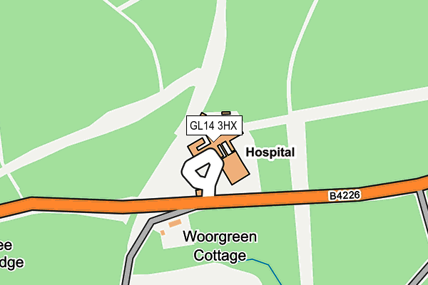
GL14 3HX is located in the Cinderford West electoral ward, within the local authority district of Forest of Dean and the English Parliamentary constituency of Forest of Dean. The Sub Integrated Care Board (ICB) Location is NHS Gloucestershire ICB - 11M and the police force is Gloucestershire. This postcode has been in use since January 1980.


GetTheData
Source: OS OpenMap – Local (Ordnance Survey)
Source: OS VectorMap District (Ordnance Survey)
Licence: Open Government Licence (requires attribution)
| Easting | 364257 |
| Northing | 212636 |
| Latitude | 51.811207 |
| Longitude | -2.519863 |
GetTheData
Source: Open Postcode Geo
Licence: Open Government Licence
| Country | England |
| Postcode District | GL14 |
➜ See where GL14 is on a map | |
GetTheData
Source: Land Registry Price Paid Data
Licence: Open Government Licence
Elevation or altitude of GL14 3HX as distance above sea level:
| Metres | Feet | |
|---|---|---|
| Elevation | 180m | 591ft |
Elevation is measured from the approximate centre of the postcode, to the nearest point on an OS contour line from OS Terrain 50, which has contour spacing of ten vertical metres.
➜ How high above sea level am I? Find the elevation of your current position using your device's GPS.
GetTheData
Source: Open Postcode Elevation
Licence: Open Government Licence
| Ward | Cinderford West |
| Constituency | Forest Of Dean |
GetTheData
Source: ONS Postcode Database
Licence: Open Government Licence
| Dilke Hospital (Speech House Road) | Cinderford | 76m |
| Dilke Hospital (Speech House Road) | Cinderford | 85m |
| Yew Tree Brake Cemetery (Speech House Road) | Cinderford | 429m |
| Yew Tree Brake Cemetery (Speech House Road) | Cinderford | 450m |
| Brook (Valley Road) | Cinderford | 801m |
GetTheData
Source: NaPTAN
Licence: Open Government Licence
GetTheData
Source: ONS Postcode Database
Licence: Open Government Licence


➜ Get more ratings from the Food Standards Agency
GetTheData
Source: Food Standards Agency
Licence: FSA terms & conditions
| Last Collection | |||
|---|---|---|---|
| Location | Mon-Fri | Sat | Distance |
| Station Street | 17:15 | 12:00 | 1,710m |
| Soudley | 16:45 | 08:00 | 2,556m |
| Littledean Estate | 16:45 | 08:30 | 3,210m |
GetTheData
Source: Dracos
Licence: Creative Commons Attribution-ShareAlike
The below table lists the International Territorial Level (ITL) codes (formerly Nomenclature of Territorial Units for Statistics (NUTS) codes) and Local Administrative Units (LAU) codes for GL14 3HX:
| ITL 1 Code | Name |
|---|---|
| TLK | South West (England) |
| ITL 2 Code | Name |
| TLK1 | Gloucestershire, Wiltshire and Bath/Bristol area |
| ITL 3 Code | Name |
| TLK13 | Gloucestershire CC |
| LAU 1 Code | Name |
| E07000080 | Forest of Dean |
GetTheData
Source: ONS Postcode Directory
Licence: Open Government Licence
The below table lists the Census Output Area (OA), Lower Layer Super Output Area (LSOA), and Middle Layer Super Output Area (MSOA) for GL14 3HX:
| Code | Name | |
|---|---|---|
| OA | E00113049 | |
| LSOA | E01022238 | Forest of Dean 004C |
| MSOA | E02004629 | Forest of Dean 004 |
GetTheData
Source: ONS Postcode Directory
Licence: Open Government Licence
| GL14 3HB | St Whites Road | 808m |
| GL14 3HA | St Whites Road | 831m |
| GL14 3HH | Railway Road | 848m |
| GL14 3HJ | Railway Road | 880m |
| GL14 3HD | St Whites Road | 887m |
| GL14 3HL | Railway Road | 933m |
| GL14 3ET | Peacock Lane | 933m |
| GL14 3HQ | Valley Road | 946m |
| GL14 3EU | Peacock Lane | 947m |
| GL14 3HP | Cullimore View | 959m |
GetTheData
Source: Open Postcode Geo; Land Registry Price Paid Data
Licence: Open Government Licence