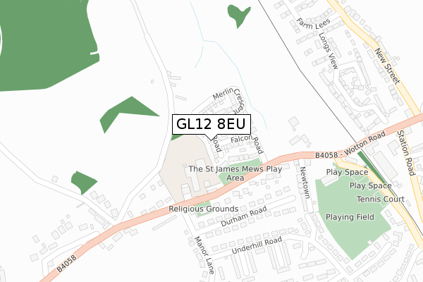
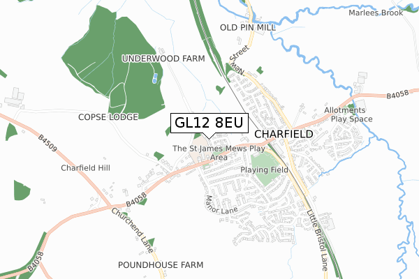
GL12 8EU is located in the Charfield electoral ward, within the unitary authority of South Gloucestershire and the English Parliamentary constituency of Thornbury and Yate. The Sub Integrated Care Board (ICB) Location is NHS Bristol, North Somerset and South Gloucestershire ICB - 15C and the police force is Avon and Somerset. This postcode has been in use since November 2018.


GetTheData
Source: OS Open Zoomstack (Ordnance Survey)
Licence: Open Government Licence (requires attribution)
Attribution: Contains OS data © Crown copyright and database right 2025
Source: Open Postcode Geo
Licence: Open Government Licence (requires attribution)
Attribution: Contains OS data © Crown copyright and database right 2025; Contains Royal Mail data © Royal Mail copyright and database right 2025; Source: Office for National Statistics licensed under the Open Government Licence v.3.0
| Easting | 372006 |
| Northing | 192310 |
| Latitude | 51.628903 |
| Longitude | -2.405823 |
GetTheData
Source: Open Postcode Geo
Licence: Open Government Licence
| Country | England |
| Postcode District | GL12 |
➜ See where GL12 is on a map ➜ Where is Charfield? | |
GetTheData
Source: Land Registry Price Paid Data
Licence: Open Government Licence
| Ward | Charfield |
| Constituency | Thornbury And Yate |
GetTheData
Source: ONS Postcode Database
Licence: Open Government Licence
12, KESTREL ROAD, CHARFIELD, WOTTON-UNDER-EDGE, GL12 8EU 2019 26 JUL £364,995 |
25, KESTREL ROAD, CHARFIELD, WOTTON-UNDER-EDGE, GL12 8EU 2019 26 JUL £489,995 |
5, KESTREL ROAD, CHARFIELD, WOTTON-UNDER-EDGE, GL12 8EU 2019 12 JUL £359,995 |
10, KESTREL ROAD, CHARFIELD, WOTTON-UNDER-EDGE, GL12 8EU 2019 28 JUN £364,995 |
19, KESTREL ROAD, CHARFIELD, WOTTON-UNDER-EDGE, GL12 8EU 2019 21 JUN £364,995 |
17, KESTREL ROAD, CHARFIELD, WOTTON-UNDER-EDGE, GL12 8EU 2019 21 JUN £362,995 |
3, KESTREL ROAD, CHARFIELD, WOTTON-UNDER-EDGE, GL12 8EU 2019 31 MAY £469,995 |
21, KESTREL ROAD, CHARFIELD, WOTTON-UNDER-EDGE, GL12 8EU 2019 30 APR £482,995 |
23, KESTREL ROAD, CHARFIELD, WOTTON-UNDER-EDGE, GL12 8EU 2019 27 MAR £482,995 |
1, KESTREL ROAD, CHARFIELD, WOTTON-UNDER-EDGE, GL12 8EU 2018 22 NOV £479,995 |
GetTheData
Source: HM Land Registry Price Paid Data
Licence: Contains HM Land Registry data © Crown copyright and database right 2025. This data is licensed under the Open Government Licence v3.0.
| Charfield Primary School (Wotton Road) | Charfield | 168m |
| Durham Road (Manor Lane) | Charfield | 199m |
| Charfield Primary School (Wotton Road) | Charfield | 271m |
| Berkeley Close (Underhill Road) | Charfield | 463m |
| Berkeley Close (Underhill Road) | Charfield | 479m |
GetTheData
Source: NaPTAN
Licence: Open Government Licence
| Percentage of properties with Next Generation Access | 100.0% |
| Percentage of properties with Superfast Broadband | 100.0% |
| Percentage of properties with Ultrafast Broadband | 100.0% |
| Percentage of properties with Full Fibre Broadband | 100.0% |
Superfast Broadband is between 30Mbps and 300Mbps
Ultrafast Broadband is > 300Mbps
| Percentage of properties unable to receive 2Mbps | 0.0% |
| Percentage of properties unable to receive 5Mbps | 0.0% |
| Percentage of properties unable to receive 10Mbps | 0.0% |
| Percentage of properties unable to receive 30Mbps | 0.0% |
GetTheData
Source: Ofcom
Licence: Ofcom Terms of Use (requires attribution)
GetTheData
Source: ONS Postcode Database
Licence: Open Government Licence


➜ Get more ratings from the Food Standards Agency
GetTheData
Source: Food Standards Agency
Licence: FSA terms & conditions
| Last Collection | |||
|---|---|---|---|
| Location | Mon-Fri | Sat | Distance |
| Charfield P.o. | 17:00 | 10:00 | 278m |
| Manor Lane Charfield | 17:00 | 10:00 | 339m |
| Wotton Road Charfield | 17:15 | 09:30 | 522m |
GetTheData
Source: Dracos
Licence: Creative Commons Attribution-ShareAlike
The below table lists the International Territorial Level (ITL) codes (formerly Nomenclature of Territorial Units for Statistics (NUTS) codes) and Local Administrative Units (LAU) codes for GL12 8EU:
| ITL 1 Code | Name |
|---|---|
| TLK | South West (England) |
| ITL 2 Code | Name |
| TLK1 | Gloucestershire, Wiltshire and Bath/Bristol area |
| ITL 3 Code | Name |
| TLK12 | Bath and North East Somerset, North Somerset and South Gloucestershire |
| LAU 1 Code | Name |
| E06000025 | South Gloucestershire |
GetTheData
Source: ONS Postcode Directory
Licence: Open Government Licence
The below table lists the Census Output Area (OA), Lower Layer Super Output Area (LSOA), and Middle Layer Super Output Area (MSOA) for GL12 8EU:
| Code | Name | |
|---|---|---|
| OA | E00075208 | |
| LSOA | E01014885 | South Gloucestershire 003B |
| MSOA | E02003092 | South Gloucestershire 003 |
GetTheData
Source: ONS Postcode Directory
Licence: Open Government Licence
| GL12 8TG | Wotton Road | 139m |
| GL12 8HY | 164m | |
| GL12 8TH | Durham Road | 213m |
| GL12 8TP | Wotton Road | 216m |
| GL12 8TF | Newtown | 238m |
| GL12 8TW | Manor Lane | 272m |
| GL12 8HX | The Drive | 307m |
| GL12 8TU | Katherine Close | 317m |
| GL12 8TL | Manor Lane | 318m |
| GL12 8TQ | Underhill Road | 319m |
GetTheData
Source: Open Postcode Geo; Land Registry Price Paid Data
Licence: Open Government Licence