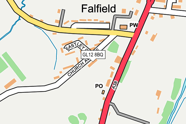
GL12 8BQ is located in the Charfield electoral ward, within the unitary authority of South Gloucestershire and the English Parliamentary constituency of Thornbury and Yate. The Sub Integrated Care Board (ICB) Location is NHS Bristol, North Somerset and South Gloucestershire ICB - 15C and the police force is Avon and Somerset. This postcode has been in use since June 2000.


GetTheData
Source: OS OpenMap – Local (Ordnance Survey)
Source: OS VectorMap District (Ordnance Survey)
Licence: Open Government Licence (requires attribution)
| Easting | 368187 |
| Northing | 193145 |
| Latitude | 51.636205 |
| Longitude | -2.461073 |
GetTheData
Source: Open Postcode Geo
Licence: Open Government Licence
| Country | England |
| Postcode District | GL12 |
➜ See where GL12 is on a map ➜ Where is Falfield? | |
GetTheData
Source: Land Registry Price Paid Data
Licence: Open Government Licence
Elevation or altitude of GL12 8BQ as distance above sea level:
| Metres | Feet | |
|---|---|---|
| Elevation | 30m | 98ft |
Elevation is measured from the approximate centre of the postcode, to the nearest point on an OS contour line from OS Terrain 50, which has contour spacing of ten vertical metres.
➜ How high above sea level am I? Find the elevation of your current position using your device's GPS.
GetTheData
Source: Open Postcode Elevation
Licence: Open Government Licence
| Ward | Charfield |
| Constituency | Thornbury And Yate |
GetTheData
Source: ONS Postcode Database
Licence: Open Government Licence
| The Huntsman | Falfield | 184m |
| The Huntsman (A38) | Falfield | 199m |
| Tortworth Road (B4509) | Falfield | 415m |
| Tortworth Road (B4509) | Falfield | 425m |
| Mount Pleasant | Falfield | 657m |
GetTheData
Source: NaPTAN
Licence: Open Government Licence
GetTheData
Source: ONS Postcode Database
Licence: Open Government Licence


➜ Get more ratings from the Food Standards Agency
GetTheData
Source: Food Standards Agency
Licence: FSA terms & conditions
| Last Collection | |||
|---|---|---|---|
| Location | Mon-Fri | Sat | Distance |
| Falfield P.o. | 16:30 | 10:30 | 111m |
| Whitfield Falfield | 16:15 | 09:15 | 1,666m |
| Lower Stone | 16:45 | 10:00 | 1,788m |
GetTheData
Source: Dracos
Licence: Creative Commons Attribution-ShareAlike
The below table lists the International Territorial Level (ITL) codes (formerly Nomenclature of Territorial Units for Statistics (NUTS) codes) and Local Administrative Units (LAU) codes for GL12 8BQ:
| ITL 1 Code | Name |
|---|---|
| TLK | South West (England) |
| ITL 2 Code | Name |
| TLK1 | Gloucestershire, Wiltshire and Bath/Bristol area |
| ITL 3 Code | Name |
| TLK12 | Bath and North East Somerset, North Somerset and South Gloucestershire |
| LAU 1 Code | Name |
| E06000025 | South Gloucestershire |
GetTheData
Source: ONS Postcode Directory
Licence: Open Government Licence
The below table lists the Census Output Area (OA), Lower Layer Super Output Area (LSOA), and Middle Layer Super Output Area (MSOA) for GL12 8BQ:
| Code | Name | |
|---|---|---|
| OA | E00075709 | |
| LSOA | E01014989 | South Gloucestershire 001E |
| MSOA | E02003090 | South Gloucestershire 001 |
GetTheData
Source: ONS Postcode Directory
Licence: Open Government Licence
| GL12 8BY | Church Avenue | 52m |
| GL12 8BZ | Eastley Close | 68m |
| GL12 8DF | Bristol Road | 85m |
| GL12 8BX | Eastwood Park | 97m |
| GL12 8DG | Orchard View | 140m |
| GL12 8DH | Bristol Road | 257m |
| GL12 8DW | Bristol Road | 257m |
| GL12 8BU | 294m | |
| GL12 8BW | Watermill Close | 341m |
| GL12 8DJ | Moorslade Lane | 552m |
GetTheData
Source: Open Postcode Geo; Land Registry Price Paid Data
Licence: Open Government Licence