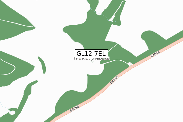
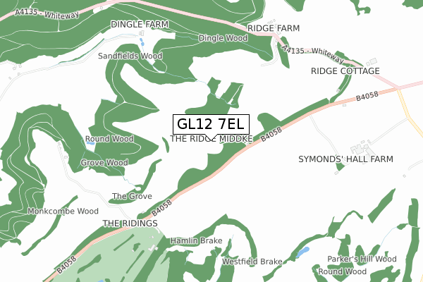
GL12 7EL is located in the Wotton-under-Edge electoral ward, within the local authority district of Stroud and the English Parliamentary constituency of The Cotswolds. The Sub Integrated Care Board (ICB) Location is NHS Gloucestershire ICB - 11M and the police force is Gloucestershire. This postcode has been in use since December 2017.


GetTheData
Source: OS Open Zoomstack (Ordnance Survey)
Licence: Open Government Licence (requires attribution)
Attribution: Contains OS data © Crown copyright and database right 2025
Source: Open Postcode Geo
Licence: Open Government Licence (requires attribution)
Attribution: Contains OS data © Crown copyright and database right 2025; Contains Royal Mail data © Royal Mail copyright and database right 2025; Source: Office for National Statistics licensed under the Open Government Licence v.3.0
| Easting | 378105 |
| Northing | 196087 |
| Latitude | 51.663135 |
| Longitude | -2.317950 |
GetTheData
Source: Open Postcode Geo
Licence: Open Government Licence
| Country | England |
| Postcode District | GL12 |
➜ See where GL12 is on a map | |
GetTheData
Source: Land Registry Price Paid Data
Licence: Open Government Licence
| Ward | Wotton-under-edge |
| Constituency | The Cotswolds |
GetTheData
Source: ONS Postcode Database
Licence: Open Government Licence
| Cotswold Edge Golf Club (B4058 Upper Rushmire) | Bowcott | 665m |
| Cotswold Edge Golf Club (B4058 Upper Rushmire) | Bowcott | 694m |
| Symonds' Hall Farm (B4058) | Bowcott | 788m |
| Symonds' Hall Farm (B4058) | Bowcott | 804m |
| Ozleworth Turn (B4058) | Bowcott | 1,066m |
GetTheData
Source: NaPTAN
Licence: Open Government Licence
| Percentage of properties with Next Generation Access | 0.0% |
| Percentage of properties with Superfast Broadband | 0.0% |
| Percentage of properties with Ultrafast Broadband | 0.0% |
| Percentage of properties with Full Fibre Broadband | 0.0% |
Superfast Broadband is between 30Mbps and 300Mbps
Ultrafast Broadband is > 300Mbps
| Percentage of properties unable to receive 2Mbps | 0.0% |
| Percentage of properties unable to receive 5Mbps | 100.0% |
| Percentage of properties unable to receive 10Mbps | 100.0% |
| Percentage of properties unable to receive 30Mbps | 100.0% |
GetTheData
Source: Ofcom
Licence: Ofcom Terms of Use (requires attribution)
GetTheData
Source: ONS Postcode Database
Licence: Open Government Licence


➜ Get more ratings from the Food Standards Agency
GetTheData
Source: Food Standards Agency
Licence: FSA terms & conditions
| Last Collection | |||
|---|---|---|---|
| Location | Mon-Fri | Sat | Distance |
| Cross Roads Waterley Bott | 16:15 | 09:00 | 2,171m |
| Ozleworth | 10:30 | 10:30 | 2,583m |
| Coombe Village | 17:00 | 08:00 | 2,617m |
GetTheData
Source: Dracos
Licence: Creative Commons Attribution-ShareAlike
The below table lists the International Territorial Level (ITL) codes (formerly Nomenclature of Territorial Units for Statistics (NUTS) codes) and Local Administrative Units (LAU) codes for GL12 7EL:
| ITL 1 Code | Name |
|---|---|
| TLK | South West (England) |
| ITL 2 Code | Name |
| TLK1 | Gloucestershire, Wiltshire and Bath/Bristol area |
| ITL 3 Code | Name |
| TLK13 | Gloucestershire CC |
| LAU 1 Code | Name |
| E07000082 | Stroud |
GetTheData
Source: ONS Postcode Directory
Licence: Open Government Licence
The below table lists the Census Output Area (OA), Lower Layer Super Output Area (LSOA), and Middle Layer Super Output Area (MSOA) for GL12 7EL:
| Code | Name | |
|---|---|---|
| OA | E00113955 | |
| LSOA | E01022415 | Stroud 015B |
| MSOA | E02004665 | Stroud 015 |
GetTheData
Source: ONS Postcode Directory
Licence: Open Government Licence
| GL12 7PT | 725m | |
| GL12 7PU | 755m | |
| GL11 5BS | Elcombe Rowden | 1124m |
| GL11 5BP | Elcombe | 1201m |
| GL11 6AD | 1516m | |
| GL11 5BW | Shadwell | 1539m |
| GL11 5AF | Rockstowes | 1750m |
| GL11 5BN | 1904m | |
| GL11 6AB | Whiteway | 1909m |
| GL11 5AQ | Fop Street | 1910m |
GetTheData
Source: Open Postcode Geo; Land Registry Price Paid Data
Licence: Open Government Licence