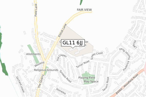
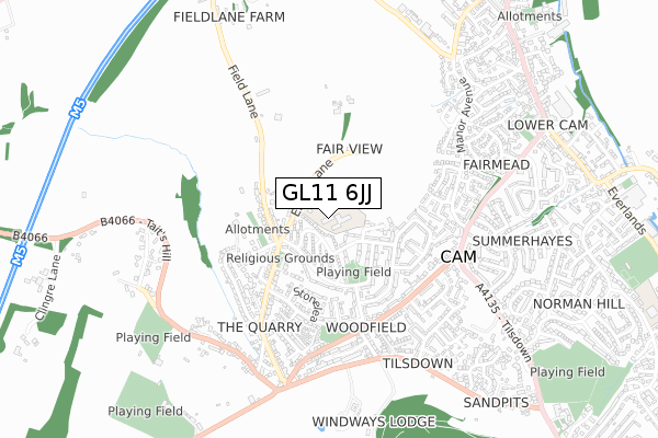
GL11 6JJ is located in the Cam West electoral ward, within the local authority district of Stroud and the English Parliamentary constituency of Stroud. The Sub Integrated Care Board (ICB) Location is NHS Gloucestershire ICB - 11M and the police force is Gloucestershire. This postcode has been in use since January 1980.


GetTheData
Source: OS Open Zoomstack (Ordnance Survey)
Licence: Open Government Licence (requires attribution)
Attribution: Contains OS data © Crown copyright and database right 2024
Source: Open Postcode Geo
Licence: Open Government Licence (requires attribution)
Attribution: Contains OS data © Crown copyright and database right 2024; Contains Royal Mail data © Royal Mail copyright and database right 2024; Source: Office for National Statistics licensed under the Open Government Licence v.3.0
| Easting | 374093 |
| Northing | 199989 |
| Latitude | 51.698047 |
| Longitude | -2.376246 |
GetTheData
Source: Open Postcode Geo
Licence: Open Government Licence
| Country | England |
| Postcode District | GL11 |
➜ See where GL11 is on a map ➜ Where is Cam? | |
GetTheData
Source: Land Registry Price Paid Data
Licence: Open Government Licence
Elevation or altitude of GL11 6JJ as distance above sea level:
| Metres | Feet | |
|---|---|---|
| Elevation | 100m | 328ft |
Elevation is measured from the approximate centre of the postcode, to the nearest point on an OS contour line from OS Terrain 50, which has contour spacing of ten vertical metres.
➜ How high above sea level am I? Find the elevation of your current position using your device's GPS.
GetTheData
Source: Open Postcode Elevation
Licence: Open Government Licence
| Ward | Cam West |
| Constituency | Stroud |
GetTheData
Source: ONS Postcode Database
Licence: Open Government Licence
| The Crapen (Tyndale Road) | Woodfield | 167m |
| The Crapen (Tyndale Road) | Woodfield | 179m |
| The Crapen Green (Tyndale Road) | Woodfield | 226m |
| Hadley Road (Tyndale Road) | Woodfield | 257m |
| Shops (Phillimore Road) | Woodfield | 361m |
| Cam & Dursley Station | 2.5km |
GetTheData
Source: NaPTAN
Licence: Open Government Licence
GetTheData
Source: ONS Postcode Database
Licence: Open Government Licence


➜ Get more ratings from the Food Standards Agency
GetTheData
Source: Food Standards Agency
Licence: FSA terms & conditions
| Last Collection | |||
|---|---|---|---|
| Location | Mon-Fri | Sat | Distance |
| Woodfield P.o. | 17:15 | 12:00 | 380m |
| Quarry | 17:00 | 08:00 | 595m |
| Springfield | 17:15 | 08:45 | 607m |
GetTheData
Source: Dracos
Licence: Creative Commons Attribution-ShareAlike
The below table lists the International Territorial Level (ITL) codes (formerly Nomenclature of Territorial Units for Statistics (NUTS) codes) and Local Administrative Units (LAU) codes for GL11 6JJ:
| ITL 1 Code | Name |
|---|---|
| TLK | South West (England) |
| ITL 2 Code | Name |
| TLK1 | Gloucestershire, Wiltshire and Bath/Bristol area |
| ITL 3 Code | Name |
| TLK13 | Gloucestershire CC |
| LAU 1 Code | Name |
| E07000082 | Stroud |
GetTheData
Source: ONS Postcode Directory
Licence: Open Government Licence
The below table lists the Census Output Area (OA), Lower Layer Super Output Area (LSOA), and Middle Layer Super Output Area (MSOA) for GL11 6JJ:
| Code | Name | |
|---|---|---|
| OA | E00113676 | |
| LSOA | E01022364 | Stroud 011F |
| MSOA | E02004661 | Stroud 011 |
GetTheData
Source: ONS Postcode Directory
Licence: Open Government Licence
| GL11 6LJ | The Crapen | 127m |
| GL11 6JQ | Elstub Lane | 154m |
| GL11 6LT | Turner Road | 157m |
| GL11 6LS | Turner Road | 180m |
| GL11 6BU | Strawberry Field | 190m |
| GL11 6JE | Field Lane | 209m |
| GL11 6LH | Tyndale Road | 224m |
| GL11 6LU | Hadley Road | 247m |
| GL11 6JF | Field Lane | 262m |
| GL11 6JH | Elstub Lane | 278m |
GetTheData
Source: Open Postcode Geo; Land Registry Price Paid Data
Licence: Open Government Licence