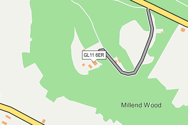
GL11 6ER is located in the Wotton-under-Edge electoral ward, within the local authority district of Stroud and the English Parliamentary constituency of The Cotswolds. The Sub Integrated Care Board (ICB) Location is NHS Gloucestershire ICB - 11M and the police force is Gloucestershire. This postcode has been in use since July 2011.


GetTheData
Source: OS OpenMap – Local (Ordnance Survey)
Source: OS VectorMap District (Ordnance Survey)
Licence: Open Government Licence (requires attribution)
| Easting | 375428 |
| Northing | 196660 |
| Latitude | 51.668173 |
| Longitude | -2.356696 |
GetTheData
Source: Open Postcode Geo
Licence: Open Government Licence
| Country | England |
| Postcode District | GL11 |
➜ See where GL11 is on a map | |
GetTheData
Source: Land Registry Price Paid Data
Licence: Open Government Licence
Elevation or altitude of GL11 6ER as distance above sea level:
| Metres | Feet | |
|---|---|---|
| Elevation | 170m | 558ft |
Elevation is measured from the approximate centre of the postcode, to the nearest point on an OS contour line from OS Terrain 50, which has contour spacing of ten vertical metres.
➜ How high above sea level am I? Find the elevation of your current position using your device's GPS.
GetTheData
Source: Open Postcode Elevation
Licence: Open Government Licence
| Ward | Wotton-under-edge |
| Constituency | The Cotswolds |
GetTheData
Source: ONS Postcode Database
Licence: Open Government Licence
| The Old Golden Heart (Pitt Court) | North Nibley | 644m |
| The Old Golden Heart (Pitt Court) | North Nibley | 654m |
| Nunnery Lane | Woodmancote | 833m |
| Cambridge House (Cambridge Avenue) | Woodmancote | 924m |
| Rangers Avenue | Woodmancote | 989m |
GetTheData
Source: NaPTAN
Licence: Open Government Licence
GetTheData
Source: ONS Postcode Database
Licence: Open Government Licence


➜ Get more ratings from the Food Standards Agency
GetTheData
Source: Food Standards Agency
Licence: FSA terms & conditions
| Last Collection | |||
|---|---|---|---|
| Location | Mon-Fri | Sat | Distance |
| Cross Roads Waterley Bott | 16:15 | 09:00 | 832m |
| Barrs Lane N Nibley | 16:30 | 10:00 | 1,508m |
| Stinchcombe Hill | 16:15 | 08:00 | 1,532m |
GetTheData
Source: Dracos
Licence: Creative Commons Attribution-ShareAlike
The below table lists the International Territorial Level (ITL) codes (formerly Nomenclature of Territorial Units for Statistics (NUTS) codes) and Local Administrative Units (LAU) codes for GL11 6ER:
| ITL 1 Code | Name |
|---|---|
| TLK | South West (England) |
| ITL 2 Code | Name |
| TLK1 | Gloucestershire, Wiltshire and Bath/Bristol area |
| ITL 3 Code | Name |
| TLK13 | Gloucestershire CC |
| LAU 1 Code | Name |
| E07000082 | Stroud |
GetTheData
Source: ONS Postcode Directory
Licence: Open Government Licence
The below table lists the Census Output Area (OA), Lower Layer Super Output Area (LSOA), and Middle Layer Super Output Area (MSOA) for GL11 6ER:
| Code | Name | |
|---|---|---|
| OA | E00113948 | |
| LSOA | E01022415 | Stroud 015B |
| MSOA | E02004665 | Stroud 015 |
GetTheData
Source: ONS Postcode Directory
Licence: Open Government Licence
| GL11 6ED | Millend | 355m |
| GL11 6EE | Warren Hill | 573m |
| GL11 6EB | Pittcourt | 615m |
| GL11 6EQ | Smarts Green | 656m |
| GL11 4AP | Twinberrow Lane | 670m |
| GL11 6EH | Pittcourt | 715m |
| GL11 4AW | Nunnery Lane | 726m |
| GL11 4BG | Blackwells | 790m |
| GL11 4AJ | 807m | |
| GL11 4AY | Cambridge Avenue | 849m |
GetTheData
Source: Open Postcode Geo; Land Registry Price Paid Data
Licence: Open Government Licence