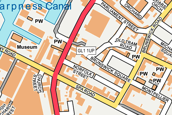
GL1 1UP is located in the Westgate electoral ward, within the local authority district of Gloucester and the English Parliamentary constituency of Gloucester. The Sub Integrated Care Board (ICB) Location is NHS Gloucestershire ICB - 11M and the police force is Gloucestershire. This postcode has been in use since January 1980.


GetTheData
Source: OS OpenMap – Local (Ordnance Survey)
Source: OS VectorMap District (Ordnance Survey)
Licence: Open Government Licence (requires attribution)
| Easting | 382933 |
| Northing | 218102 |
| Latitude | 51.861237 |
| Longitude | -2.249239 |
GetTheData
Source: Open Postcode Geo
Licence: Open Government Licence
| Country | England |
| Postcode District | GL1 |
➜ See where GL1 is on a map ➜ Where is Gloucester? | |
GetTheData
Source: Land Registry Price Paid Data
Licence: Open Government Licence
Elevation or altitude of GL1 1UP as distance above sea level:
| Metres | Feet | |
|---|---|---|
| Elevation | 10m | 33ft |
Elevation is measured from the approximate centre of the postcode, to the nearest point on an OS contour line from OS Terrain 50, which has contour spacing of ten vertical metres.
➜ How high above sea level am I? Find the elevation of your current position using your device's GPS.
GetTheData
Source: Open Postcode Elevation
Licence: Open Government Licence
| Ward | Westgate |
| Constituency | Gloucester |
GetTheData
Source: ONS Postcode Database
Licence: Open Government Licence
14, ALBION STREET, GLOUCESTER, GL1 1UP 2021 23 APR £210,000 |
GetTheData
Source: HM Land Registry Price Paid Data
Licence: Contains HM Land Registry data © Crown copyright and database right 2025. This data is licensed under the Open Government Licence v3.0.
| The Docks (Southgate Street) | Gloucester | 114m |
| The Docks (Southgate Street) | Gloucester | 125m |
| Spa Road (Southgate Street) | Gloucester | 147m |
| The Warehouse (Parliament Street) | Gloucester | 178m |
| Spa Road (Southgate Street) | Gloucester | 189m |
| Gloucester Station | 0.9km |
GetTheData
Source: NaPTAN
Licence: Open Government Licence
GetTheData
Source: ONS Postcode Database
Licence: Open Government Licence


➜ Get more ratings from the Food Standards Agency
GetTheData
Source: Food Standards Agency
Licence: FSA terms & conditions
| Last Collection | |||
|---|---|---|---|
| Location | Mon-Fri | Sat | Distance |
| Albion | 18:30 | 12:30 | 78m |
| Brunswick Road | 186m | ||
| Brunswick Road | 18:45 | 12:30 | 205m |
GetTheData
Source: Dracos
Licence: Creative Commons Attribution-ShareAlike
The below table lists the International Territorial Level (ITL) codes (formerly Nomenclature of Territorial Units for Statistics (NUTS) codes) and Local Administrative Units (LAU) codes for GL1 1UP:
| ITL 1 Code | Name |
|---|---|
| TLK | South West (England) |
| ITL 2 Code | Name |
| TLK1 | Gloucestershire, Wiltshire and Bath/Bristol area |
| ITL 3 Code | Name |
| TLK13 | Gloucestershire CC |
| LAU 1 Code | Name |
| E07000081 | Gloucester |
GetTheData
Source: ONS Postcode Directory
Licence: Open Government Licence
The below table lists the Census Output Area (OA), Lower Layer Super Output Area (LSOA), and Middle Layer Super Output Area (MSOA) for GL1 1UP:
| Code | Name | |
|---|---|---|
| OA | E00113599 | |
| LSOA | E01022347 | Gloucester 004B |
| MSOA | E02004639 | Gloucester 004 |
GetTheData
Source: ONS Postcode Directory
Licence: Open Government Licence
| GL1 1UE | Albion Street | 32m |
| GL1 1US | Norfolk Street | 40m |
| GL1 1SJ | Old Tram Road | 49m |
| GL1 1UF | Spa Mews | 60m |
| GL1 1UR | Southgate Street | 63m |
| GL1 1UG | Brunswick Square | 75m |
| GL1 1WA | Spa Road | 80m |
| GL1 1UT | Southgate Street | 90m |
| GL1 1UN | Brunswick Square | 93m |
| GL1 1UY | Spa Road | 96m |
GetTheData
Source: Open Postcode Geo; Land Registry Price Paid Data
Licence: Open Government Licence