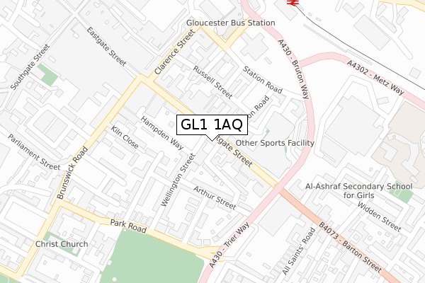
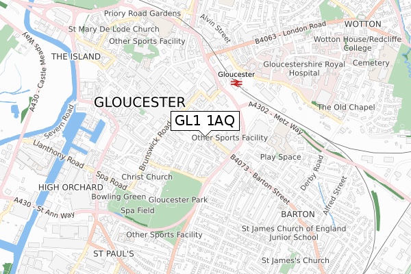
GL1 1AQ is located in the Westgate electoral ward, within the local authority district of Gloucester and the English Parliamentary constituency of Gloucester. The Sub Integrated Care Board (ICB) Location is NHS Gloucestershire ICB - 11M and the police force is Gloucestershire. This postcode has been in use since April 2019.


GetTheData
Source: OS Open Zoomstack (Ordnance Survey)
Licence: Open Government Licence (requires attribution)
Attribution: Contains OS data © Crown copyright and database right 2025
Source: Open Postcode Geo
Licence: Open Government Licence (requires attribution)
Attribution: Contains OS data © Crown copyright and database right 2025; Contains Royal Mail data © Royal Mail copyright and database right 2025; Source: Office for National Statistics licensed under the Open Government Licence v.3.0
| Easting | 383493 |
| Northing | 218256 |
| Latitude | 51.862646 |
| Longitude | -2.241112 |
GetTheData
Source: Open Postcode Geo
Licence: Open Government Licence
| Country | England |
| Postcode District | GL1 |
➜ See where GL1 is on a map ➜ Where is Gloucester? | |
GetTheData
Source: Land Registry Price Paid Data
Licence: Open Government Licence
| Ward | Westgate |
| Constituency | Gloucester |
GetTheData
Source: ONS Postcode Database
Licence: Open Government Licence
| Gl1 Leisure Centre (Eastgate Steet) | Gloucester | 73m |
| Gl1 Leisure Centre (Eastgate Street) | Gloucester | 75m |
| Eastgate Street | Gloucester | 114m |
| Bingo Hall (Eastgate Street) | Gloucester | 132m |
| Gl1 Leisure Centre (Bruton Way) | Gloucester | 204m |
| Gloucester Station | 0.4km |
GetTheData
Source: NaPTAN
Licence: Open Government Licence
| Percentage of properties with Next Generation Access | 100.0% |
| Percentage of properties with Superfast Broadband | 100.0% |
| Percentage of properties with Ultrafast Broadband | 0.0% |
| Percentage of properties with Full Fibre Broadband | 0.0% |
Superfast Broadband is between 30Mbps and 300Mbps
Ultrafast Broadband is > 300Mbps
| Percentage of properties unable to receive 2Mbps | 0.0% |
| Percentage of properties unable to receive 5Mbps | 0.0% |
| Percentage of properties unable to receive 10Mbps | 0.0% |
| Percentage of properties unable to receive 30Mbps | 0.0% |
GetTheData
Source: Ofcom
Licence: Ofcom Terms of Use (requires attribution)
GetTheData
Source: ONS Postcode Database
Licence: Open Government Licence


➜ Get more ratings from the Food Standards Agency
GetTheData
Source: Food Standards Agency
Licence: FSA terms & conditions
| Last Collection | |||
|---|---|---|---|
| Location | Mon-Fri | Sat | Distance |
| Eastgate Street | 18:45 | 12:30 | 122m |
| Bus Station | 18:30 | 12:45 | 259m |
| Asda | 18:30 | 12:45 | 325m |
GetTheData
Source: Dracos
Licence: Creative Commons Attribution-ShareAlike
| Risk of GL1 1AQ flooding from rivers and sea | Medium |
| ➜ GL1 1AQ flood map | |
GetTheData
Source: Open Flood Risk by Postcode
Licence: Open Government Licence
The below table lists the International Territorial Level (ITL) codes (formerly Nomenclature of Territorial Units for Statistics (NUTS) codes) and Local Administrative Units (LAU) codes for GL1 1AQ:
| ITL 1 Code | Name |
|---|---|
| TLK | South West (England) |
| ITL 2 Code | Name |
| TLK1 | Gloucestershire, Wiltshire and Bath/Bristol area |
| ITL 3 Code | Name |
| TLK13 | Gloucestershire CC |
| LAU 1 Code | Name |
| E07000081 | Gloucester |
GetTheData
Source: ONS Postcode Directory
Licence: Open Government Licence
The below table lists the Census Output Area (OA), Lower Layer Super Output Area (LSOA), and Middle Layer Super Output Area (MSOA) for GL1 1AQ:
| Code | Name | |
|---|---|---|
| OA | E00113598 | |
| LSOA | E01022347 | Gloucester 004B |
| MSOA | E02004639 | Gloucester 004 |
GetTheData
Source: ONS Postcode Directory
Licence: Open Government Licence
| GL1 1RB | Wellington Street | 28m |
| GL1 1PY | Eastgate Street | 30m |
| GL1 1QT | Eastgate Street | 79m |
| GL1 1QX | Kings Barton Street | 81m |
| GL1 1QB | Eastgate Street | 85m |
| GL1 1RA | Wellington Street | 89m |
| GL1 1QN | Eastgate Street | 94m |
| GL1 1QY | Arthur Street | 117m |
| GL1 1QD | Nettleton Road | 123m |
| GL1 1PN | Eastgate Street | 129m |
GetTheData
Source: Open Postcode Geo; Land Registry Price Paid Data
Licence: Open Government Licence