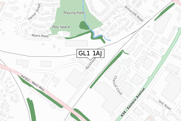
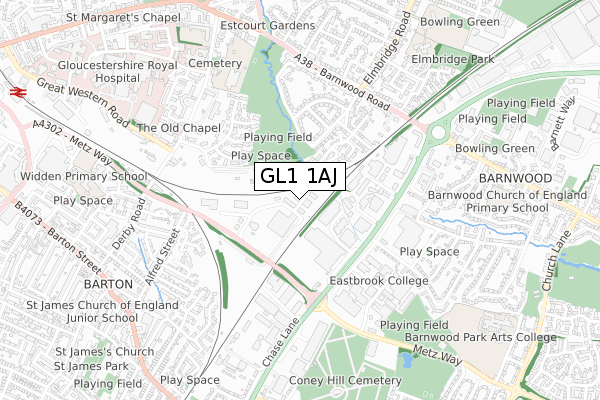
GL1 1AJ is located in the Elmbridge electoral ward, within the local authority district of Gloucester and the English Parliamentary constituency of Gloucester. The Sub Integrated Care Board (ICB) Location is NHS Gloucestershire ICB - 11M and the police force is Gloucestershire. This postcode has been in use since January 2018.


GetTheData
Source: OS Open Zoomstack (Ordnance Survey)
Licence: Open Government Licence (requires attribution)
Attribution: Contains OS data © Crown copyright and database right 2025
Source: Open Postcode Geo
Licence: Open Government Licence (requires attribution)
Attribution: Contains OS data © Crown copyright and database right 2025; Contains Royal Mail data © Royal Mail copyright and database right 2025; Source: Office for National Statistics licensed under the Open Government Licence v.3.0
| Easting | 384855 |
| Northing | 218137 |
| Latitude | 51.861614 |
| Longitude | -2.221328 |
GetTheData
Source: Open Postcode Geo
Licence: Open Government Licence
| Country | England |
| Postcode District | GL1 |
➜ See where GL1 is on a map ➜ Where is Gloucester? | |
GetTheData
Source: Land Registry Price Paid Data
Licence: Open Government Licence
| Ward | Elmbridge |
| Constituency | Gloucester |
GetTheData
Source: ONS Postcode Database
Licence: Open Government Licence
| Morrison's Supermarket | Gloucester | 296m |
| Morrison's Supermarket | Gloucester | 298m |
| Gloucester Retail Park (York Road) | Gloucester | 393m |
| Gloucester Retail Park (York Road) | Gloucester | 416m |
| Queen's (Barnwood Road) | Barnwood | 513m |
| Gloucester Station | 1.3km |
GetTheData
Source: NaPTAN
Licence: Open Government Licence
GetTheData
Source: ONS Postcode Database
Licence: Open Government Licence


➜ Get more ratings from the Food Standards Agency
GetTheData
Source: Food Standards Agency
Licence: FSA terms & conditions
| Last Collection | |||
|---|---|---|---|
| Location | Mon-Fri | Sat | Distance |
| Hamer Street | 17:30 | 13:00 | 446m |
| Armscroft Road | 17:45 | 12:15 | 486m |
| Eastern Avenue | 17:00 | 12:45 | 498m |
GetTheData
Source: Dracos
Licence: Creative Commons Attribution-ShareAlike
The below table lists the International Territorial Level (ITL) codes (formerly Nomenclature of Territorial Units for Statistics (NUTS) codes) and Local Administrative Units (LAU) codes for GL1 1AJ:
| ITL 1 Code | Name |
|---|---|
| TLK | South West (England) |
| ITL 2 Code | Name |
| TLK1 | Gloucestershire, Wiltshire and Bath/Bristol area |
| ITL 3 Code | Name |
| TLK13 | Gloucestershire CC |
| LAU 1 Code | Name |
| E07000081 | Gloucester |
GetTheData
Source: ONS Postcode Directory
Licence: Open Government Licence
The below table lists the Census Output Area (OA), Lower Layer Super Output Area (LSOA), and Middle Layer Super Output Area (MSOA) for GL1 1AJ:
| Code | Name | |
|---|---|---|
| OA | E00168977 | |
| LSOA | E01022312 | Gloucester 002D |
| MSOA | E02004637 | Gloucester 002 |
GetTheData
Source: ONS Postcode Directory
Licence: Open Government Licence
| GL2 0RT | Armscroft Gardens | 199m |
| GL4 3YY | Southbrook Road | 221m |
| GL2 0SL | Blinkhorns Bridge Lane | 225m |
| GL1 1AH | Triangle Way | 250m |
| GL2 0SR | Coronation Grove | 285m |
| GL2 0SW | Armscroft Place | 289m |
| GL2 0TE | Armscroft Court | 293m |
| GL2 0BT | Blinkhorns Bridge Lane | 300m |
| GL4 3DP | Northbrook Road | 303m |
| GL1 3QL | Norman Ball Way | 322m |
GetTheData
Source: Open Postcode Geo; Land Registry Price Paid Data
Licence: Open Government Licence