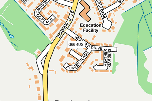
G66 4UG is located in the Lenzie and Kirkintilloch South electoral ward, within the council area of East Dunbartonshire and the Scottish Parliamentary constituency of East Dunbartonshire. The Community Health Partnership is East Dunbartonshire Community Health Partnership and the police force is Scotland. This postcode has been in use since January 1980.


GetTheData
Source: OS OpenMap – Local (Ordnance Survey)
Source: OS VectorMap District (Ordnance Survey)
Licence: Open Government Licence (requires attribution)
| Easting | 264266 |
| Northing | 671936 |
| Latitude | 55.921293 |
| Longitude | -4.173639 |
GetTheData
Source: Open Postcode Geo
Licence: Open Government Licence
| Country | Scotland |
| Postcode District | G66 |
➜ See where G66 is on a map ➜ Where is Kirkintilloch? | |
GetTheData
Source: Land Registry Price Paid Data
Licence: Open Government Licence
| Ward | Lenzie And Kirkintilloch South |
| Constituency | East Dunbartonshire |
GetTheData
Source: ONS Postcode Database
Licence: Open Government Licence
| Heather Drive (Boghead Road) | High Gallowhill | 100m |
| Heather Drive (Boghead Road) | High Gallowhill | 117m |
| Glenwood Road (Boghead Road) | High Gallowhill | 184m |
| Spruce Drive (Boghead Road) | High Gallowhill | 301m |
| Boghead Road | High Gallowhill | 585m |
| Lenzie Station | 1.2km |
| Bishopbriggs Station | 3.7km |
| Stepps Station | 4km |
GetTheData
Source: NaPTAN
Licence: Open Government Licence
| Percentage of properties with Next Generation Access | 100.0% |
| Percentage of properties with Superfast Broadband | 100.0% |
| Percentage of properties with Ultrafast Broadband | 100.0% |
| Percentage of properties with Full Fibre Broadband | 0.0% |
Superfast Broadband is between 30Mbps and 300Mbps
Ultrafast Broadband is > 300Mbps
| Median download speed | 41.7Mbps |
| Average download speed | 65.0Mbps |
| Maximum download speed | 200.00Mbps |
| Median upload speed | 9.4Mbps |
| Average upload speed | 9.1Mbps |
| Maximum upload speed | 10.00Mbps |
| Percentage of properties unable to receive 2Mbps | 0.0% |
| Percentage of properties unable to receive 5Mbps | 0.0% |
| Percentage of properties unable to receive 10Mbps | 0.0% |
| Percentage of properties unable to receive 30Mbps | 0.0% |
GetTheData
Source: Ofcom
Licence: Ofcom Terms of Use (requires attribution)
Estimated total energy consumption in G66 4UG by fuel type, 2015.
| Consumption (kWh) | 237,793 |
|---|---|
| Meter count | 10 |
| Mean (kWh/meter) | 23,779 |
| Median (kWh/meter) | 25,606 |
| Consumption (kWh) | 63,776 |
|---|---|
| Meter count | 10 |
| Mean (kWh/meter) | 6,378 |
| Median (kWh/meter) | 6,621 |
GetTheData
Source: Postcode level gas estimates: 2015 (experimental)
Source: Postcode level electricity estimates: 2015 (experimental)
Licence: Open Government Licence
GetTheData
Source: ONS Postcode Database
Licence: Open Government Licence


➜ Get more ratings from the Food Standards Agency
GetTheData
Source: Food Standards Agency
Licence: FSA terms & conditions
| Last Collection | |||
|---|---|---|---|
| Location | Mon-Fri | Sat | Distance |
| Moss Road | 18:00 | 12:30 | 1,023m |
| Beech Road | 17:15 | 12:15 | 1,180m |
| Lenzie Post Office | 18:00 | 12:15 | 1,224m |
GetTheData
Source: Dracos
Licence: Creative Commons Attribution-ShareAlike
The below table lists the International Territorial Level (ITL) codes (formerly Nomenclature of Territorial Units for Statistics (NUTS) codes) and Local Administrative Units (LAU) codes for G66 4UG:
| ITL 1 Code | Name |
|---|---|
| TLM | Scotland |
| ITL 2 Code | Name |
| TLM8 | West Central Scotland |
| ITL 3 Code | Name |
| TLM81 | East Dunbartonshire, West Dunbartonshire, and Helensburgh and Lomond |
| LAU 1 Code | Name |
| S30000050 | East Dunbartonshire |
GetTheData
Source: ONS Postcode Directory
Licence: Open Government Licence
The below table lists the Census Output Area (OA), Lower Layer Super Output Area (LSOA), and Middle Layer Super Output Area (MSOA) for G66 4UG:
| Code | Name | |
|---|---|---|
| OA | S00101431 | |
| LSOA | S01008117 | Lenzie North - 02 |
| MSOA | S02001524 | Lenzie North |
GetTheData
Source: ONS Postcode Directory
Licence: Open Government Licence