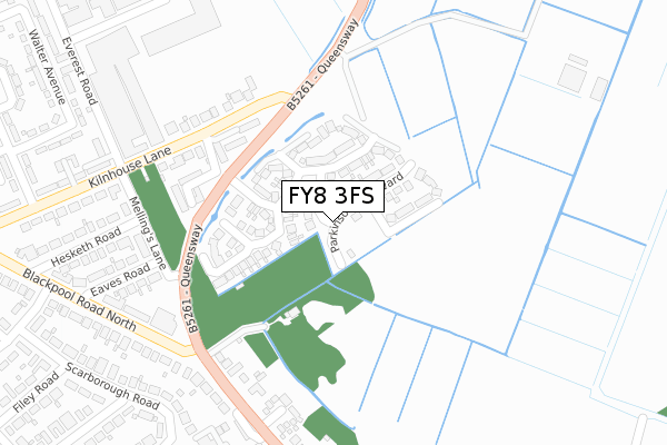
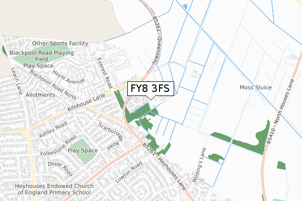
FY8 3FS is located in the Kilnhouse electoral ward, within the local authority district of Fylde and the English Parliamentary constituency of Fylde. The Sub Integrated Care Board (ICB) Location is NHS Lancashire and South Cumbria ICB - 02M and the police force is Lancashire. This postcode has been in use since December 2018.


GetTheData
Source: OS Open Zoomstack (Ordnance Survey)
Licence: Open Government Licence (requires attribution)
Attribution: Contains OS data © Crown copyright and database right 2024
Source: Open Postcode Geo
Licence: Open Government Licence (requires attribution)
Attribution: Contains OS data © Crown copyright and database right 2024; Contains Royal Mail data © Royal Mail copyright and database right 2024; Source: Office for National Statistics licensed under the Open Government Licence v.3.0
| Easting | 333548 |
| Northing | 430374 |
| Latitude | 53.765471 |
| Longitude | -3.009572 |
GetTheData
Source: Open Postcode Geo
Licence: Open Government Licence
| Country | England |
| Postcode District | FY8 |
➜ See where FY8 is on a map ➜ Where is Lytham St Anne's? | |
GetTheData
Source: Land Registry Price Paid Data
Licence: Open Government Licence
| Ward | Kilnhouse |
| Constituency | Fylde |
GetTheData
Source: ONS Postcode Database
Licence: Open Government Licence
| Queensway Court (Kilnhouse Lane) | St Annes | 162m |
| Queensway Court (Kilnhouse Lane) | St Annes | 162m |
| Meadowcroft (Kilnhouse Lane) | St Annes | 358m |
| Kilnhouse Lane (Derwent Road) | St Annes | 410m |
| Kilnhouse Lane (Derwent Road) | St Annes | 412m |
| St Annes-on-the-Sea Station | 1.9km |
| Ansdell & Fairhaven Station | 2.9km |
| Squires Gate Station | 3km |
GetTheData
Source: NaPTAN
Licence: Open Government Licence
| Percentage of properties with Next Generation Access | 100.0% |
| Percentage of properties with Superfast Broadband | 100.0% |
| Percentage of properties with Ultrafast Broadband | 93.8% |
| Percentage of properties with Full Fibre Broadband | 93.8% |
Superfast Broadband is between 30Mbps and 300Mbps
Ultrafast Broadband is > 300Mbps
| Percentage of properties unable to receive 2Mbps | 0.0% |
| Percentage of properties unable to receive 5Mbps | 0.0% |
| Percentage of properties unable to receive 10Mbps | 0.0% |
| Percentage of properties unable to receive 30Mbps | 0.0% |
GetTheData
Source: Ofcom
Licence: Ofcom Terms of Use (requires attribution)
GetTheData
Source: ONS Postcode Database
Licence: Open Government Licence


➜ Get more ratings from the Food Standards Agency
GetTheData
Source: Food Standards Agency
Licence: FSA terms & conditions
| Last Collection | |||
|---|---|---|---|
| Location | Mon-Fri | Sat | Distance |
| 197 St Annes Road East, St Annes | 17:15 | 12:00 | 404m |
| 1 Filey Road, St Annes | 16:00 | 11:30 | 556m |
| 8 Spring Gardens, St Annes | 17:15 | 12:00 | 600m |
GetTheData
Source: Dracos
Licence: Creative Commons Attribution-ShareAlike
The below table lists the International Territorial Level (ITL) codes (formerly Nomenclature of Territorial Units for Statistics (NUTS) codes) and Local Administrative Units (LAU) codes for FY8 3FS:
| ITL 1 Code | Name |
|---|---|
| TLD | North West (England) |
| ITL 2 Code | Name |
| TLD4 | Lancashire |
| ITL 3 Code | Name |
| TLD45 | Mid Lancashire |
| LAU 1 Code | Name |
| E07000119 | Fylde |
GetTheData
Source: ONS Postcode Directory
Licence: Open Government Licence
The below table lists the Census Output Area (OA), Lower Layer Super Output Area (LSOA), and Middle Layer Super Output Area (MSOA) for FY8 3FS:
| Code | Name | |
|---|---|---|
| OA | E00126902 | |
| LSOA | E01025001 | Fylde 005A |
| MSOA | E02005207 | Fylde 005 |
GetTheData
Source: ONS Postcode Directory
Licence: Open Government Licence
| FY8 3ET | Kilnhouse Lane | 129m |
| FY8 3DW | Mellings Wood | 153m |
| FY8 3DS | Kilnhouse Lane | 187m |
| FY8 3DX | Mellings Lane | 249m |
| FY8 3RT | Heyhouses Lane | 277m |
| FY8 3RY | Eaves Road | 289m |
| FY8 3HG | Everest Close | 302m |
| FY8 3RS | The Croft | 306m |
| FY8 3DY | Hesketh Road | 328m |
| FY8 3RU | Blackpool Road North | 347m |
GetTheData
Source: Open Postcode Geo; Land Registry Price Paid Data
Licence: Open Government Licence