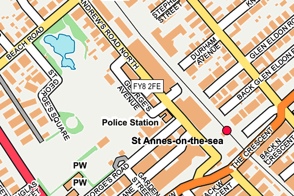
FY8 2FE is located in the Kilgrimol electoral ward, within the local authority district of Fylde and the English Parliamentary constituency of Fylde. The Sub Integrated Care Board (ICB) Location is NHS Lancashire and South Cumbria ICB - 02M and the police force is Lancashire. This postcode has been in use since May 2017.


GetTheData
Source: OS OpenMap – Local (Ordnance Survey)
Source: OS VectorMap District (Ordnance Survey)
Licence: Open Government Licence (requires attribution)
| Easting | 332096 |
| Northing | 429079 |
| Latitude | 53.753646 |
| Longitude | -3.031310 |
GetTheData
Source: Open Postcode Geo
Licence: Open Government Licence
| Country | England |
| Postcode District | FY8 |
➜ See where FY8 is on a map ➜ Where is Lytham St Anne's? | |
GetTheData
Source: Land Registry Price Paid Data
Licence: Open Government Licence
| Ward | Kilgrimol |
| Constituency | Fylde |
GetTheData
Source: ONS Postcode Database
Licence: Open Government Licence
| Police Station (St Andrews Road North) | St Annes | 20m |
| Sainsburys (St Andrews Road North) | St Annes | 55m |
| Square (St Annes Square) | St Annes | 216m |
| St Georges Road Alighting Only (St Georges Road) | St Annes | 227m |
| St Annes Road East (St David's Road North) | St Annes | 229m |
| St Annes-on-the-Sea Station | 0.2km |
| Ansdell & Fairhaven Station | 2.9km |
| Squires Gate Station | 2.9km |
GetTheData
Source: NaPTAN
Licence: Open Government Licence
GetTheData
Source: ONS Postcode Database
Licence: Open Government Licence


➜ Get more ratings from the Food Standards Agency
GetTheData
Source: Food Standards Agency
Licence: FSA terms & conditions
| Last Collection | |||
|---|---|---|---|
| Location | Mon-Fri | Sat | Distance |
| Garden Street | 17:30 | 11:30 | 161m |
| Garden Street | 17:30 | 11:30 | 162m |
| St Georges Square | 16:45 | 11:00 | 203m |
GetTheData
Source: Dracos
Licence: Creative Commons Attribution-ShareAlike
The below table lists the International Territorial Level (ITL) codes (formerly Nomenclature of Territorial Units for Statistics (NUTS) codes) and Local Administrative Units (LAU) codes for FY8 2FE:
| ITL 1 Code | Name |
|---|---|
| TLD | North West (England) |
| ITL 2 Code | Name |
| TLD4 | Lancashire |
| ITL 3 Code | Name |
| TLD45 | Mid Lancashire |
| LAU 1 Code | Name |
| E07000119 | Fylde |
GetTheData
Source: ONS Postcode Directory
Licence: Open Government Licence
The below table lists the Census Output Area (OA), Lower Layer Super Output Area (LSOA), and Middle Layer Super Output Area (MSOA) for FY8 2FE:
| Code | Name | |
|---|---|---|
| OA | E00126819 | |
| LSOA | E01024986 | Fylde 006C |
| MSOA | E02005208 | Fylde 006 |
GetTheData
Source: ONS Postcode Directory
Licence: Open Government Licence
| FY8 2AW | St Georges Road | 57m |
| FY8 2JF | St Andrews Road North | 85m |
| FY8 2JB | St Andrews Road North | 107m |
| FY8 2EP | Durham Avenue | 125m |
| FY8 2BD | Durham Avenue | 131m |
| FY8 2AE | St Georges Road | 138m |
| FY8 2AU | Glen Eldon Road | 146m |
| FY8 2AA | Garden Street | 159m |
| FY8 2JE | St Andrews Road North | 171m |
| FY8 2BU | Stephen Street | 172m |
GetTheData
Source: Open Postcode Geo; Land Registry Price Paid Data
Licence: Open Government Licence